Camp Westfalia

Archive for Journeys

Route 66 (sort of) to the Grand Canyon and beyond

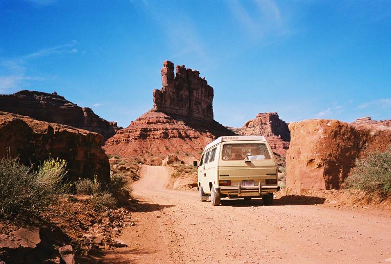
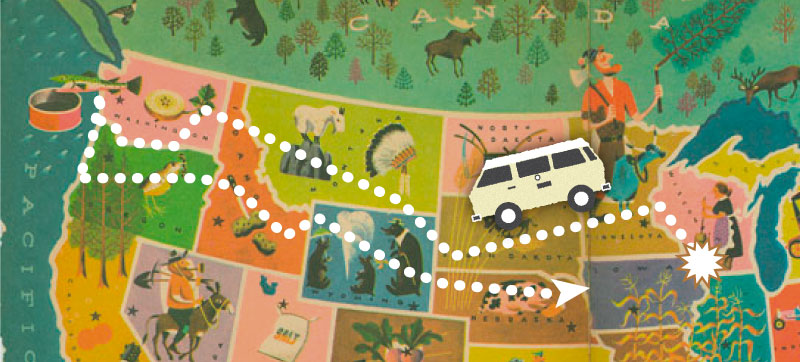
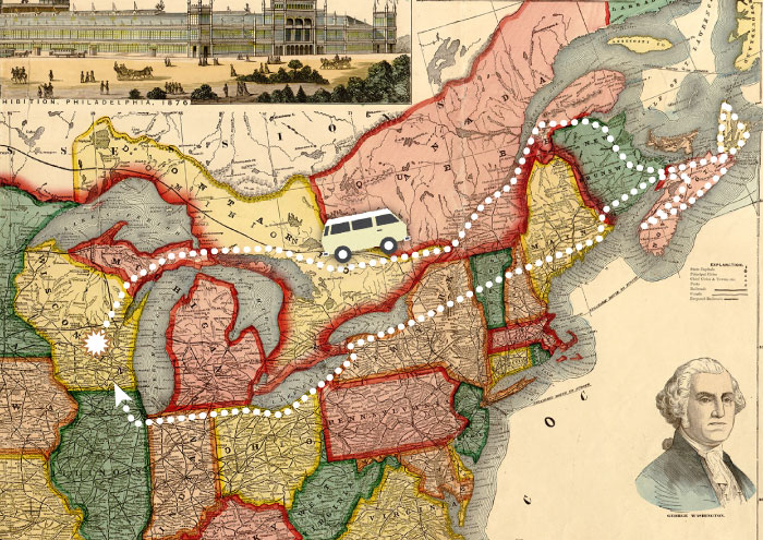
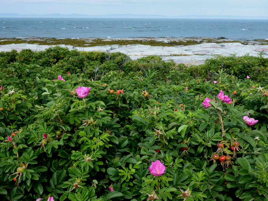
A three-week, 5000-mile road trip loosely following Route 66 from central Illinois to the Grand Canyon. With a few side trips …

We leave Beigeville Heights, Wisconsin, on a Friday morning and drive directly south, then turn to the southwest at Bloomington, Illinois, when we catch Route 66.

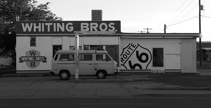
Or, perhaps I should say “the nominal Route 66.” Safety improvements, replacement of bridges and railroad crossings, traffic congestion, all led to various bits and pieces of the designated Route being realigned numerous times since it was first established in 1926. So when one sets out to get one’s kicks on Route 66, one must ask, “When? The Route 66 of the 1930’s? Of the 1950’s? Before or after US Interstates 44 and 40 superseded the original Mother Road?”

In some places we find original concrete, in others the route is a barely-visible dirt path cutting across sagebrush country. Interstates 44 and 40 were in some places laid directly atop the old roadbed, in others were built miles away from the original route. In many places, the original Route 66 can now be seen closely paralleling the new Interstate as a frontage road.

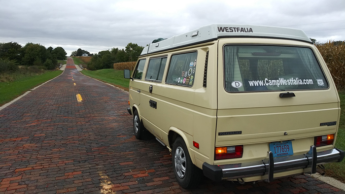
Near Auburn, Illinois, we find a couple miles of an early brick-paved section of the old Mother Road.

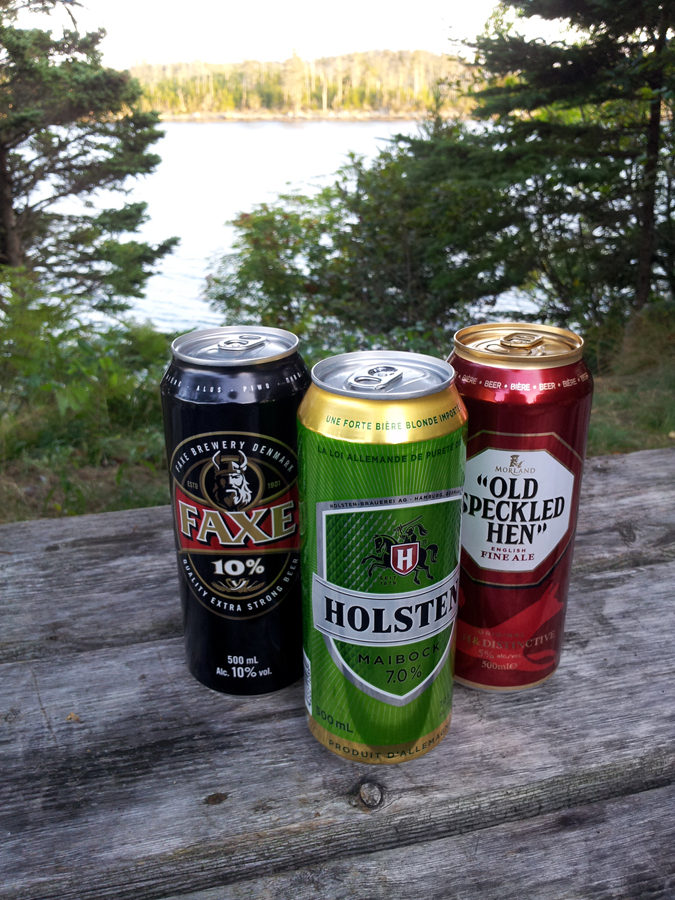
In our hasty packing for the trip we have both forgotten adult beverages. Fortunately, it is in no short supply here in the town of Bourbon, Illinois.

Fill ‘er up, please!


In sleepy Spencer, Missouri, we find a place to fill up the van, too. Only 14.7 cents for a gallon of Ethyl!


Just a mile east of Cadillac Ranch in Amarillo, Texas, I spot my first of the legendary “Muffler Men,” this one now repurposed as “2nd Amendment Cowboy.” A plaque near his boots (complete with spurs) features the pertinent quote from the US Constitution.


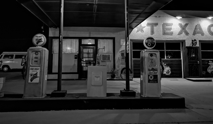
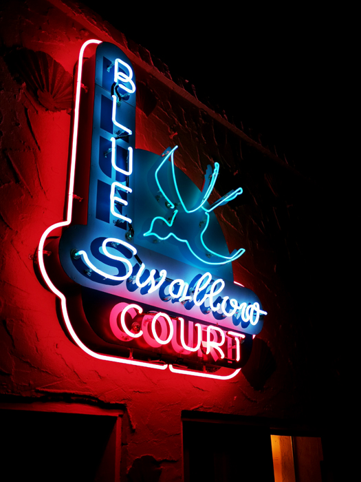
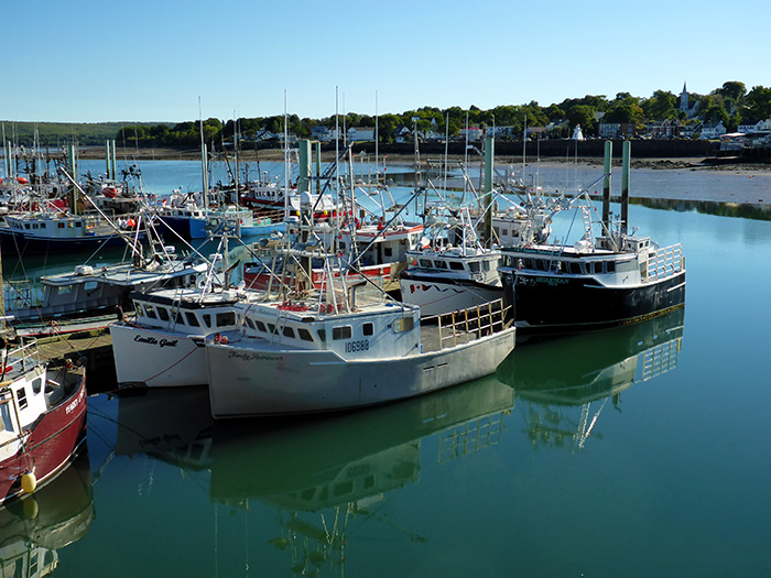
We arrive at Tucumcari, New Mexico, and take a room at the classic Blue Swallow Motel, then cruise the original Route through town at sunset to check out some vintage and retro gas stations.


In Arizona we stop at Petrified Forest National Park. About 225 million years ago, trees that fell into rivers here were buried by volcanic ash sediments, and eventually fossilized in remarkably original appearance. Whole logs, some 40 feet long and 3 feet in diameter, now lie intact on the ground, their bark, knots, and even growth rings clearly visible.

In the parking lot, some Italian tourists express disappointment that the ‘fossilized forest’ is no longer comprised of standing trees …

One day I find this 1.5″ red-winged waspy thing eating dead bugs off the front of the Vanagon. Turns out it’s a Pepsis Wasp, whose sting is considered the most painful of all animal stings. It was described by one researcher as, “Blinding, fierce, shockingly electric. A running hair drier has been dropped into your bubble bath.” It won’t kill you, but it will likely be the longest three minutes of your life.

“They are also called tarantula hawks because the females hunt tarantulas (and other large spiders).”

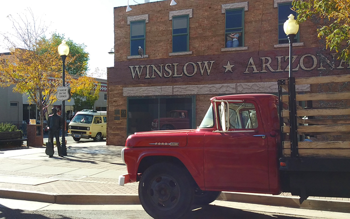
“Standin’ on a corner in Winslow, Arizona,
Such a fine sight to see.
It’s a tired old man in a camper van,
Slowin’ down to find a place to pee.”
(with apologies to Glenn Frey)


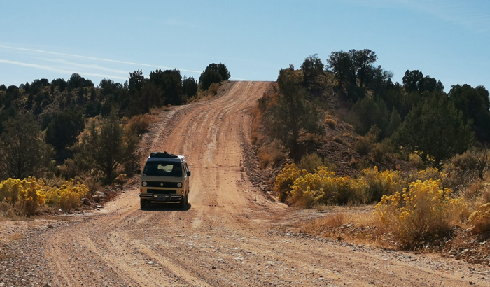
We start the morning by driving a couple miles of the original-original Route 66 (now gravel). Then, on our journey to the Grand Canyon, we pause to visit the SECOND largest hole in the ground. Meteor Crater is 3/4 of a mile in diameter, over 500 feet deep, and was formed when a 150-foot meteorite struck at 29,000 MPH. Though not a National Park, this private, family-owned operation boasts perhaps one of the best such visitor centers/museums we’ve ever been to (and that’s quite a lot). Especially if you’re kind of a space-science nerd. We also highly recommend the one-hour guided rim walk; our local Navajo-Hopi guide really gave some great scientific and cultural context to this strange and spectacular place.


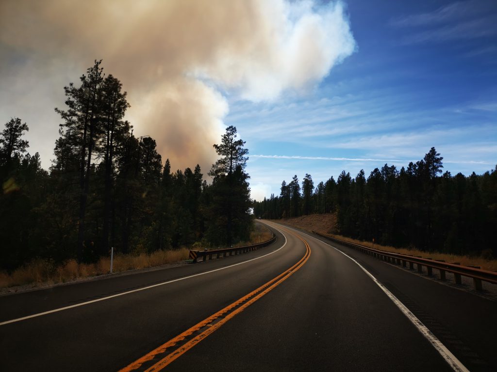
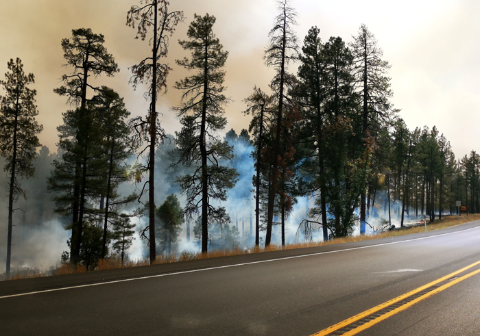
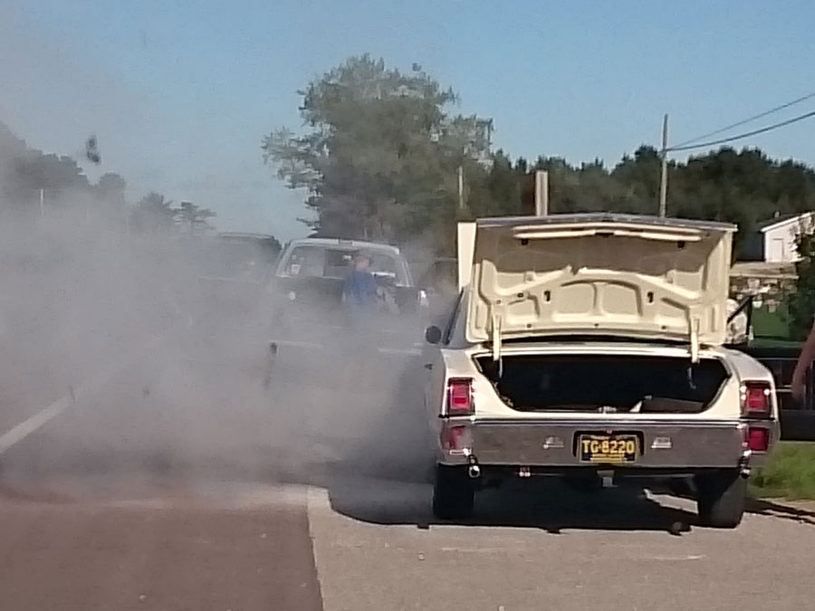
On our way through Flagstaff, Arizona, we finally learn the unfortunate source of those singular smoke columns we’ve been seeing on the horizon the last couple of days.


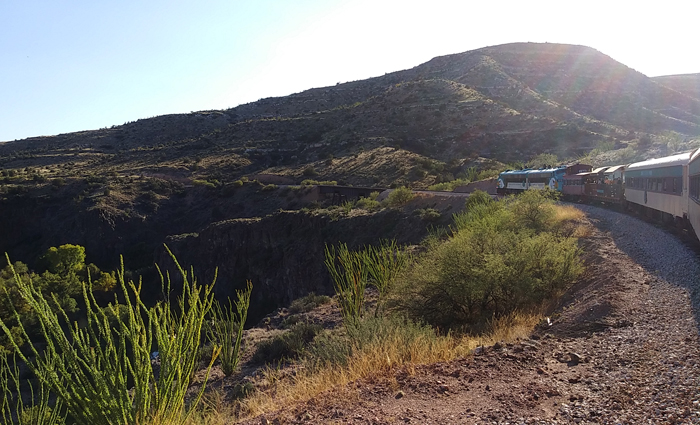
Quite by accident, we take one of the most beautiful scenic drives we’ve enjoyed so far on this trip, following State Route 89A down through Oak Creek Canyon, dropping nearly 2000 feet in 15 miles, into Sedona. We take a room for a few nights and enjoy day hikes, a ride on the Verde Canyon Railroad, and a sunset Jeep tour into the local hills.

Over breakfast on our final day here, another guest visiting from Phoenix complains that they have not seen any wildlife during their trip. I mention that last night while strolling back to the B&B with our Thai takeout boxes, we saw three coyotes cross the street, just a block from here. She clutches her purse and appears worried.


Eager to escape the utterly maddening traffic of Sedona, we climb back up Oak Creek Canyon to Flagstaff. We briefly cruise a few blocks of old Route 66 through downtown Flagstaff, then make a detour from the Mother Road. There are other roads to drive, and other sights to see, so we turn north toward the Grand Canyon, and are rewarded with a wonderful drive up through high desert ponderosa pine forests which open out to broad views of the San Francisco Peaks.

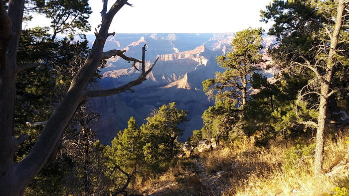
We enter Grand Canyon Village, claim our reserved campsite, then hurry to Trail View Point for our first glimpse over the South Rim.

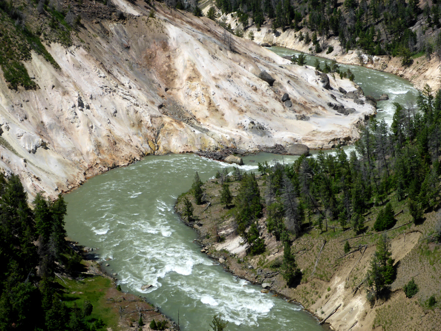
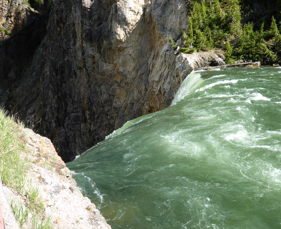
Over our many years of Westy traveling in North America, we’ve seen a lot of big stuff. We’ve dipped the wheels in both oceans; driven the 1500 miles around the world’s largest freshwater lake; crossed the Continental Divide countless times, sometimes as high as 11,000 feet; and camped below a prehistoric waterfall which was once five times the width of Niagara with ten times the flow of all the current rivers in the world combined.

But nothing prepared me for the depth, the breadth, the utter scale of the Grand Canyon. For the first several minutes, I just stand there dizzily clutching the handrail like a dope, my eyes ratcheting in and out like a digital camera unable to auto-focus on its intended subject.

I finally recover, we drive to the next overlook, and it happens all over again.

Really, just a nearly incomprehensible magnitude of space …


For most of the peak season, the only way to see the western portion of the South Rim is via the National Park Service shuttle buses. They’re free, easy, they run every 10-15 minutes so you can hop on and off as you like, and they prevent the dangerous, frustrating, polluting traffic jams that used to plague the park. We ride the bus for much of our sightseeing the next day, and highly recommend this break from driving your own Bus.

The next day, we drive from Mather Campground to the east entrance along the Desert View Drive, then return the same way, stopping at all the viewpoints and other sites.


In the morning, we leave the South Rim via the same east entrance and head to the North Rim. This turns out to be one of the most dramatic and visually stunning scenic routes of this trip so far. Up the Little Colorado River gorge, then up the Marble Canyon flanked by the Vermilion Cliffs, over the soaring Navajo Bridge, then up the Kaibab Plateau to the North Rim Campground. Map.

The lodge and cabins are closed for the season, but the campground is open, so we settle in for a couple of 26-degree nights.


It took about a full day for my feeble brain to finally comprehend the immensity of the Grand Canyon’s South Rim, and upon arriving at the North Rim, I have to start all over again. In addition to being 1000 feet higher in elevation, the North Rim is also set back from the Colorado River 2-3 times further than the South Rim, with more spectacularly carved side canyons.

Also, a mere fraction of the crowds. Though still a fair number of narcissistic numbskulls (as seen above) who happily scamper beyond the designated barriers to take Instagram selfies posing on the precipice. Each year, of course, several fall to their deaths …

An enjoyable way to visit many of the scenic overlooks is a drive up Cape Royal and Point Imperial Roads, the latter of which offers a view from the highest point in all the Grand Canyon (elevation 8800′). So high, in fact, that the bag of Caramel & Cheddar Popcorn we purchased in eastern New Mexico (4000′) now spontaneously bursts open.


On our way from the North Rim to our next destination, we take a 30-mile backcountry byway on washboard gravel through the Vermilion Cliffs National Monument. The twisted and warped landscape here was formed when two tectonic plates collided 40 to 80 million years ago. Pretty quiet today.

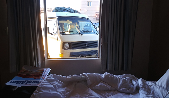
In Page, Arizona, we take a room where we can keep a close eye on our beloved vintage van. Or, perhaps the van is keeping an eye on us?

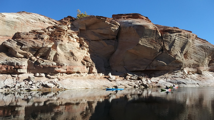
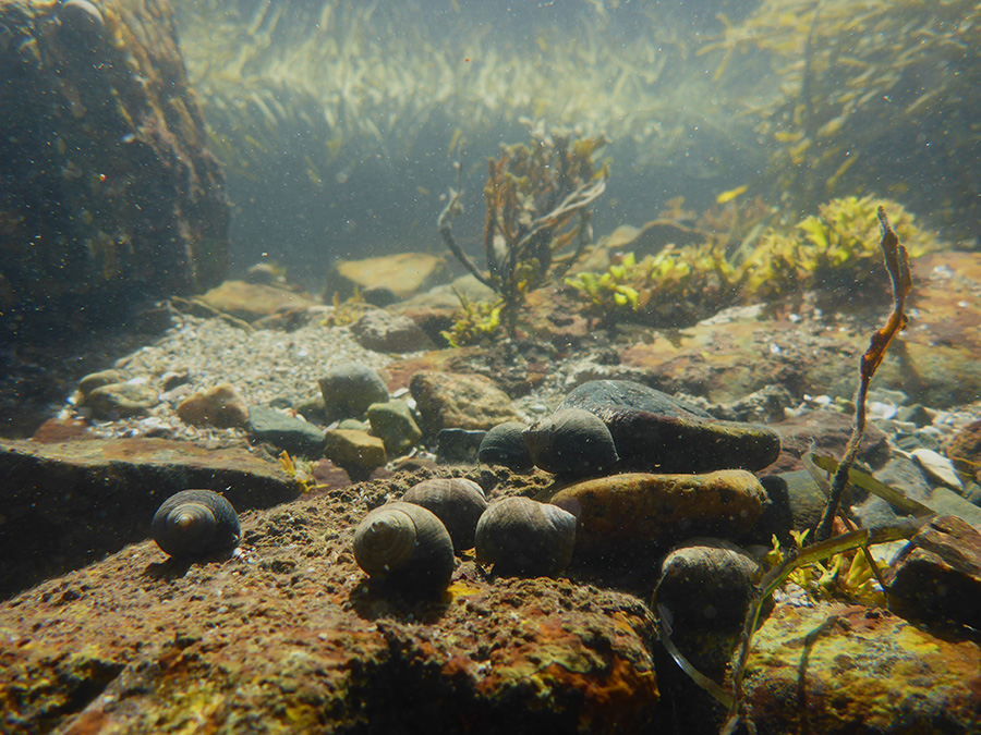
The next morning, we enjoy a guided cruise in Lake Powell to visit Lower Antelope Canyon.


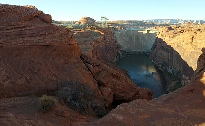
Later, we tour Glen Canyon Dam, the controversial 700-foot-high concrete arch-gravity dam which holds back 27 million acre⋅ft of water to form Lake Powell, one of the largest man-made reservoirs in the U.S.. The hydro-electric generators also produce 5 billion kilowatt hours each year, or enough to power 330,000 homes at any given moment.


We depart in the morning for Bryce Canyon National Park, take a site at Sunset Campground, then spend the rest of the day tooling along the main park road enjoying all the scenic overlooks and viewpoints.

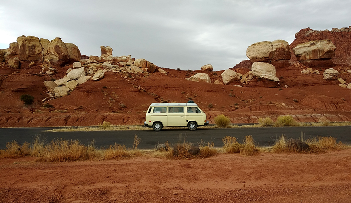
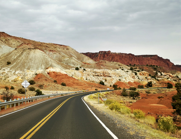
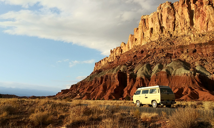
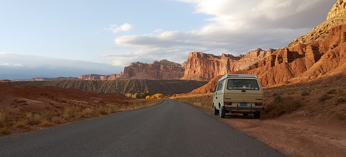
The drive northeastward from Bryce Canyon on US 12 starts off scenic enough but mile by mile, as we continue through Cannonville, Escalante, and Boulder, the country grows increasingly dramatic. By the time we swing eastward at Torrey and enter Capitol Reef National Park, the jaw-dropping bluffs and cliffs are ablaze in gold and crimson as sunset approaches.


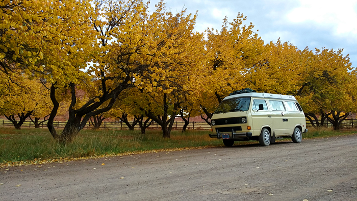
We discover the campground at Fruita, Utah, has several cancellations due to the sudden cold snap, so we take a site and settle in. After a day of motoring across the rocky, barren land of the Kaiparowits Plateau, we find the tiny former community at the junction of the Fremont River and Sulphur Creek a veritable oasis. Now preserved by the NPS for its historical value, the small farm and orchard complex was a small, isolated community of largely self-sufficient Mormon farmers and other frontier folk. The orchards of her residents prospered, offering apples, apricots, cherries, peaches, pears, and plums, and by 1900 Fruita was known as “the Eden of Wayne County.”

The broken and jumbled landscape here is the result of a hundred-mile long warp in the Earth’s crust that formed between 50-70 million years ago, along an ancient buried fault line. Today, the rock layers in Capitol Reef reveal ancient environments as varied as rivers and swamps, deserts, and inland seas, recording nearly 200 million years of geologic history.

In the morning we follow State Hwy 24 along the Fremont River as it tumbles down the rocky canyon. Like so many other routes in this area, the 40 miles to Hanksville, Utah, is a dramatic and stunning drive.

We plan to begin our eastward swing here, cutting across the midsections of Utah and Colorado and eventually homeward. But a pair of winter storms is sweeping down on the region, predicted to drop 4-10″ of snow before we’re able to cross the central Rockies. So, instead we scoot south from here to Albuquerque to steer clear of the storms, rejoining Route 66 and retracing our route along I-40.

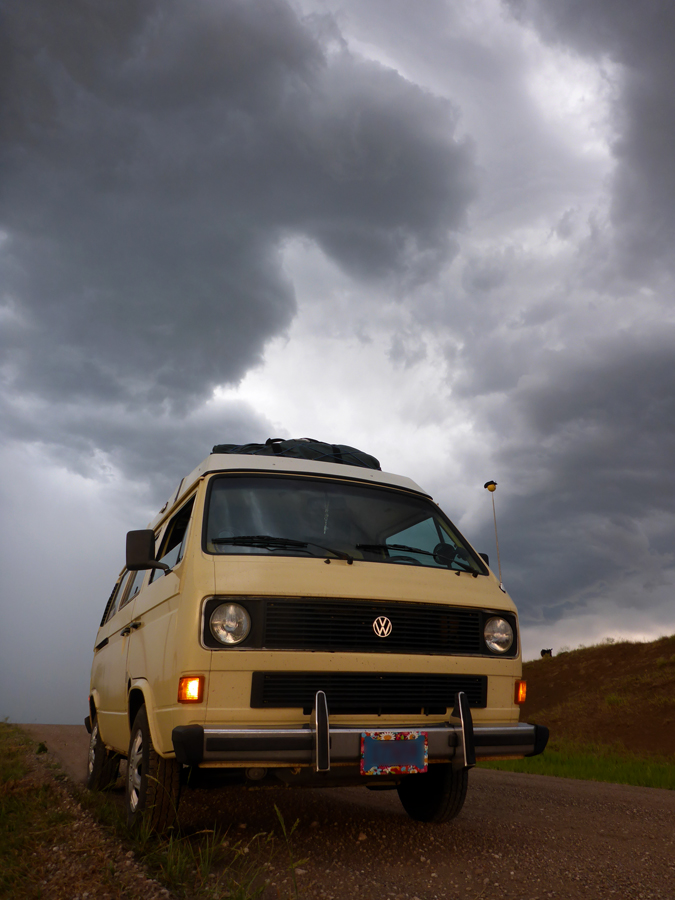
We have clear sailing with a favorable tailwind until Santa Rosa, New Mexico, when the expanding gray storm front swells to overtake us. We are soon surrounded by strange twisting wraiths of freezing fog, pelted by snow-hail, and the Westy windshield becomes glazed with icy sleet. A sense of impending danger descends, so we pull off the highway, take one of the last available rooms at Tucumcari, and order a pizza. Throughout the night, we hear almost constant sirens on the nearby Interstate …


The next morning, under clear and cold skies, we resume our homeward drive. Every few miles are marked by a car stuck in a culvert, or an overturned pickup, or any number of crashed semi-trucks. In a couple places, there is nothing left but a rectangle of black and charred pavement and a road crew scooping up a smoldering pile of twisted steel.

We are fortunate in so many ways, and carefully thread our way home along the Mother Road …

Lake Superior Circumnavigation 2

The Camp Westfalia crew recently embarked on another Lake Superior Circle Tour: 1000 miles around the wild and rugged shores of the Greatest of the Great Lakes. Ride along!

We drive north today toward the inland sea of Lake Superior. Happily cruising along in very light traffic under sunny skies, when suddenly an old El Camino in the right-hand lane veers left in front of us, to cross the median. I throw the wheel over hard to the left and lock up the Vanagon’s brakes, and we go into a four-wheel crabbing skid. We finally stop in the median cross-road, only five feet from his door.

The eighty-year-old driver smiles and goes on his way, apparently oblivious to his deadly mistake. I scowl and go in search of a good stiff drink to settle my nerves …

From Duluth we continue north along Minnesota’s North Shore. Make it as far as Grand Portage, Minnesota, where we have a late-night slice of pizza in the casino cafe. We take a site in the adjacent RV park overlooking the marina, and settle in among the retirees squandering their 401k’s in the casino.

“Lorie’s Lounge” is soon open and (as previously mentioned) I finally enjoy my long-awaited adult beverage …

Sunrise on Lake Superior.

Our border crossing is uneventful, and we soon hit Thunder Bay, Ontario.


After a quick tour of the Sleeping Giant peninsula, we continue eastward along the Trans-Canada Highway, around the northernmost point of Lake Superior. Late afternoon finds us in Rossport, Ontario, where we stop at Rainbow Falls Provincial Park for lakeside camping on the Inland Sea …


We cruise the north shore today, rolling through rugged and rocky Canadian Shield country. Cold inland lakes glitter between granite mountains.

Exploring remote forest roads often leads to beautiful new discoveries. Sometimes not …


We finally camp at Pukaskwa National Park.


At Young’s General Store in Wawa, Ontario we are greeted by one of the city’s famous gargantuan geese. This particular bird was recently retired, and replaced by a new stainless steel model, which can be seen right from the highway.


Another fantastic campsite right on the beach at Agawa Bay Campground.

There are a few advantages to travelling in the off season: no crowds, no noise, no bugs (my god, the bugs!). In fact, not much of anything at all …


Pancake Bay Provincial Park. Legend has it when Lake Superior voyageurs camped here, they knew they were only one day away from fresh supplies in Sault Ste. Marie. So they used up the last of their flour and enjoyed a big ole batch of pancakes.

Mmmm, pancakes …


Having nearly completed our loop of the lake, I realize the Westy is entirely too clean. So, before turning south for home, we let her off the leash for a bit of backwoods romping in the dirt.

For an unabridged account of one of our Lake Superior Circle Tours, check out “A Superior State of Mind.”

Pacific Northwest 2

We recently returned from a four-week, 6800-mile Westfalia road trip from Wisconsin to the Pacific Northwest. We leisurely followed Highway 101 down the Pacific Coast through much of Washington and Oregon, then returned through John Day country and spent a few days in Yellowstone National Park.

We drive hard from Wisconsin and arrive at Badlands National Park about sunset. Before taking a site at Sage Creek campground we must carefully navigate a small herd of the native bovines. Note: a 2500-lb. bison has the right of way over a Vanagon.

An early start gets us over the Continental Divide at Homestake Pass, then on to the Missoula, Montana, KOA tonight, where a fellow Kamper™ arrives in a vintage GMC motor home towing a sweet Beetle.

At Kennewick, WA, we join the mighty Columbia River and opt to drive the northern bank rather than the more usual I-84 on the southern shore. The very lightly traveled Highway 14 follows the river down through stunning and ever-changing landscapes and ecosystems, sometimes high above the river, skirting around soaring basalt bluffs, and eventually entering deep forest near the Cascade Range.

We camp at Columbia Hills Historical State Park, a small but lovely campground right on the banks of the Columbia. Just a short hike away are several Native American petroglyphs which were saved from inundation when the nearby Dalles Dam was built.

We follow the Columbia River all the way down to where it empties into the Pacific, camping at Cape Disappointment State Park. Our site is just a few steps from the ocean, and only a mile from where Captain William Clark camped with a few of his men when the Lewis & Clark expedition arrived here in 1805.

The Lewis & Clark Interpretive Center sits on a decommissioned 1904 artillery battery, built to overlook and protect the harbor entry at the mouth of the Columbia River below.

Having arrived at the edge of the continent, I guess this is as far West as the Westy will be driving.

Exploring the backwoods of Leadbetter Point State Park.

Fortunately, the Westy requires no welding during this trip.

An afternoon at Heceta Beach reveals entire worlds thriving in the tide pools: anemones, sea stars, crabs, sea urchins, and more.

Our campsite near Florence, OR, offers a commanding view of the mouth of the Suislaw River; one afternoon a small pod of orcas swims up the river, hunting sea lions.

At John Day Fossil Beds National Monument, volcanic ash and other debris were laid down over millions of years, then eroded, leaving these colorful badlands.

The rusticated stone Roosevelt Arch at the north entrance of Yellowstone National Park, named for Theodore Roosevelt, who happened to be visiting the day the arch was begun and was asked to lay the cornerstone.

At Mammoth Hot Springs, geothermal-heated water travels underground through limestone, dissolving calcium carbonate, which then precipitates to form these hills of travertine.

The Yellowstone River roars through the Grand Canyon of the Yellowstone.

The rugged terrain of the Park requires some advanced highway engineering.

At the head of the Grand Canyon, the Yellowstone River drops over 100 feet at Upper Falls.

A young grizzly cub learns from Mom how to dig for grubs.

Tiny Isa Lake, straddling the Continental Divide, drains into TWO oceans: the Pacific and the Gulf of Mexico. Either way, for the Vanagon, it’s all downhill from here …

A quick side trip through Grand Tetons National Park and Jackson Hole.

Homeward bound, the Rocky Mountains fade behind us.

We turn a few heads in Nebraska.

Our final night on the road, in a quiet Nebraska county campground …


What do you think? Leave a question or comment below, and use the social links to share with friends!

More Journeys Here!

Seaway Trail to Nova Scotia, Week 4

Having toured the shores of the Bay of Fundy, learning about local maritime history and discovering tidal bores and million-year-old fossils, we now set about exploring Acadia National Park.

Day 22: Winter Harbor, Maine

We break camp on the Schoodic Peninsula and head for Bar Harbor. Along the way we stop at the Mount Desert Narrows on the Taunton River near Hancock, Maine to view a tidal fall.

Similar to the tidal bores we saw in Nova Scotia, a tidal fall occurs when the rising ocean tide moves upriver and meets what is normally a low waterfall in the freshwater river. This rather rare confluence of fresh and salt water, rocky ridges and ledges constrict the flow, and the water “piles up,” in some places actually engulfing and reversing the falls. Eventually the tide turns, and the natural river flow resumes out toward the Gulf of Maine again.

We continue on into Bar Harbor, our old van turning a few heads as we mingle with the Mercedes and BMWs, then continue south on Highway 3 to the ocean side of Mount Desert Island. We choose a site at Blackwoods Campground, drop our camp chairs to claim our spot, then drive north on the park loop road to Cadillac Summit Road.

As the name implies, this narrow, twisty road wends its way up the flanks of Cadillac Mountain, climbing about 1200 feet in only 3.5 miles. Our 1.9-liter diesel employs each and every one of its 64 horsepower to push our overloaded yellow brick up the grade, and we stop only a couple of times to take in the increasingly heady views. Finally, we crest the final rise in the road and arrive at the summit of Cadillac Mountain.


I let the van idle a few minutes to dissipate excess heat from the climb, then we jump out and explore the trails threading the crown of the mountain.

About the time the fossils we saw at the nearby Bay of Fundy were being formed, this area of Maine was undergoing major volcanic transformations. Volcanoes occasionally collapsed, revealing the hellish molten interiors of their magma chambers, and Cadillac Mountain is the remaining edge of one such disintegrated volcanic cone.

We find the raw granite surfaces of the mountain gouged and scarred in a distinct north-south pattern, evidence of a series of enormous continental glaciers which later scoured this landscape. The mile-thick glaciers tore off the remaining mountaintops and ground their surfaces clean of nearly all loose boulders and soil, leaving only the smooth rounded bare surfaces we see today.

Far below, the harbor is sprinkled with small boats and cruise ships, and the namesake ‘bar’ is clearly visible at low tide.

On a clear day one can see Nova Scotia to the east, and Mount Katahdin, Maine’s highest mountain, to the north, both over a hundred miles away. In fact, at over 1500 feet (466 meters), Cadillac Mountain is the tallest peak within 25 miles of the east coast of North America between Cape Breton Island and Mexico.

We coast back down the summit road and drive into Bar Harbor for an early dinner of lobster and steak on the waterfront. After a few such meals while here on the east coast, I’m beginning to feel like a bit of an old hand, and I set about happily dismantling the delicious crustacean like a seagull working over a crab.

We stroll the wharf for awhile to stretch our legs and walk off our meal, then drive to Jordan Pond House for dessert.

This historic restaurant first began serving tea & popovers on the lawn overlooking nearby Jordan Pond in the 1890s, and it’s been a tradition ever since. With a cool afternoon wind whipping in between the Bubble Mountains and ruffling the surface of Jordan Pond, we’re happy to sit indoors near the fireplace while enjoying the warm pastries made from local berries, and hot tea.

Returning to Blackwoods Campground we find a group of boisterous Boy Scouts has made camp behind us, and who are apparently earning their merit badges for Whooping Loudly While Whacking Trees with Sticks.

Just as well, as the late September evening has grown even cooler, so we settle into the cozy Westy for the evening.

Day 23: Bar Harbor, Maine

We set out this morning for a day of windshield touring.

We find Acadia unlike almost any other National Park we’ve ever visited. Most American national parks were still wild and wooly places when their natural beauty was recognized and they were first set aside as Parks. But the 100-square-mile (280 km2) Mount Desert Island has a long history of early fishing and shipbuilding settlement by Europeans.

In the mid-1800’s the Island began drawing ‘rusticators:’ painters, poets, writers, and other bohemian types who came from the cities each summer and paid local villagers for simple room and board in their back rooms and sheds.

Later, the place was discovered by wealthy eastern families like the Fords, Carnegies, Vanderbilts, and Rockefellers, who built extravagant three-story granite ‘country cottages’ with high sweeping gables, wrap-around verandas, and turrets overlooking the Atlantic.

Eventually, the Great Depression put a damper on much of this ostentatiousness and many of these Gilded Age elites began packing up their fancy pants. The rest were driven out in 1947 by a devastating fire that burned nearly half of the eastern side of Mount Desert Island, consuming modest villages and sumptuous estates alike.

Already in 1919, President Woodrow Wilson had signed into existence Lafayette National Park, as it was first called. It was the first national park east of the Mississippi River, and the name was changed to Acadia National Park in 1929. Former resident John D. Rockefeller Jr. very generously donated much of the land of the modern-day Park, as well as the labor and materials for the winding carriage roads and seventeen beautiful stone bridges.

Because of this long and varied history of settlement, Acadia today remains a patchwork of wild public parkland and private developed estates.

We park the van and stroll down to a quiet cove to enjoy the warm sunlight, but several tour buses soon arrive and deposit hundreds of tourists from the visiting cruise ships. Most appear a little lost here, and many are dressed as though they were expecting a cocktail party, with tweed jackets, pleated skirts, and gold broaches. Some wear four-inch high heels.

To a place called Sand Beach.

ELLSWORTH AMERICAN FILE PHOTO

We drive down the shore a bit to Thunder Hole, an inlet carved by the ocean into the rocky cliffs. When the waves kick up here, the sign says, air and water are forced into the cavern and then back out, spouting 30-40 feet high and making the namesake ‘thunderous’ roar.

During Hurricane Bill in 2009, Thunder Hole endured several hours of sustained swells of 12-15 feet, and crowds gathered to watch the power of Mother Nature. When a much larger wave struck, it swept seven people off the platform and into the water, drowning one.

Today, however, the place is not thundering at all but only gurgling and softly clearing its throat, evidently due to a falling tide, calm wind conditions, or perhaps a malfunctioning pump.

We continue touring the southern shore of the island, through Seal Harbor, Northeast Harbor, and up around Somes Sound. This part of the island and Park is noticeably less developed and more rural than the Bar Harbor area, and we understand why it’s often referred to by locals as “The Quiet Side” of the island.

In Southwest Harbor we stop at the Cafe Drydock & Inn. While we enjoy a fine lunch near the front windows, I catch British accents from a young family seated at a nearby table.

“Hey look,” says Father to the children, pointing outside to our beflowered Westy parked across the street, “it’s the Scooby-Mobile!”

Lorie and I hop into the Mystery Machine and resume our drive of the island. A turn down a side road to see another random lighthouse turns out to be ‘the’ lighthouse of Acadia National Park: Bass Harbor Head Lighthouse.

This iconic light, featured on countless postcards, key chains, and novelty socks, was built in 1876 to mark the entrance to Bass Harbor and Blue Hill Bay, at the extreme southern point of Mount Desert Island. The lighthouse itself is on private property but a short hike down some steep wooden stairs offers a pretty dramatic view in a beautiful setting.

We continue our drive around the western shore of Mount Desert Island, then cut across the middle and return to camp at Blackwoods Campground.

Day 24: Bar Harbor, Maine

Our last full day in Acadia National Park, we sleep in late today, then motor into Northeast Harbor for breakfast. Lorie orders the spicy chili omelette, while I take what may be my first and last opportunity for a lobster omelette.

We drive to a nearby seaside park to soak up the warm morning sun and to wade around in the pools left behind by the falling tide.

The Northeast Atlantic offers some of the most lively tidepools I’ve seen, and they are distinctly different from those seen in the Pacific Northwest. Slowly stepping from one exposed granite boulder to the next, I carefully explore this intertidal ecosystem draped in vibrant green and red seaweeds.


I find clusters of snail eggs attached to rocks, mussels with open shells, some kind of sea worms covered with tiny scales, slow-moving starfish, even the occasional shy crab. I find myself lost in the world of these adaptive but delicate creatures who spend half of each day exposed to the air and sunlight and the other half completely submerged in this natural aquarium left between the rocks.

Lorie finally calls me from my marine reverie and we drive back up to Northeast Harbor for a scenic nature cruise. Our tour boat chugs out of the harbor and onto the ocean behind the protection of a smattering of islands.

We glide below the white Bear Island Lighthouse, gleaming in the afternoon light, then south to see what might possibly be the world’s largest osprey nest, slightly more spacious than my first apartment. The boat turns east through waters scattered with thousands of small buoys, almost close enough to step from one to the next. Each buoy is painted a unique combination of color and stripes or bands, indicating the owner of the lobster trap to which it is anchored. We circle around a few smaller islands, their shores lined with large harbor seals basking in the sun.

Our tour is led by a local naturalist and former school teacher, who maintains an engaging ongoing narration of the sights and sounds of this place, pointing out hidden features and creatures as we motor along.

We soon arrive at Little Cranberry Island, where the boat deposits us at the tiny fishing village of Isleford. Lorie and I enjoy our packed lunches on the lawn at the foot of the wharf, then stroll up to the Islesford Historical Museum, full of intriguing exhibits about the life of the multi-generational lobster fishing families who have lived and worked here since 1927.


We return to the pier and watch the bustle and clatter as the workers unload lobsters from the incoming boats. Then we shove off and head back to the mainland, where we cruise up into the Somes Sound. This long bay runs deep into Mount Desert Island, almost splitting the island in two, with tall vertical cliffs rising right out of the water. The Sound is often referred to as the only fjord on the East Coast.

Back at the dock, we jump in the Vanagon and return to Bar Harbor where Lorie has arranged a surprise for me; this is our last evening of this month-long road trip and tomorrow we will turn westward for home. After a quick dinner in a local ale house she leads me around the corner and down the street to the Criterion Theater.

Perplexed, I glance up at the overhead marquee to see the name of one of my favorite authors and producers, who is speaking here tonight.

If you don’t yet know him, you almost certainly know much of his work.

Dayton Duncan, often working with longtime collaborator Ken Burns, has written and produced some of the best award-winning American historical documentaries, usually airing on PBS. The Civil War, Baseball, Mark Twain, The West, and more.

His stories are of special interest to those who love the outdoors and epic travels. Horatio’s Drive follows Horatio Jackson in his Winton auto-car, with his friend Sewall Crocker and a bulldog named Bud, on the first cross-country automobile journey in the US, in 1903.

And Lewis & Clark: The Journey of the Corps of Discovery, is a four-hour documentary of what might have been America’s Ultimate Road Trip.

But perhaps my favorite Dayton Duncan work is not a film but a tattered paperback I often carry tucked away in one of the Westy’s cabinets: Out West: A Journey through Lewis and Clark’s America. In 1984, Duncan and his family set out in their own Volkswagen camper van to retrace the steps of Lewis and Clark’s epic adventure through the American West, and it is a fascinating read.

We go inside and claim our tickets, then take our seats in the third row. Other audience members file in and I note that they are about evenly divided between rumpled hikers and campers, and well-to-do Mount Desert Islanders out for an evening away from their gated estates.

The house lights soon dim, the host takes the podium for a few words, then introduces the featured speaker. Immediately behind me, I hear someone clear his throat, rise to stand, and Dayton Duncan makes his way to the stage. Turns out the renowned producer had been seated directly behind me …

Duncan is an eminently skilled writer and an equally eloquent speaker. He offers a brief history of the National Park system and the cultural significance of it in American society, then circles in on Acadia National Park, which is celebrating its centennial this year.

He then introduces a special cut of The National Parks: America’s Best Idea, which describes the fascinating history and larger-than-life characters who struggled to first establish the parks, then devotes several minutes to Acadia National Park. While the vivid images and inspiring narration of the twenty-minute documentary roll on the screen, Duncan sits behind me again. I catch the occasional whispered comment between him and his wife, about the day they shot this scene or that one, or an amusing historical footnote, and it’s like getting a special-edition producer’s cut of the film.

Afterwards, Duncan elaborates on the cultural significance of the Park system in American society. He passionately makes the argument that the inherent birthright of all citizens to visit and partake of these sacred lands and places rivals nearly any other freedom outlined in our Bill of Rights. The parks, he says, are woven into the very fabric of our democracy, yet like any fabric, if not cared for they can be unraveled.

Little do we know that just six months from now, our President’s budget proposal for the coming fiscal year will seek to trim $1.5 billion from the budget of the Interior Department, which includes the Park Service.

“The National Park idea says it doesn’t matter if your parents came over on the Mayflower or your parents just arrived. Each one of you is the owner of some of the best seafront property this nation has … You own awesome views of stunning mountains and breathtaking canyons. They belong to you. And all that is required in return is that you put it in your will for your children so that they can have it too.”

As Duncan speaks, Lorie and I reflect on all our own visits to our National Parks, usually in the Westy, and we realize that the parks are perhaps the one truly eternal element in the fleeting impermanence of our lives.

Tomorrow we will awaken on our final morning in Acadia, we will turn the Vanagon’s wheels to the west, and we will sail homeward across this great continent.

But there are many more National Parks yet to be seen, and the journey never ends …

Seaway Trail to Nova Scotia, Week 3

Day 15: Digby, Nova Scotia

Over breakfast we write postcards to family, and I include one to the original owner of our Westfalia, who I recently met by chance. She and her husband picked the van up at the factory in Hannover, Germany in the summer of 1983 and had it shipped to their home in the US. It briefly changed hands one more time before we bought it, and I think she’ll be pleased to know that 34 years later it’s still making coast-to-coast road trips.

In clear and sunny weather we roll through the verdant rolling fields surrounding the Annapolis Basin, then swing north at Windsor, NS to catch the Glooscap Trail. Closely following the shore, this scenic driving route runs 360 km (220 mi) along the south and north sides of the Minas Basin, the eastern portion of the Bay of Fundy.

We cruise along the shore, stopping at various roadside parks and scenic overlooks. At the Walton Lighthouse we find a small wedding party gathering for their ceremony on the high bluff overlooking the bay.

We stop for a picnic lunch at Burntcoat Head, site of the world’s highest tides. Because of the unique combination of topography and water flow, the tides here average 17 meters (56 feet). But during a major storm in 1869, the high tide was recorded at an unimaginable 22 meters, or 71 feet.

After lunch we tour the lighthouse, a replica of the original 1858 structure, and the small but informative historical museum upstairs. As we’re heading back to the Westy we once again meet our friends from Minnesota in the EuroVan, and stop to chat.

As we continue eastward, I notice that many of the roadside mailboxes here bear the same names as those of the Loyalist settlers I learned about in the lighthouse museum, and I recall a forgotten 250-year-old link to the colonial United States.

During the American Revolution of 1775, tens of thousands of American colonists who supported the British cause, and who advocated against declaring American independence, fled the colonies and migrated here and elsewhere in British North America. They built modest homes, farms, and businesses, and established some of the area’s first educational, religious, social and governmental institutions, many of which survive today.

We swing around the back of the basin to drive to Five Islands Provincial Park, where we find a site on a hill overlooking Fundy at sunset.

Day 16: Five Islands, Nova Scotia

This morning we get up early and race back to Maitland on the banks of the Shubenacadie River, which we’ve been told is a good spot from which to witness a tidal bore.

Photo: http://www.tripsister.com

A natural phenomenon that occurs in only a few places in the world, a bore happens when a rising tide moves into a bay which narrows at the back, especially one with an outflowing river. As the bay grows more shallow, and the shores more narrow, the incoming tide tends to ‘stack up’ to form a rising, rolling wave at the leading edge.

Depending on the season, the lunar cycle, and a few other factors, the bore can range anywhere from a ripple to over 2 meters (6.6 ft) in height.

We pull in behind the Frieze & Roy General Store, and Lorie runs in for coffee and donuts while I claim a spot on the river bank among the German tourists.

While we wait, a silver pickup parks nearby and the owner gets out. I see him eyeing the Westy with some interest. He eventually comes over and tells us all about his ’76 Camper: road tripping across the country to music festivals, the girls, the hazy years.

He says lots of people wanted to buy his magic Bus over the years—to experience the vanlife long before it was a hashtag—but were horrified by the occasional need to adjust the distributor points, or to replace a broken accelerator cable with a piece of fishing line in order to get home.

He tells us he eventually sold his Bus to a local restorer who makes them look better than new, “and I get first dibs on buying it back. But, you know …” he shrugs and gazes wistfully across the brown tidal flat.

“Yeah,” I reply, “what’s the cost to buy back your youth?”

He laughs. “Well, I gotta go milk three hundred cows.”

At last the tide comes in, a low churning riffle sweeping across the surface of the cappuccino-colored water, surging gently up onto the muddy banks in a wide arc.

Frankly, it’s a bit underwhelming so we race up the river a few miles to the Fundy Tidal Interpretive Centre.

Here a modified old railroad trestle extends over the river bank, and a small crowd has gathered to await the arrival of the tidal bore approaching from downstream. An interpretive guide provides helpful narrative while Zodiac inflatable motor skiffs buzz around in the roiling brown water.

Within a few minutes a collective “Oooh …” sweeps through the spectators as the bore swings around the bend and churns upriver toward us. The river seems to stop and reverse direction, briefly flowing backwards. Confined here within the narrower river channel, the wave on the leading edge is certainly higher than before, perhaps a half meter (18”) high. But as it swishes past us and continues up the river, it soon peters out and dissipates.

The show apparently over, a disappointed tourist turns to leave and says to me, “So, that’s a tidal bore, huh? Now I know why the locals call it a Total Bore …”

On the way back to Five Islands Ocean Resort we stop for groceries at the Masstown Market. A sort of large rambling grocery store, deli, farmers market, bakery, and restaurant, the market seems to go on forever, and we restock provisions for our continuing month-long trip. Among other things, I grab some local craft beers, a half-pound of smoked Fundy salmon, and am thrilled to rediscover a childhood favorite—Jiffy Pop popcorn in the familiar silver pan with the extraordinary expanding turban-shaped foil dome.

Back in camp, we build a fire and watch the turning tide drain the bay like a bathtub while enjoying ”The Magic Treat — as Much Fun to Make as it is to Eat.”

Day 17: Five Islands, Nova Scotia

Donuts and coffee get us going and on the road, but we stop in Parrsboro for a proper breakfast. We find the Harbour View Restaurant right on the water next to the wharf. It’s hard to beat the view, and my eggs & haddock breakfast is perfectly serviceable, but Lorie’s lukewarm omelet is made with canned mushrooms and hand-torn barely-melted scraps of American ‘cheese’ slices.

Afterwards we stroll around the beach at the world-famous low tide, finding a few tiny crabs hiding in the lingering puddles, and observing the timber cradles into which the fishing boats settle when the tide drops, sometimes as much as 50 feet (15 meters). For those keeping score at home, that’s as high as 7.3 Vanagon Westfalias.

Just around the corner is the Fundy Geological Museum, which we find packed with well designed exhibits and displays illustrating the rich geological history of the region. Real and replica fossils from some of the oldest dinosaur bones in Canada: the world’s first reptiles, early dinosaurs, giant dragonflies, and more.

We are astounded to learn that 250 million years ago, before super-continent Pangea broke apart and the pieces began floating around the planet all loosey-goosey, Nova Scotia was snug up against modern-day Morocco.

We continue driving west along the Glooscap Trail to Port Greville, where we stop into the Age of Sail museum.

The friendly host greets us and sets us loose among the exhibits housed in an 1854 church, and boasting some great displays and thousands of artifacts from the days of local lumbering and boat building. Port Greville has a rich history in this regard, having built and launched hundreds of wooden sailing ships from the snug cove just below the museum.


When we leave, we find this part of the Minas Basin completely socked in with fog, and we take extra care on the twisty, hilly roads. Within a few miles, and in keeping with our nautical maritime theme, we arrive at the Old Shipyard Beach Campground at Spencers Island, NS. Our plan is to park the Vanagon on an assigned patch of gravel between the large RV’s and campers, but when Lorie sees the quaint little cabins just a few steps from the Fundy shore, she books one.


After getting settled we stroll up to the restored Spencer’s Island Lighthouse. Built in 1904 and still bearing its original wooden clapboard siding, the lighthouse was crucial to the settlement and economic development of the Spencer’s Island area, also a significant shipbuilding town. The light helped provide safe passage for the many ships and crews that travelled this rugged and often foggy shoreline of the Bay of Fundy. It’s one of the few original lighthouses built here on the north shore still in existence.

We enjoy drinks on the front porch as the gloom descends into evening.

Day 18: Spencer’s Island, Nova Scotia

Upon our arrival last night I noticed a large pond immediately behind our cottage, but this morning I see it has completely drained with the falling tide to reveal a grassy salt marsh. Six hours later, it will once again be a small lake.

After breakfast in the cabin we drive north to the Joggins Fossil Centre.

Officially included on the UNESCO World Heritage List, the cliffs here have been described as the “coal age Galápagos” for their unmatched wealth of fossils of prehistoric life. Fossilized skeletons and tracks of very early animals, and plants of the rainforest in which they lived, can be found here, and we’re eager to find some ourselves.

The visitors center and museum offers a great introduction to geology in general, as well as the birth and development of modern geological sciences.

During the mid-1800’s, Charles Lyell, considered by many the father of modern geology, explored these tall cliffs on the shore of Fundy and declared the Joggins exposure of Coal Age rocks and fossils to be “the finest example in the world”. Along with his colleague, Nova Scotian geologist Sir William Dawson, Lyell discovered, among other things, the earliest known reptile to ever walk the planet. Lyell’s writings would influence those of Charles Darwin and many other preeminent natural scientists of the day.

Armed with this geological and historical background, we join a walking tour. Our guide is Calvin, a young geology student from nearby Acadia University, and his knowledge and obvious enthusiasm are contagious. But best of all is his ability to explain complex principles of geology and prehistory in simple terms.

As we follow Calvin down the stairs we notice placards installed every 10 meters (30 feet) or so, denoting the corresponding geologic time period through which we’re descending. By the time we step off the stairs and onto the rocky beach we’ve gone back over 300 million years into the geological past.

From the water’s edge, one can look back at the 25-meter- (80-foot-) tall cliffs, comprised of multiple distinct layers. The strata are tilted here, so by simply hiking along the base of the cliff one can clearly see—and even lay one’s hand upon—several eons of time.

We don’t have to look hard to see large fossils embedded in the cliff face, slowly being exposed by the erosion of the high tides of Fundy. We see the fronds of prehistoric horesetail ferns, shellfish, even intact two-meter-long sections of fossilized tree trunks.

Most are high out of reach, but scattered about the cobble beach we find countless mystifying fossil artifacts: leaves, stalks, branches, coprolites, even the footprints left in ancient mud by a passing tetrapod. It’s difficult to turn around for fear of stepping on another 300-million-year-old specimen …


We gaze from one end of the 15 kilometre (9 mile) cliff to the other in the hazy distance, and ponder the uncountable fossils and other relics of bygone eras. It makes one’s own existence here seem small, insignificant, and oh so brief …

Day 19: Spencer’s Island, Nova Scotia

Lorie sleeps in late today, and I take my coffee out to the front porch to look for the sun among the heavy gloom.

Our next-door neighbor rumbles up on a four-wheeler and unloads a couple of buckets full of red seaweed he’s just collected from the intertidal zone. He dumps the broad flat multi-lobed leaves on the ground in front of his porch to dry.

“Dulse,” he says simply, seeing my curious gaze.

A kind of seaweed that grows in the shallows, he explains he’ll soon rinse the 50-cm (20-in) long leaves and pack them into mesh onion sacks and then take them home to hang in his garage for further drying.

From there, the dulse can be ground into flakes or a powder and used as seasoning for soups or stews, cut into strips and fried like bacon, or his favorite—simply torn into small scraps and eaten like chips. Later today, I will see roadside stands offering small sandwich bags of the dried seaweed snack.

My interest and appetite whetted, Lorie calls me home for breakfast, then we hit the road and drive out to Cape d’Or lighthouse. We hike down to the tower perched right on the very point at the entrance to the Minas Basin. This is a prime location for a lighthouse, visible for many miles across the sweeping Bay of Fundy and serving as a marker above the treacherous waters of the Dory Rips, created by the collision of three strong tidal currents.


Fundy is a bifurcated bay, the back portion split into two smaller bays, divided by the high headland of nearby Cape Chignecto Provincial Park. About 40 square kilometres (10,000 acres), Cape Chignecto is the largest provincial park in Nova Scotia, and encompasses some of the area’s most spectacular scenery, rare “fog forests,” Alpine-like ecosystems unique to the region, and an endangered moose herd.

Though the park offers backcountry camping and 50 kilometres of trails, from the visitors center it’s only a short hike down to the water’s edge where we clamber around on the Red Rocks formations.

Then it’s back to Advocate Harbour to check in at Nova Shores Adventures, where we have booked an afternoon of kayaking. Directions in hand, we drive out to the remote Apple River Beach on Spicers Cove to meet up with the guides and the rest of our group.

About a dozen tandem sea kayaks and other gear are already set out on the sand near the water’s edge, but the wind and waves have kicked up, so our guides delay our launch a couple of hours. While waiting, we all enjoy the field-prepared lunches and stroll the broad beach near the mouth of the river.

Finally, the wind dies and the waves lie down, and our guides give the okay. We all launch our kayaks out through one-foot breakers, then meet up to form a tight group for the one-mile paddle to the first point.

Clearing the peninsula, we cruise the tall cliffs to a cavernous amphitheater large enough to accommodate our entire flotilla of kayaks. Rounding another rocky point, we soon see the Three Sisters, the famous trio of sea stacks rising majestically from the waters of the bay.

According to legends of the native Mi’kmaq people, their creator-god Glooscap had three younger sisters. Like little sisters everywhere, these three followed Glooscap around wherever he went, pestering him and generally getting underfoot as he went about creating all the local natural features, inventing the canoe, and saving the world from an evil frog-monster who had swallowed all the Earth’s water.

Eventually, one day Glooscap had had enough, he lost his temper, and turned his three unfortunate siblings into the giant pillars of stone we see today.


We paddle our kayaks around their feet, through an overhanging sea arch, and slip thorough narrow slot canyons. Across the Bay in the distant sea haze we catch views of distant New Brunswick, through which Lorie and I will drive tomorrow.

We finally turn around and point our bows toward home. The afternoon sun begins to drop behind us, casting a warm light on the tall cliffs, and we enjoy a gentle push from the three-foot swells. A mild tailwind carries us ashore, and we soon land back on the golden beach …

Day 20: Spencer’s Island, Nova Scotia

After our last night in our seaside cabin at the Old Shipyard Beach Campground, I get up early to make coffee, and then step outside to enjoy our final sunrise on the Bay of Fundy. Today will be a big driving day as we finish tracing the Fundy shore and head south for Acadia National Park.

While Lorie cleans up after a quick breakfast, I carry our bag of recyclables down to the office where I find a gold Vanagon camped next to the lighthouse. I stop to chat with the owners, and as so often happens, we’re soon sharing stories and exchanging travel tips. They are only the second owners of their van, having inherited it from her parents, and it’s in fine shape.

Lorie and I jump into our own Westfalia and hit the road, giving the other Vanagonauts a friendly wave. It’s a clear day and we’re able to enjoy distant views that have previously been enshrouded in fog. In Parrsboro we spend the last of our Canadian currency on groceries and diesel fuel, then drive north to Amherst and Moncton, hooking around the very back of the Bay of Fundy.

We follow Highways 2 and 1 to St. John, NB, leaving our big fold out Nova Scotia map now in tatters.

Crossing into Maine near Calais, we meet perhaps the most congenial US Customs officer I’ve ever encountered. He’s also the only one ever to request we open the Vanagon’s sliding door for a quick interior inspection. He praises our rig, and climbs inside.

“Oops, your toilet kit is about to fall,” he zeroes in on Lorie’s zipper bag with a prescription medicine bottle peeking out the top. Casually confirming that it is indeed Lorie’s name on the label, he tucks everything away and closes the door. Smiling, he hands our passports back to us and wishes us a good trip.

Our fuel gauge indicates 1/4 tank so I begin looking for a station. And looking, and looking.

And looking …

We drive for miles and miles through the dense Maine forest without seeing so much as a house, the endless steep hills sapping our speed and our precious fuel. The ups and downs, lefts and rights throw the needle all over, but mostly it hovers in the worrisome orange zone.

I slow to 50 mph to conserve fuel, I coast downhill, and briefly consider stopping at a Highway Department depot to siphon a gallon of fuel from an idle snow plow. As I drive, I recall the bottle of Diesel Kleen fuel additive I carry under the bench seat, and I mentally calculate how far a full quart of the stuff will get me.

Lorie boots up a fuel station finder app, but the regional map looks as dismal as a nighttime satellite photo of North Korea …

Hopefully, we pull into a roadside diner with two pumps out front, but they’re both gasoline. I go inside where I find a lone skinny kid in a dirty smock inexplicably frying up ten pounds of bacon on a Tuesday afternoon, and I ask him where the nearest diesel can be found.

“Fifteen miles that way,” he points with his greasy spatula. “You going that way?”

“I am now …”

We finally coast into Richie’s General Store on kerosene fumes. I open the nozzle and the pump runs and runs and runs …

When I go inside to pay, the checkout girl asks if I realize that I just pumped my old VW van full of diesel fuel?

“Yeah, why?”

“I don’t think they made any VW vans that use diesel. Are you sure it runs on diesel!?”

I glance outside to the far pump island, where the slanting Maine sun casts a warm glow on our cheery yellow Vanagon.

“All day,” I reply, “from coast to coast.”

We cruise down to Winter Harbor without seeing a single other fuel station …

Arriving at Schoodic Woods Campground, we choose a site then go back to the office to register. Lorie runs inside and as I wait in the van two strapping young National Park Service rangers march out to start their evening patrol. They cast a suspicious eye toward our beflowered hippie bus. Perhaps looking for an easy first kill, the commanding officer strides up to my window.

He looks me up and down, and his eagle eyes scan the Vanagon’s interior.

“You all set?”

“Yeah …”

He nods.

“I like your van,” he states flatly. “Very … colorful.”

“Umm, thanks?”

“Carry on.”

Lorie returns and we drive down to get settled in a great campsite, the stunted green spruce of these coastal northern boreal forests bathed in the golden light of sunset. We build a campfire against the brisk evening air, and the occasional breeze carries the sound of fishing boats on the nearby harbor.

Day 21: Winter Harbor, Maine

The day dawns gray and wet so we drive into Winter Harbor for a big breakfast, with extra helpings of overheard local gossip. Then we’re off to tour the Schoodic Peninsula.


The only part of Acadia National Park located on the mainland, Schoodic is located about five miles across the narrows from the park proper, and has similarly rugged shorelines as Mount Desert Island. But being far more secluded and virtually undeveloped compared to Bar Harbor and other popular destinations, Schoodic is the quiet side of Acadia.

We drive the loop road, stopping at pull outs and scenic overlooks to see the harbor, the windswept, rocky point, and distant views of Cadillac Mountain.

Continuing northwest, we take in a few small fishing villages, the gritty hardworking side of coastal Maine, then swing west to Bar Harbor on Mount Desert Island.

I don’t recall what I envisioned Bar Harbor to be but it sure wasn’t this: heavy workaday traffic, the roads lined with gift shoppes, fudge outlets, and lobstah shacks. The town center is even worse, packed tight with countless trinket vendors, galleries of faux art, and novelty tee shirteries.

We park the van and stretch our legs, mingling with the thousands of well-heeled tourists on shore leave from the three gigantic cruise ships anchored in the harbor, who stroll aimlessly around in their Helly Hansen expedition rain wear and Italian loafers while licking organic ice cream cones.

We peruse the seaweed soaps and kelp candles, crab-shaped keychains, and pirate-themed bottle openers. Inspired to buy something nautical, I shop for a new knitted watch cap for the recent cold evenings, and I find a high-end sporting goods boutique offering 33% off Patagonia outdoor wear. So, instead of the name-brand beanie costing me the usual arm and a leg, I am able to purchase it for only a finger and a couple of toes.


After a few weeks of enjoying some of the most scenic natural wonders of the region, and looking forward to more in Acadia National Park tomorrow, we find this bustling marketplace of schlock a little overwhelming.

The only saving grace here is that about every third place is a pub, tavern, or alehouse. So, after going with the flow for awhile we dive into the nearest drinkery (always our first refuge), where we enjoy a couple of local IPA’s over a basket of fish-n-chips.

We finally jump in the Westy and follow the caravans of tour buses out of town and past countless inns and lodges with “No Vacancy” signs, leaving the clamoring throngs behind us, and return to our restful campsite in Winter Harbor.


Next: Week Four of this road trip, when we attempt to climb Cadillac Mountain, tour Acadia National Park, visit an historic island fishing village, and more!

Seaway Trail to Nova Scotia, Week 2

Day 8: St. Peter’s, Nova Scotia

A fresh sea breeze drifts in from the bay while we enjoy breakfast in camp.

We pack up the Vanagon and drive the inland route along the shores of Bras d’Or Lake nearly to Sydney, then turn south to Louisbourg.

In 1713, a fortress and fortified seaport was built here in the harbour by the French military. To guide ships and fishing boats into the safety of the harbour, a lighthouse was built across the bay in 1734. From this rocky peninsula we enjoy a commanding view of the harbour entrance, laced with treacherous shoals and rocks.

We motor to the fort visitors center, filled with engaging and informative exhibits. But this place really comes alive when the shuttle bus traces the shores of the harbour and deposits us at the gates of the fortress town.

Once a thriving community, this French settlement was captured, destroyed, and abandoned by the British between 1758 and 1768, and languished for two centuries. But in the 1960’s and 70’s, Canada embarked upon a colossal assessment, archeology, and reconstruction of the old town site. Historians, architects, and engineers directed local displaced coal miners to employ 18th-century masonry techniques to rebuild dozens of the original buildings on their locations, in some cases using the very same stones.


Today, we stroll these old streets on a warm and sunny afternoon, immersed in what was once a bustling, remote New World seaside village. We purchase a small loaf of bread from a lovely blond living-history baker girl, and walk the grounds while munching the hard, dark Old World bread which must surely contain a week’s worth of dietary fiber.

From the wharf to the tavern to the Kings Bastion and parade grounds, one can easily get lost in this sprawling open-air museum of over fifty buildings covering 12 acres. Indeed, we are surprised to learn that only about one-quarter of the original town site has been reconstructed, and the majority remains buried beneath layers of soil and centuries of time …

The shuttle bus carries us back to the 21st century, and the VW bus soon carries us to a seaside diner offering fresh seafood. This has been high on my to-do list since our departure from the upper Midwest, and now that we’re here it seems the perfect time to partake of an authentic Atlantic lobster lunch.

We take a table on the outdoor deck overlooking the harbour and the nearby commercial fishing fleet pier, and we place our orders. While we enjoy cold beers before our meal, we chat with a couple of fellow travelers at the next table from New Hampshire. Soon my lobster arrives.

I love a good surf-n-turf combo, and even we in the heartland are quite acquainted with lobster tail. But here is the whole crimson beast. He is perched almost upright on the plate, gazing upward at me rather disconcertingly, his claws awkwardly embracing a small sauce cup as if to say, “Here, I’m delicious with drawn butter. Enjoy my tender flesh!”

Off to one side are arrayed various accoutrements unfamiliar to me, and everything is set out and arranged with all the ritualistic complexity of the Chanoyu Japanese tea ceremony. There is a plastic bib and a plethora of napkins. There is a small wicker basket, presumably for fragments of exoskeleton? There is a set of tiny forks and some sort of cracking implement resembling an Irwin curved jaw locking pliers one might use to remove a rusted nut on a Vanagon clutch slave cylinder.

I struggle with my bib in the sea breeze like George W. Bush with his rain poncho at the Trump inauguration. One of our new friends at the next table helps tie it on, and wishes me well in my first full-on lobster endeavour.

I begin by tentatively turning over the charming crustacean and am puzzled when I discover a small puddle of a mysterious brown-green goo beneath him. Is this some sort of complementary sauce or garnish, or an indication of bacterial infection, or merely a harmless prank played on an unsuspecting Midwestern tourist?

I ignore this for the moment and set about extricating the engaging arthropod from his shell. I find more of the green melange inside and begin picking around it, but I remain perplexed.

“Well,” inquires one of our new friends at the next table, “how’s your lobster?”

“How should I know?” I reply, “I’m from Wisconsin, about as far from an ocean as you can get.”

In the end, I enjoy my meal immensely, and only later do I learn that the strange secretion is known as ‘tomalley.’ You can learn more about it here, and decide for yourself whether I was wise to dine around it.

We clamber back into the Westfalia and continue north a few kilometres to Main-à-Dieu, the most easterly community in Nova Scotia. There’s another small task on my to-do list, so I steer the van onto the cobble beach and down a concrete boat ramp. Lorie jumps out—whether for safety or to take photos, I do not know—and while a half dozen amused commercial fishermen watch from a nearby pier, I roll forward a couple of feet into the ocean until the seawater laps around the hubcaps.

In the last two years since removing this van from a prolonged storage and installing a new engine and rebuilt transmission, replacing the entire cooling system and half the brake system, plus countless other tasks large and small, this Vanagon has dipped its wheels first in the Pacific and now the Atlantic Ocean.

And before we return home from this trip, it will have been doused in the spray of Niagara Falls.

I savor the moment, and the countless hours of effort and the thousands of miles from one edge of the continent to the other, which has brought us here. Then, much to the disappointment of the fishermen, we back out of the water and head up the highway.

We drive the coast roads to Glace Bay and then to North Sydney, where a wrong turn nearly puts us aboard the gigantic evening ferry to Newfoundland, and what might have been an intriguing $400, 16-hour detour.

We finally roll into a small private campground at Big Bras d’Or.

Day 9: Big Bras d’Or, Nova Scotia

Under overcast skies we motor around the shores of St. Anns Harbour and join the Cabot Trail.

Named for the Venetian navigator whose 1497 visit to the North American coast is often believed to have been the first European exploration of the mainland of North America since the Vikings, the auto route now encircles most of Cape Breton Island. Generally hugging the coast for much of the route, the 300 kilometre (190 mile) Trail offers spectacular ocean views, and traverses the steep hills of Cape Breton Island.

As so often, I have opted to drive the Trail in a counterclockwise fashion, in order to afford Lorie the best views and photo opportunities from the Vanagon’s passenger seat.


We head up along the southeastern shore of the island, puttering our way up the first long steep climb to Cape Smokey. Though cloudy today, the lookout here offers commanding views of the high and dramatic cliffs falling down into the sea, and reminds us of the rugged western shore of Ireland.

We pass through a succession of small fishing villages and finally enter the Cape Breton Highlands National Park.

The first in Canada’s Maritimes, the national park encompasses over a quarter-million acres of perhaps the most dramatically scenic portion of the island, with broad high plateaus which drop off steeply into deep river cuts or the surrounding Atlantic Ocean or Gulf of St. Lawrence.

We stop for lunch at the Coastal Restaurant in Ingonish. Lorie spies poutine on the menu, the renowned Canadian specialty made of French Fries (or sometimes cheese curds) topped with a light brown gravy. We’ve already munched on the poutine-flavoured chips while driving, but here’s our chance to try the real thing. She asks our server if it’s good.

“Well,” he considers for a moment, “it’s probably not good for you. But it is good.”

After consuming the entire plate with our sandwiches, we can agree on both counts.

When we leave we find two couples lingering near the Westfalia in the parking lot. Turns out they’re traveling in a 90’s VW EuroVan Westfalia parked nearby and a large pickup camper, and are from our neighboring state of Minnesota. We chat and swap stories and suggestions from the region, and finally bid farewell.

The next 20 miles (or, as they say up here in Canada, 32 kilometres) is the most beautiful coastal driving we’ve enjoyed so far, the smooth curving highway tracing the dramatic rocky shore northward.

Down a side road we find the Hide Away Campground and Oyster Market, and take a camp site perched on a high bluff overlooking North Harbour near Dingwall. After dinner we take a couple of cold bottles of beer across the way and watch the clouds play around the heights of Cape North.

Day 10: Dingwall, Nova Scotia

We wake to a cold and blustery morning, and enjoy a hot breakfast in the Westfalia before heading out and continuing north.

At the small village of Cape North we stop to visit the North Highlands Community Museum.

Though small, the museum boasts excellent historical exhibits on the human inhabitants of Cape Breton, from the first aboriginal settlements through the arrival of Europeans, to those who live here today. In our brief visit here, we take in more culture about Cape Breton’s fishing families, lighthouses, shipwrecks, farms, and mines than we’ve learned anywhere else on this trip, and we go away with a richer understanding of the people who live in this remote, beautiful, and sometimes harsh place.

The skies begin to clear as we drive a winding gravel road, the northernmost road on the island, until it peters out at Meat Cove. Rare in this place of rugged terrain and steep cliffs, Meat Cove Campground is a flat and broad expanse of grass perched above the crashing waves. We choose a campsite and pop the Westfalia top, then stroll up to the chowder hut to enjoy fish-and-chips at the outdoor tables.


Gazing along the mountainous and jagged north coast of the island, to Black Point, Cape North, and the distant St. Paul’s Island, I cannot recall another meal in such a picturesque setting …

It seems this somewhat remote spot attracts a rather hardy and varied traveller: we share the rustic campground with an older couple from Ontario sleeping in the back of their pickup, college kids in rental cars, retirees in sleek Sprinter RVs, and a couple of seasoned Germans touring on a pair of mud-spattered vintage BMW R100 motorcycles. There are even a couple of other Westfalias camped near the cliff edge.

Day 11: Meat Cove, Nova Scotia

I rise at 5:45 a.m. to witness one of the earliest sunrises on the North American mainland each day. A few other campers are up too, sipping coffee and gazing around blearily, and a quiet excitement pervades our little campground as the eastern sky lightens and the sun finally breaks the horizon with an almost audible flourish …

Lorie and I quickly break camp and motor back out to the pavement of the Cabot Trail, continuing our circle tour of the island.

This stretch of highway from Cape North to Pleasant Bay traverses the most rugged and mountainous part of Cape Breton Island, tracing the Aspy River up a picturesque gorge formed by a deep tectonic fault. It is days like this that we appreciate the broad vistas and visibility offered by the wide Vanagon windshield.

We descend the Highlands and rejoin the rugged shore, and when we pause at a roadside scenic overlook we again meet the Minnesota folks in the Eurovan. Like us, they’ve been quite keen for a whale-watching boat tour. One woman tells us that when she called a tour operator in nearby Cheticamp she was told that no reservations were needed. But when they all showed up at the dock for their tour, they were informed that the boat was full and there was no room for them.

To add to her disappointment, today—and the next several days in fact—high winds and waves have indefinitely cancelled all whale-watching tours …

When we arrive in Cheticamp, Lorie shops in a small grocery store to replenish our victuals. I sit in the Vanagon with the windows down to enjoy a harbour breeze and to peruse our maps. As other customers come and go in the parking lot, I catch snippets of a foreign tongue which I soon identify as Acadian French. To my ears, their neighborly greetings and friendly chatter sound more melodic than the French we heard in Quebec, and evoke memories of our visits to their distant cousins’ Cajun country of New Orleans, Louisiana.


Highway 19 plays tag with the coastline, sometimes closely skirting the shore and sometimes traversing deep in the woods, and we soon enter a region settled largely by Scottish immigrants. The landscape is reminiscent of that green and moist country; indeed, the name Nova Scotia means New Scotland.

We stop at the much-extolled Glenora Distillery for a tour and perhaps some gifts for friends at home, but we are surprised to find their prices … um, unbecoming a thrifty Scot. On the day of our visit it seems their gift store is out of stock of their more affordable whiskies, and offers only their top-shelf limited-edition specialty bottlings. I ogle the amber ambrosia, but for the same cost as I usually enjoy a bottle of authentic single-malt Scotch whisky (ya know, made in Scotland), here one can barely purchase an imprinted polo shirt …

I have no doubt my cat-sitter would be suitably impressed by a $350 bottle of the esteemed single-malt but we move on, pausing only long enough for a photo of the Vanagon beneath the distillery’s entry archway, which garners us glares from the driver of a passing Mercedes.

As we proceed southward to complete our circumnavigation of Cape Breton Island, I helpfully announce our arrival in each new town in my best Sean Connery brogue:

“Dunvegan.”

“Strathlorne.”

“Craigmore!”

“Crrreig-nish!”

Lorie only rolls her eyes and turns the stereo louder.

We motor across the causeway and turn east, hugging the twisting coastal road to Fox Island, and find a quiet site in an RV park overlooking Chedabucto Bay. The lights of Port Hawkesbury twinkle across the Straits of Canso.

Day 12: Fox Island, Nova Scotia

We drive southwest along the Marine Drive through a series of tiny fishing villages: Port Felix, Charlos Cove, Larry’s River, Seal Harbour, and others.

Contrary to the name, the Marine Drive does not in fact trace the sea coast. Due to the very rugged and rocky nature of this region, the road instead follows a winding route several kilometres inland, only periodically emerging from the dense forest and cutover scrubland to a bay or a river mouth, with a sleepy fishing village now in long decline due to big-haul industrial fishing.

To make matters worse, the condition of the pavement is possibly some of the worst we’ve seen so far (except perhaps for the aforementioned Montreal expressways). Rough, rutted, broken—even the vast stretches of compound potholes are only patched with slightly shallower potholes …

With roads like these one wonders how these small remote communities even came to be, until one realizes that the villages probably sprang up long before there were roads. They were instead for a long time connected only by the fishing boats and the ships plying the coast, carrying people and freight from village to village. Only later were these roads carved out from the rough granite landscape.

The road improves only when it finally ends—and I do mean “ends”—at the landing for the Country Harbour ferry. We trundle aboard for the one-kilometre crossing, the deck man chatting with us about old VWs, commercial fishing, and informing us that the ten-minute ferry ride saves us over an hour of driving the inland route.

The pavement which awaits us on the south shore of the harbour is indeed much better: new, smooth, and making for proper driving on an enjoyable and scenic route. We stop at Beanie’s Bistro in Sherbrooke for fantastic paninis (and free Wi-Fi), then refill the diesel and drive to a campground at Murphy Cove.

My first Canadian threesome

In addition to the typical tidy RV park, Murphy’s Camping also offers several secluded tent sites, and we select one tucked away at the back end of the short loop, completely unoccupied on the day of our visit.

After a frustrating day on bad roads, guided by a recalcitrant and unreliable GPS unit, hunched over the Vanagon steering wheel intently dodging cavernous potholes, well … Papa needs a beer.

Maybe three.

Later, after dinner we enjoy a crackling campfire while the moon drifts in and out of the scattered clouds, glittering on the calm Atlantic waters of the cove just below our campsite …

Day 13: Murphy Cove, Nova Scotia

Considering yesterday’s hectic driving experience, we decide to forego our planned drive along the twisty and reportedly quite scenic southern Lighthouse Coast today, and instead opt for a simpler and more direct route. On wide smooth motorways we swoop along at speeds which seem positively hypersonic, from Tangier through metropolitan Halifax and beyond.

In Bridgewater we stop for lunch, and take a sunny table on the back deck overlooking the namesake river at the River Pub.

At a nearby table we overhear several other diners discussing the upcoming 2016 US presidential election south of the border. They’ve no doubt heard the reports of some disconcerted Americans planning to seek political asylum in Canada should things go sideways.

“Before they come up here they should know what they’re getting themselves into,” one of them declares. “Those Americans should have to spend the winter on Cape Breton Island. Whoever survives until Spring is welcome to stay!”

Everyone has a good laugh, including us, though we may not be chuckling on November 9.


Back in the Vanagon, we cruise up and over the southern peninsula, through Kejimkujik National Park, and finally descend into Digby, Nova Scotia.

It’s near dinner time, so we stroll the front street overlooking the bay in search of a good restaurant. There’s a general family-style diner, a pizza joint, and the House of Wong, offering something called Canadian-Chinese food.

“That’s just Wong …” Lorie declares.

Digby is of course famous for its scallop fishing fleet, so we finally select a seafood restaurant and enjoy a sampler platter of fresh clams, shrimp, scallops, and other delicacies from the Bay of Fundy.

Afterwards, we take a nice room at the Admiral Digby Inn and enjoy drinks on the balcony overlooking the Annapolis Basin.

Day 14: Digby, Nova Scotia

After an early breakfast, we jump in the Vanagon and drive southwest along the narrow peninsula of Digby Neck separating St. Marys Bay from the Bay of Fundy. When we run out of road we board the East Ferry and cross to Long Island, then drive its length to Freeport. Another ferry carries us across to Brier Island.

Rolling off the ramps and onto this island of islands, way out here at land’s end, we feel as though we’ve entered another place and time. The island is home to only about 200 inhabitants, most working in the commercial fishing industry. At less than 15 square kilometres, virtually surrounded by the sea and often shrouded in fog, it can be a confining place, and at least one young lad who grew up here longed to see more of the world.

A lot more.

Joshua Slocum lived on Brier Island, working in his father’s shop making shoes and boots for local fishermen. But in 1860 at age sixteen, Joshua ran away from home to work on a variety of ships. He sailed to Europe, South America, Asia, and more, rounding Cape Horn twice before age eighteen. Slocum exhibited a knack for sailing and soon took command of a succession of large sail ships, enjoying a life of adventure at sea.

But at age 51, his wanderlust still unsatisfied, he set out from Boston on the first solo journey around the world, in a rebuilt eleven-meter sloop oyster sailboat, the Spray.

“I had resolved on a voyage around the world, and as the wind on the morning of April 24, 1895 was fair … the sloop shot ahead under full sail. … A thrilling pulse beat high in me. My step was light on deck in the crisp air. I felt there could be no turning back, and that I was engaging in an adventure the meaning of which I thoroughly understood.”

Spoiler Alert: he made it.

Having solo-sailed a distance of more than 74,000 km (46,000 miles) in just over three years, he sailed the Spray into the harbour at Newport, Rhode Island. He chronicled his adventures in a memoir, Sailing Alone Around the World, about which one reviewer raved, “Boys who do not like this book ought to be drowned at once.”


After paying our respects at the modest memorial to Slocum and his epic voyage, we drive out to the Brier Island Lighthouse. The westernmost lighthouse in all of Nova Scotia, the light is perched on a raw and rocky ledge with a commanding view of the Bay of Fundy. Adjacent to the lighthouse grounds is a 1200-acre reserve managed by the Nature Conservancy, with trails threading the bogs and wetlands that are havens for migrating birds.

We return to the tiny village of Westport and board a boat for a whale-watching tour with Brier Island Whale Watch. We motor through the Grand Passage and out onto the open Bay, cruising west for several kilometres.

The engaging onboard naturalists provide helpful background information on the marine life of the Bay of Fundy, and tell us that a portion of all profits from the boat tours goes to support further whale research.

Soon someone shouts, “There she blows,” and we all turn to see the telltale spout of an exhaling whale, the lingering vapor silhouetted against the afternoon sun. The boat veers sharply and carefully approaches the pod of marine mammals, then slows to a crawl.

Another humpback breaks the surface nearby and spouts, almost immediately followed by a smaller whale beside her, who exhales a baby-sized spout. The crowd goes wild.


During the warmer months these waters are inhabited by hundreds of female humpbacks escorting their yearling calves. They have been living and grazing here all summer, feeding on the abundant krill, squid, herring, pollock and mackerel found in the Bay of Fundy, growing fat and fit for their upcoming journey to the Gulf of Mexico, where they will spend the winter.

Over the next couple of hours we see perhaps 12 or 15 adult whales, many with their offspring, all just cruising about, rolling and splashing with their flippers and generally reveling in these final days of summer.

The boat chugs along the western side of the island and we now get a view of the Brier Island Lighthouse from the water. Lounging on the rocks at the south entrance to the Grand Passage are hundreds of seals, while bald eagles watch from above.

As the sun sets and the tide turns, we motor back into the inner harbour and ease up against the pier.

Lorie and I drive the Vanagon onto the returning ferry, then race the length of Long Island to catch the next ferry on the half-hour. But in my rush I miss the final turn and go rocketing up into what soon narrows to a private roadway. Realizing my mistake, I quickly stop and turn around, only to see the ferry raising its boarding ramps and shoving off.

At least we’ll be the first in line for the next ferry …

We finally make it back to Digby, where we enjoy a Recardo’s Pizza as a full moon rises over Digby Harbour.


Check out Week Three of this road trip, when we tour the shores of the Bay of Fundy, learn about local maritime history, discover tidal bores and million-year-old fossils, and spend an afternoon kayaking on Fundy!

Seaway Trail to Nova Scotia, Week 1

Six thousand miles along the Saint Lawrence Seaway through Ontario, Quebec, New Brunswick, and Nova Scotia, to Maine’s Acadia National Park.

“I have travelled around the globe.  I have seen the Canadian and American Rockies, the Andes, the Alps and the Highlands of Scotland, but for simple beauty Cape Breton outrivals them all.”
Alexander Graham Bell

Last fall, the Camp Westfalia crew embarked on a 4-week, 6000-mile roundtrip tour from Wisconsin to the extreme northeastern points of Cape Breton Island, returning home through Maine. Highlights of this trip included Montreal, the Bay of Fundy, Acadia National Park, and more.

We had long wanted to drive this historic route, the St. Lawrence Seaway being the ancient ‘water highway’ of natives, voyageurs, and modern vessels since the end of the last ice age. And having previously circumnavigated the upper Great Lakes of Superior and Michigan, we were eager to see the others.

Hop in and ride along …!

Day 1:  Escanaba, Michigan

We drive hard from Wisconsin into the Upper Peninsula of Michigan, wedged between Lakes Superior and Michigan. We cannot ask for fairer weather today, the warm autumn sun tempered by the cool lake breezes wafting in through the Vanagon’s wing windows.

A few miles past Manistique, we crest a rise in the highway to see a nicely restored classic 1960’s sedan pulled over on the side of the road, hood up and smoke rolling from the open engine compartment. I stop hard on the shoulder a safe distance back, grab the Westfalia fire extinguisher, and rush ahead to find the owner in a Hawaiian shirt peering into the open engine compartment.

“I think I’ve got it …” he announces, having just emptied his economy-sized extinguisher. But a moment later sparks erupt and the carburetor is again engulfed in flames. I quickly hand him my extinguisher and he puts it out for good.

Near St. Ignace, Mich., we pause at a roadside rest area for a view of the Mackinac Bridge. Spanning the five-mile straits between Lakes Michigan and Huron, it’s the longest suspension bridge in the Western Hemisphere.

We don’t take the bridge today, but instead turn north, finally crossing into Ontario and taking a campsite in Sault Ste. Marie.

Day 2: Sault Ste. Marie, Ontario

After breakfast in a Tim Horton’s (delectable donuts, characterless coffee), we jump on the Trans-Canada Highway and swing east, the Vanagon’s 1.9-liter diesel thrumming steadily as we motor along the north shore of Lake Huron.

Several years ago on our circumnavigation of Lake Superior , we paused in modern-day Thunder Bay to visit Fort William. Along with nearby Grand Portage, this collection point formed the western nexus of the great North American fur trade. Beaver pelts collected in the western forests were brought down to the lake, loaded into immense canoes paddled by twelve hardy men, and transported 1400 miles down the entire length of the Great Lakes to Montreal.

I think of these rugged, determined voyageurs today as we head eastward along the same route in the Vanagon, cruising along at a mile a minute, sipping coffee …

Shortly past Sudbury we join the Ottawa River and follow it all afternoon, finally camping on its south bank at Fitzroy Provincial Park.

Day 3: Ottawa, Ontario

Cruising past Ottawa, we soon enter the New France separatist stronghold of Quebec, where I learn, among other things, that while kilometers are considerably smaller than miles, it doesn’t take a whole lot of them to get one in trouble with the local gendarmerie.

Near Montreal we take a campsite at the La Prairie KOA. After checking in at the office we putter along at a stately pace to our assigned site. But no sooner have we parked than an attendant comes racing up in a golf cart and skids to a stop beside our driver’s door, a cloud of dust swirling around him.

Quebec is known for its rich French culture and arts, as seen in this Montreal KOA Kampground™

“You must slow down in the Kampground™,” he informs me in a thick French accent. ”Your speed must be eight km/h!”

I glance at the Vanagon’s speedometer, and see that it starts at 18 km/h, or 10 MPH.

“Do you know how fast you were driving?” he asks.

“Umm … nine?”

He is not amused.

In the end, errors are acknowledged, amends are made, and an international incident is averted which may very well have resulted in my permanent expulsion by an angry New-Frenchman in a yellow golf Kart™.

Day 4: Montreal, Quebec

We break camp and head north for a day in the city, somewhat naively assuming this will be a leisurely jaunt.

But we soon realize that the greater metropolitan area of Montreal has recently suffered an ongoing barrage of intercontinental ballistic missiles bearing thermonuclear warheads, resulting in the near-total destruction of all major roads, highways, bridges, and many city streets.

We carefully traverse an endless narrow ribbon of broken pavement, outlined by a veritable sea of orange signs and barrels, and surrounded on all sides by dense morning rush-hour traffic, immense construction (or destruction?) equipment. Plumes of dust and smoke rise from towering pyramids of concrete rubble.

After about two hours of this post-apocalyptic mayhem, we finally find a quiet cafe in Vieux (Old) Montreal for some of the best croissants and coffee we’ve ever tasted.

Built on an island at the confluence of the Saint Lawrence and Ottawa rivers, Montreal was first settled by First Nation peoples over 4000 years ago, then by French explorers and traders in the 1600’s. The second-largest French-speaking city in the world (after Paris) Montreal remains a major commercial and cultural hub in Canada.

After breakfast we walk the streets of Old Montreal to the Notre-Dame Basilica, its twin Gothic Revival bell towers rising two hundred feet toward the blue heavens. Built between 1824 and 1843, the Roman Catholic church remained the largest in North America for over fifty years.

We stroll in off the Place d’Armes, the second oldest public square in Montreal. Built in 1693, the square has served as a major gathering place for public and military events, hay and wood markets, and even as a Victorian garden.

Inside, the Basilica’s dramatic and grand interior is rich and colorful, every surface gilded with gold, silver, reds, blues, and purples. Our eyes follow the soaring walls upward to the dark blue ceiling, spotted with celestial stars, and daylight streams in through immense stained glass windows. Even non-believers are offered a glimpse of a world beyond this one …

In the multi-level parking structure on the King Edward Quay overlooking the roaring Saint Lawrence River, we jump back in the Vanagon and head for our final Montreal stop: the site of the old fur trading post at Lachine.

Lorie punches the address into the GPS and we make our way through the dense metropolitan traffic on rough cobbled streets, our route taking us further and further away from the river and up steep inclines. Finally, the GPS helpfully informs us that we have reached our destination, but it is a three-story brownstone walk-up, at least ten city blocks from the river.

I’m an avid paddler of canoes and kayaks myself, and something tells me this isn’t right. Even the most enthusiastic of voyageurs wouldn’t be so foolish as to haul his 35-foot canoe this far from the water. Uphill. Full of four tons of beaver pelts.

We check the map and find a similar address in a more likely location, and are soon at the western end of the Canal de Lachine. We park the van and walk across the footbridge to the small island where the stone warehouse and office overlooks the canal. It was here that the furs from the North American interior were transferred from canoe to sailing ships for delivery to Europe, and it marked the final destination for our hardy voyageurs.

For avid Great Lakes-region paddlers and history buffs, this is sacred ground. As I stroll the shady lawn, I imagine dozens of immense canoes hauled up here, hundreds of bone-tired men sprawled on the grass. Exhausted from their thousand-mile journey and elated to have arrived before the worst of the winter storms, they turned in their furs and collected their pay. Tonight, they would eat well, would drink even better, and would sleep the sleep of the weary.

Reluctantly, we dive back into heavy highway traffic, which has not been improved by the addition of sweltering afternoon heat. A few days from now, a Quebecois Westy owner we meet at a Cape Breton beach will tell me that Montreal is the great provincial laughingstock for its intolerable traffic situation and perpetual road construction, and for seemingly cornering the world market on orange barrels. Some have suggested the city’s visitors bureau adopt a new slogan: “Montreal—We’re busy, come back next year!”

We continue eastward to Montmagny, where we stop only for fuel but where we also make some new friends.

A new Mini Cooper pulls in and stops at the adjacent fuel pump, and François and his little family pile out to excitedly admire our Westfalia. François tells us that he’s currently on his third Westy, a Syncro. His partner and Lorie exchange travel stories while François and I chat about the inevitable mechanical misadventures, and we all share the instant camaraderie that seems to come with Vanagon ownership.

François’ delightful young daughter, perhaps five or six, is of course a native French-speaker like her parents, but she sings for us a charming little English song she is learning in school. In appreciation, Lorie plucks one of the many small magnetic flower stickers from the flanks of our Vanagon and presents it to the girl; she promptly applies the single pink flower to her father’s gunmetal silver Mini Cooper.

François recommends an intriguing side-trip for us, and even calls ahead to request that the French-speaking ferry operators hold a place for us on the last boat. We reluctantly bid our new friends au revoir, and hurry up the highway to the wharf, and are soon gliding across the dark waters to the mysterious L’Isle-Verte, the Green Island.

There is little to see in the darkness when we roll off the ferry and onto the pier. Motoring up and down the single main gravel road running the length of the island at night, it seems François’ assurances of ample overnight parking/camping sites here were perhaps somewhat optimistic.

Finally, one of the side roads peters out in a small gravel parking area and we stop, pull the curtains, and settle in for a night of quiet stealth-camping …

Day 5: L’Isle-Verte, Quebec

We wake early in the morning to see that we are just a few short steps from the St. Lawrence Seaway, so we stroll down to the water’s edge to investigate the small tide pools there. Out on the water, over ten miles wide here, we see oceangoing freighters steaming in from the Atlantic Ocean and heading upriver perhaps even as far as Duluth, Minn., over 2000 miles away at the far western end of Lake Superior.


We drive to the only place which can be considered a café on this isolated island, and go inside for coffee.

“Hello,” I say, and the proprietor greets us warmly, though upon hearing my English the two Quebecois women at the next table look away coldly. We enjoy a pair of freshly steamed caffè latte while poring over our maps.

When Lorie steps away to visit the jewelry workshop in the next room, the owner points to our maps and in halting English inquires of our origins.

“Wisconsin,” I reply.

“Ah, oui. I drove trucks to Wisconsin,” he says, “Milwaukee, Madison, Wausau …”

“Yes, we came up through Sault Ste. Marie, Ottawa, Montreal, to here,” I trace the route on the map with my finger.

His eyes widen, perhaps recalling all those miles he himself has driven so many times. He glances out the window to where the old Vanagon is parked on the grass, then looks back at me.

“You have a very fine machine,” he declares earnestly.

Lorie returns with a lovely handmade necklace and matching earrings, thereby chalking up perhaps 1% of this tiny island’s annual GDP, and we spend the day exploring the few roads, beaches, and a beautiful old lighthouse. We catch the first evening ferry back to the mainland, and continue northeasterly as a misty rain turns to a torrential downpour, finally taking a campsite at Parc national du Bic.

Day 6: Rimouski, Quebec

We part ways with the Seaway at Mont-Joli and turn inland to climb through hilly highlands toward Campbelltown. A Canada lynx, tall as an American Boxer and over a meter long from its bob tail to the tips of its tufted ears, emerges from the dense forest and dashes across the highway just ahead of us.

The skies clear as we motor south along the Northumberland Strait and take a campsite at Amherst Shores Provincial Park, where the attendant at the office is perhaps the most helpful and congenial of any we’ve met. We settle in for the evening and find this place to be one of the nicest and quietest public campgrounds on this trip so far.

We are impressed by how the Nova Scotia Parks department bundles their firewood for sale: nice large helpings, with an assortment of sizes from kindling up to larger pieces of dry wood that snaps and crackles satisfyingly. And they include a wad of old newspapers to get you started. Heck, even the firepits have been cleaned and tidied for your campfire enjoyment.

Day 7:  Northport, Nova Scotia

After a quick breakfast in camp we motor east along Nova Scotia Hwy 6, the Sunrise Trail, with periodic side trips to tiny shoreside parks. Even from the highway we catch glimpses of harbour seals lounging on rocks near the shore, and they turn their heads to watch as we pass by.

We continue through New Glasgow, then cross the kilometer-long causeway over the Strait of Canso to Cape Breton Island. Knowing this may be the last city of any size we’ll visit for awhile, we stop in Port Hawkesbury to replenish some groceries, pick up a few forgotten items, and replace the fire extinguisher I spent on the collector car in Michigan.

At St. Peter’s we choose a nice hillside campsite at Battery Provincial Park. A tidy white lighthouse, built in the distinctive wooden pepper-shaker style, stands over the entrance of the St. Peter’s Canal and lock system, allowing large boats to sail a half mile from the Atlantic Ocean to Bras d’ Or Lake, in the heart of Cape Breton Island.

After long hot showers, we enjoy a stroll around the grounds as the afternoon sun descends over St. Peter’s Bay.


Check out Week Two of this road trip, when we tour Cape Breton Island’s Cabot Trail, and make our way to the Bay of Fundy!

Nova Scotia, Cape Breton, and Acadia NP

p1010681The Camp Westfalia crew recently completed a 4-week, 6000-mile roundtrip tour in our 1983 Vanagon Westfalia, tracing the northern shore of the St. Lawrence Seaway eastward from Wisconsin through Ontario, Quebec, New Brunswick, and Nova Scotia  to the Atlantic, then returning home along the south bank of the Seaway.

Highlights include: Montreal, Cape Breton Island, Bay of Fundy, Acadia National Park, New Hampshire’s White Mountains, Niagara Falls, and more.

Here are a few photos & video clips to inspire your own Vanagon journeys, and check out the full trip report here!


A cliffside campsite overlooking Meat Cove, the northernmost road on Cape Breton Island, is the perfect place to witness one of the first sunrises on North America each day.

The Bay of Fundy is known for its extreme tidal ranges, rising and falling as much as 53 feet twice each day. But the effects are not confined to the ocean beaches, as can be seen in this salt marsh behind our campsite.

This time-lapse video was shot over a period of about three hours.


Great Northern Roadtrip, Day 1

A 3800-mile cross-country roadtrip from Wisconsin to Glacier National Park, retracing portions of the routes of Lewis and Clark, and the nation’s northernmost transcontinental railroad.

“No sand or heavy mountain grades,
Mosquitos as scarce as hen’s teeth,
No bad creeks or rivers to ford,
Plenty of water, no sand storms,
Eighty tourist camping grounds, all free as the air,
Real live Indians and crying papooses”

From “Theodore Roosevelt International Highway: Guide To Montana”, 1921

Day 1: Amnicon Falls State Park, Superior, Wisconsin

To journey across the northern Great Plains in a brand-new 1921 Model T, jouncing along roads described as “Slightly improved dirt and gumbo”, must have been an epic roadtrip indeed, fraught with hazards and great discomfitures. These days we are thrown into a rage when our smooth highway journey is spoiled by a blundered drive-thru order. “I didn’t order Diet Coke …!”

So this morning as my traveling partner, Lorie, and I drive our 1983 Volkswagen Camper away from the edge of Lake Superior and climb US Route 2 up the steep bluffs behind Duluth, Minn., we embark on a roadtrip that will soon join the path of many earlier westward explorers who went before us.

Over a century ago, railroad magnate James J. Hill began laying track for his Great Northern Railway along this same route, the nation’s fifth and northernmost transcontinental railroad, linking the Great Lakes and the Mississippi River with the Pacific Ocean. Our journey also marks the bicentennial of the 1804 outbound leg of the Lewis and Clark expedition, which followed the Missouri River up to the Continental Divide and beyond. And long before that were the Sioux, Hidatsa, Arikara, and other native Americans who for thousands of years had used the water highway of the upper Missouri as a route for trade, hunting, and warfare.

Paul-Bunyan-Babe-Bemidji-largeWe motor along through the dense northern forests of Minnesota with a light rain falling and gray skies. At Bemidji we swing in off Route 2 to pay homage to Paul Bunyan, mythical king of the lumberjacks. Legend has it that the famous ten thousand lakes of Minnesota were formed by the oversized feet of the giant Paul, along with his bovine sidekick, Babe the Big Blue Ox, as they stomped around in the thick northwoods, a’choppin’ down trees.

Local Native Americans find that quite curious, as they seem to recall there being plenty of lakes here before the guys in flannel shirts showed up, so who knows? In any case, looking at Paul’s misshapen and uncomfortable footwear, I wonder if he shouldn’t have been called Paul Bunion.

The other feet, shown here for scale, are those of your humble author. The sandals are undoubtedly more comfortable, but completely unsuitable for creating a Land O'Lakes, and probably should not be worn anywhere west of the Mississippi. More on that later.

The other feet, shown here for scale, are those of your humble author. The sandals are undoubtedly more comfortable, but completely unsuitable for creating a Land O’Lakes, and probably should not be worn anywhere west of the Mississippi. More on that later.

US Route 2 has been called the Great Northern Route, in honor of Hill’s railroad. Locals along the western portions of this highway applied the same nickname they used for the railway, “The Highline,” since it closely parallels the Canadian border, sometimes veering within eighteen miles of our northern neighbor. Nearby Interstate I-90, though perhaps offering a smoother and faster drive west, unfortunately suffers from the same maladies as most Interstates: seemingly endless superslab monotony, eerily identical ‘travel plazas’, and dense clots of glaze-eyed motorists. Completely unsuitable for the fine art of Westy touring.

Instead we cruise along the smooth and sparsely driven two-lane highway through these green forests, Robert Frost’s evocative “road less traveled by.” We shall see if that indeed makes all the difference.

Toward evening, we roll into Devils Lake, North Dakota, and decide to stop for the night. I passed through here once a couple of years ago, and I know there’s a campground nearby, so we turn south to find it.

Road to Nowhere

There is definitely something odd going on in Devils Lake, and like the first time I visited here, we are soon struck by a pervasive sense of death, impending doom, and nature gone wrong. The Sioux who lived here before white immigration called the place Spirit Lake, but the spirits seem disgruntled now. Above-average precipitation in recent years has caused the lake to rise more than twenty-five feet, and to nearly triple in size, from seventy square miles to over two hundred.

devils-lake-north-dakota-silosNeedless to say, this has gobbled up lots of farmland, hundreds of homes, highways, railroads, and other infrastructure, and is threatening to consume the city of Devils Lake. In recent years, more than 350 million in federal dollars have been spent to relocate people, raise roads, and build levees, and everywhere you look there are giant earthmovers and great piles of rip-rap. Side roads turn off and promptly disappear beneath the waves, standing forests of dead and blackened trees line the shallows, and abandoned farms poke up out of the water.

The local Chamber of Commerce has tried to put a smiley face on the matter, enthusiastically calling themselves “The Sportsman’s Paradise!”, but everyone is still sandbagging. Indeed, the place has become renowned as a regional fishing hotspot, but we didn’t see many other pleasure craft like water skiers or sailboats. You wouldn’t want to snag your keel on someone’s submerged silo or windmill, I guess.

devils-lake-north-dakota-largeWe drive around looking for the campground for over an hour, the map directing us down roads which no longer exist, and I swear our compass spins in circles. Great swarms of insects the size of sparrows hurl themselves at our windshield, and local landmarks appear to have been uprooted and transplanted five miles away from their original locations. I don’t know exactly what the citizens here did to anger the spirits or Mother Nature, but something is definitely amiss.

We finally stumble upon the state park, and gratefully settle in for the night.

Gallery: Southwest by Westy

Some additional photos from Camp Westfalia’s “Southwest by Westy” travelogue >>