Camp Westfalia

Archive for Lake Superior – Page 2

A Superior State of Mind, Day 6

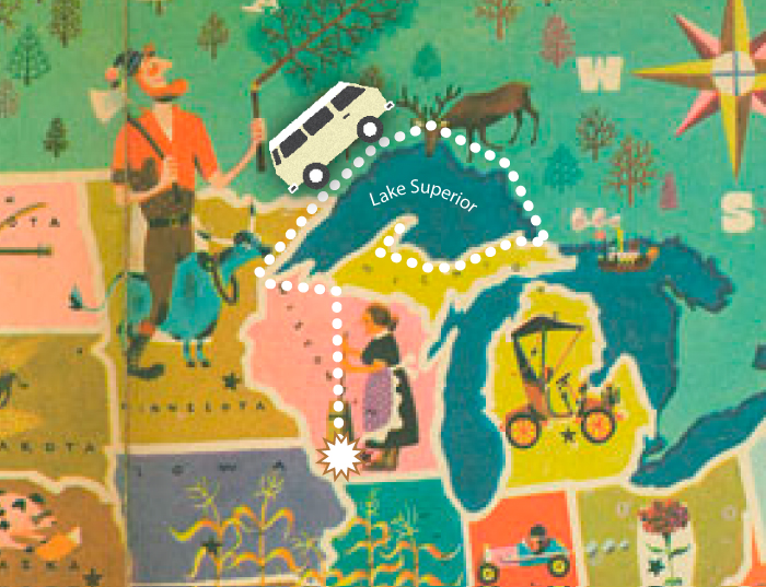
Day 6  Grand Marais, Minnesota

Our wake-up call this morning comes courtesy of Jake, genius boy-inventor of the noisy “Jake Brake”, standard equipment on the rumbling logging trucks on the highway just outside our front door. We arise early and have breakfast in a cafe overlooking the small harbor, and see no sign of the Grand Marais—or Big Swamp.

gunflint-trailBefore hitting the road, we stop at a convenience store for road snacks. It’s a briskly cold morning, so when Lorie goes inside I turn on the Westy’s seldom used diesel-fueled auxiliary heater to warm things up while I check the Westy’s tire pressures. Lorie returns with Twinkies and chocolate milk just in time to find the van, and me, engulfed in white smoke clouds of cumulonimbus proportions. I quickly reach inside the cab to switch off the heater, and when I emerge from the swirling billows of smoke I see Lorie halted, petrified, a safe distance away while other patrons nervously duck or crouch warily behind their vehicles. I finally manage to coax Lorie into the van, and I cheerfully wave and motor away, leaving behind only a lingering odor and some bewildered townsfolk.

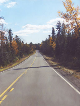
We follow the historic Gunflint Trail out of Grand Marais, up into the wild country of extreme northeast Minnesota. Probably first blazed by Archaic native peoples more than 5,000 years ago, the Gunflint was later used as a trade route by Ojibwe, Voyageurs, and fur trappers. Even today it is one of the primary gateways to the backcountry of the Boundary Waters Canoe Area, a remote region along the Canadian border boasting probably half of Minnesota’s famed 10,000 lakes. Ancient pictographs can still be found on rock faces and cliffs along the lakes in this region, and trapping and trading flourished here through the 19th century.

"Water at this point flows northward into Canada's Hudson Bay watershed and eastward into the Saint Lawrence watershed."

Laurentian Divide: “Water at this point flows northward into Canada’s Hudson Bay watershed and eastward into the Saint Lawrence watershed.”

We drive inland only as far as the point at which the Gunflint crosses the Laurentian Divide between the Red and Rainy River basins and the Mississippi and Lake Superior basins. At the marker here we see the vast devastation left behind by the notorious windstorm which swept through here a little over a year before our visit. On July 4th, 1999, the storm hit this region in the early afternoon, bringing torrential rains and winds ranging between eighty and one hundred miles per hour. One hundred seventy-two thousand acres and 25 million trees within the wilderness were leveled that day, some of them three feet in diameter.

Hundreds of hikers and paddlers were camped in the Boundary Waters, and even those with weather radios had nowhere to hide when the powerful straightline winds blasted into their camps. Search-and-rescue floatplanes and helicopters spent days evacuating the injured. Despite the awesome destruction, the Wilderness Area has begun its recovery, with new areas opened up to deer and wolf populations, and young seedlings already struggling upward among the fallen bodies of their parents.

Rejoining Hwy 61, we continue northward and cross into Canada just north of Grand Portage, MN, then drive nearly to Thunder Bay, Ontario. It is almost dark when we arrive at Kakabeka Falls Provincial Park and camp for the night.

A Superior State of Mind, Day 5

Day 5: Amnicon Falls State Park, Superior, Wisconsin

Big-Manitou-fallsIn the morning we make a short sidetrip south of the city of Superior to Pattison State Park, where we find Wisconsin’s highest waterfall, and the fourth highest east of the Rockies. At 165 feet, the waterfall was called Big Manitou by the native Ojibwa, who heard the voice of the Great Spirit in the bellowing and crashing waters of the Black River. At the base of the falls is a steep-walled gorge carved over the past 10,000 years. In the fall, chinook salmon swim several miles upstream from Lake Superior to the base of Big Manitou to spawn.

We return to Duluth for yet more shopping and kitsching. After lunch we finally turn onto Hwy 61 and head up the Minnesota North Coast into the Arrowhead Country. I am not sure whether it is called this because if one squints and holds the map kind of sideways, that part of the state resembles an arrowhead, or because of the many roadside trinket shops selling flaked stone ‘Indian’ arrowheads and spearpoints, all made in Thailand.

Fifty miles inland from this north shore of Lake Superior is the eastern end of the Iron Range, a hundred-mile-long vein of ore that has been producing mid-grade iron and taconite since the 1880s. Many of the towns along the lakeshore seem to exist only for the purpose of transferring countless tons of taconite pellets, carried down from the mines by rail, onto waiting ore freighters like the Irvin we toured in Duluth. Great ruddy ore docks extend into the arctic-green waters of the bays, from which the freighters are loaded, most bound for the forges and foundries of the lower Great Lakes.

We finally arrive in Grand Marais, MN, where we decide to take a room. We find a place just east of town which, in addition to the usual roadside strip motel, also offers quaint log cabins for the night. Their sales literature explains that the cabins were “Originally built in 1925 by Swedish settlers …”, and if our experience is any indication, the place hasn’t been cleaned since the Swedes moved out. Motoring the Westy back to a cabin, we climb the lopsided porch and enter to find the place colder on the inside than the evening air is on the outside.

Split Rock lighthouse. It’s not very tall but it doesn’t need to be; perched atop a 170-foot granite cliff, it offers a commanding view of the lake. The keeper climbed the spiral stairs to light the kerosene burner for the first time in 1910, after a rash of serious shipwrecks on the rocks below. Ships’ navigation compasses were rendered inaccurate by large masses of iron beneath the lake.

Split Rock lighthouse. It’s not very tall but it doesn’t need to be; perched atop a 170-foot granite cliff, it offers a commanding view of the lake. The keeper climbed the spiral stairs to light the kerosene burner for the first time in 1910, after a rash of serious shipwrecks on the rocks below. Ships’ navigation compasses were rendered inaccurate by large masses of iron beneath the lake.

Bothered by the niggling sensation that someone or something has just left the place upon hearing us arrive, I discover that the back door is hanging ajar, its lock mechanism ripped from the doorjamb and now unlockable. I jam a wooden chair under the doorknob and we resolve to make the best of it and start bringing in our luggage. But when Lorie throws back the bed linens and finds a couple of black curlies between the sheets, we hastily vacate the premises and collect our refund.

Returning to the crossroads of Grand Marais, we select another motel right on the main strip and I go in to inquire about a room. As in many motels, the front office is directly attached to the proprietor’s living room, from which I can hear what sounds like a marital dispute between a real-life Frank & Estelle Costanza. But in French.

Finally, upon my third dinging of the countertop bell, a slovenly woman appears in a dirty pink bathrobe and slippers, an ashy cigarette drooping from her lips.

“Yes …?” she snarls at me distractedly. I believe she was once quite an attractive woman, with short jet-black hair and a penetrating gaze. But every rose has its thorns, I suppose, and now she cannot hide her disdain for the world in general, and for inquisitive tourists in particular.

“Er, do you have a room available?” I ask brightly.

“YES!” she barks, as though it were the stupidest question ever.

“A non-smoking room?”

“Off coorse,” she replies, blowing a grey cloud of cigarette smoke my way, “but eet ees zee last one.”

Her thick French accent and her sultry eyes tell me I’d better get while the gettin’ is good, but instead I ask for a key so that I might see the room first, to look for signs of forced entry and wayward pubic hairs. She throws it at me.

As I trudge out to the room, I wonder if the woman is the last desperate descendant of a French explorer or fur-trapper who refused to be driven out when the upstart Yankees claimed this land and sent them all packing to Canada. She lingers here now, taking our filthy American money and doling out surly attitude in return, the last of her dying race.

The “non-smoking” room looks fine, but stinks like a pool hall ashtray, so I politely return the key and leave, the ill-mannered Gallic peasant woman muttering dark words as I go. We finally find a nice, non-descript national chain motel nearby, and collapse gratefully into bed.

A Superior State of Mind, Day 4

Day 4: Amnicon Falls State Park, Superior, Wisconsin

After breakfast in camp, we drive into the twin cities of Superior, WI and Duluth, MN. A visitor is soon struck by a distinct sense of local rivalry between these two cities on the lake. Some locals will tell you that it goes back to 1903, when Duluth (or was it Superior?) determined to field a baseball team, the Cardinals, in the fledgling Northern League. Superior (or was it Duluth?) was not to be outdone, and assembled their own Longshoremen team. Both teams took their civic pride to the ball diamond and many a game ended in fisticuffs.

Others insist the dispute started before even that, in the 1860s, when Duluth-bound ore ships were forced to enter the harbor on the Superior end of a large sand bar, and accordingly to pay hefty entry fees to that city. The situation was not improved when several prominent Duluth businessmen took up shovels and excavated a canal through the sand bar, thereby bypassing the Superior side.

Duluth Aerial Lift Bridge

Duluth Aerial Lift Bridge
A Greek vessel carefully enters the Duluth canal and glides under the famous aerial lift bridge to the protected harbor beyond

Probably, the origins of the feud go farther back than that, and perhaps involve an Ojibwe and a white explorer squabbling over a fish or a camping spot, with each trying to tip over the other’s canoe.

Now, centuries later, the two cities, compelled by circumstances to share the same harbor, are still sore at one another. In the end, it seems blue-collar Superior has gotten all the profitable railroads, ship piers, and factories, while uppity Duluth got the fancy-schmancy art galleries and snooty pasta boutiques. And running water.

These northern twin cities are situated at the mouth of the St. Louis River. A little farther up the river, probably too far for big freighters, is the little burg of Fond du Lac—French for “back of the lake”, which is certainly apt. This is the highest point on the entire Great Lakes chain and freighters from all over the world make their way up the St. Lawrence seaway, through the lakes, and finally here to the back of Superior.

William A. Irvin.

At 610 feet in length, and capable of hauling up to 14,000 tons of taconite pellets in her holds, the Irvin boasts even more clever storage space than a 1983 VW Westfalia.

Curious about these giant ships, we tour the William A. Irvin. Launched in 1938, the Irvin plied the waters of the Great Lakes, mostly carrying bulk freight such as iron ore and coal to various midwestern ports. But in addition to such mundane cargoes, the “Pride of the Silver Stackers” also hauled the prodigious bulks of the captains of industry—prospective investors and wealthy customers—who slept in her well appointed staterooms, were entertained in the gleaming Art Deco dining hall, and drove golf balls and flew kites from her tidy decks.

After forty years of such service, the Irvin, once considered the utmost in size and technology, was finally becoming outdated and was destined for the scrap heap. But she was spared the cutter’s torch and was instead refurbished as a floating museum. Visitors can explore the Irvin’s upper decks, wheelhouse, guest quarters, engine room, and more. For an intimate glimpse into this facet of Great Lakes history, it is a tour not to be missed.

William A. Irvin These hatches routinely swallowed the contents of 200 rail cars.

William A. Irvin
These hatches routinely swallowed the contents of 200 rail cars.

Also brought back from retirement was our tour guide, Ole. At the age of eighteen he climbed the ladder of his first Great Lakes ore carrier and, like the Irvin, spent the next forty years piloting all up and down the chain. Now over seventy, Ole brings a lifetime of vivid stories to what would otherwise be only so much floating steel. Up in the pilothouse, when Ole spins the wheel and starts shouting orders, I fear we might tear away from the pier and head out onto the great inland sea of Superior.

What was formerly a typically dirty and workaday Great Lakes industrial area has now been restored to a somewhat charming and seemingly prosperous downtown and waterfront neighborhood. After lunch in an overpriced burger joint overlooking the famous Duluth Aerial Lift Bridge, we spend a few hours browsing in the art galleries and bookstores and strolling the waterfront. We finally return to Amnicon Falls SP to camp for the night.

A Superior State of Mind, Day 3

Day 3: Big Bay State Park, Madeline Island, Wisconsin

In the morning Lorie and I drive over to the nearby parking and picnic area of the barrier beach, and share a big pot of Malt-O-Meal while watching the sun rise on Big Bay. We amble down to the sand, where we discover a lone stranger sprawled on the shore, wrapped in a blanket. Worried that it might be yet another victim of the many historical shipwrecks in the area, we hurry over to offer aid.

big-bay-state-park
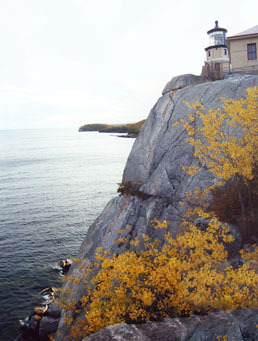
But as we approach, he stirs and sits up, blinking at his surroundings in great confusion and gazing dumbfounded at the blazing orange ball rising in the sky, as if seeing it for the very first time. It seems as though he is not from this world. I recall the mysterious shimmering lights I saw in the sky last night, and wonder if perhaps he is some wayward humanoid alien, a galactic traveller cast off on this distant terrestrial shore by his mutinous shipmates. I hope he doesn’t want to bum a ride; if he is accustomed to interstellar travel, he will be duly disappointed with the speed of the diesel Vanagon, which is barely inter-state …

We leave him to get acquainted with his new planet while we enjoy the short self-guided boardwalk tour through an impounded lagoon and peat bog, once part of Lake Superior but now separated from the lake by a coastal barrier spit. Designated a State Natural Area, a wide array of rare and specialized plants and animals inhabit this unique ecosystem and geological landscape.

We motor out of the park and drive to the north end of the island, then turn southward along the North Shore Road. I cannot recommend this route, as it is about ten miles of gravel, with dense forest on both sides and only rare, mere glimpses of the lake.

Even worse, I almost lost my socks. Though I have been on vacation only two days so far, the unseasonably warm autumn weather has instilled in my socks an aroma more common to, say, July or August. So last night, for the benefit of all parties, and to prevent my own mutinous exile from this good ship, I stowed the pungent things in the rooftop luggage bin. Now a brisk northerly sea breeze has inspired the socks to perform a quiet soft-shoed tap dance up there, so I niftily reach up and pluck them down before they break into a burlesque-style kick number and are lost forever.

cornucopia-wisconsin
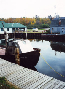
Arriving back in LaPointe we board the ferry to return to the mainland. The streets of Bayfield are quiet this morning, the Apple Festival revelers evidently sated and sleeping off the effects of yesterday’s apple orgy. We motor northward on Hwy 13 and pass through the tiny hamlet of Cornucopia, Wisconsin’s northernmost town. After enjoying lunch in a lakeside picnic ground here we visit the used bookstore and walk the tiny historic waterfront. Quaint, charming, and the whole place smells of fish. We rejoin Route 2 and continue westward to Amnicon Falls State Park.

Long about, oh, a billion years ago, a major volcanic eruption sent lava and molten rock oozing out and covering this entire region. Then, just another 500 million years later, a series of violent earthquakes tore the place apart along what is now called the Douglas Fault, which runs from modern-day Minneapolis to east of Ashland. It is along this upthrust fault that several spectacular waterfalls are now located, including Amnicon Falls and several others we will visit. The afternoon is spent hiking along the riverside trails and scampering about the basalt ledges and water-carved steps of Amnicon. At night, nestled in the Westy, the constant roar of the falls is nearly enough to drown out the sound of the nearby highway …

A Superior State of Mind, Day 2

Day 2: Washburn, Wisconsin

Swinging north, we are soon in Bayfield, a quaint ‘seaside’ town perched on the shore of Superior. Bayfield built its early success on a sturdy three-legged stool which served it quite well, at least for the first few decades of its existence. In 1870 the first commercial fishery was founded, and within twenty years nearly 500 workers were employed year-round catching and processing the flavorful whitefish. The abundant northern forests inspired a large logging operation, and several sawmills soon sprang up along the shores of the bay. And the local brown sandstone proved to be a prized construction material desired for large municipal buildings across the upper midwest; examples may still be seen today in Duluth’s Central High School, the Milwaukee courthouse, and many others. All three local industries sent their goods out to the larger world via Great Lakes schooner.

Madeline-island-beachBut the stool soon grew wobbly: rampant overfishing—combined with excessive logging and sawdust from the mills, which fouled the shallow spawning grounds of the whitefish—depleted the once-great natural fisheries here. And the growing popularity of new architectural materials such as steel and concrete undermined the brownstone industry, closing the quarries. But the rug was really pulled out from beneath the city when the two regional railroads selected nearby Ashland and Washburn as their terminal ports, further isolating the already-remote Bayfield from its distant markets.

Today, Bayfield’s primary export appears to be fudge. The excruciatingly enchanting town with a candy “shoppe” on every corner is this weekend crawling with tourists drawn to Bayfield for her annual Apple Festival. The place is packed with marching bands, street artists, crotch-nuzzling golden retrievers, impertinent jugglers, and endless numbers of wailing, stroller-bound children with chocolate-smeared faces. We briefly consider partaking of the apple pie, apple jam, apple butter, apple sundaes, apple chili, apple dumplings, or—most tempting of all—apple bratwurst. But instead we make for the ferry docks to escape the madding crowds. After purchasing tickets, we pull ahead and the Vanagon is escorted onto the decks of the ferry, the comparatively diminutive Westy jammed in among the large SUVs and trucks of our fellow travellers.

Madeline-island-ferry
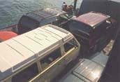
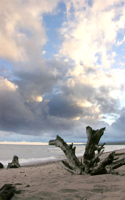
Bayfield is now considered the gateway to the Apostle Islands archipelago. Set aside by Congress as a National Scenic Lakeshore in 1970, the twenty-two islands which make up the Apostles offer a glimpse into a distant and pristine natural history visible in few other places. The layers of precambrian sandstone which once formed the ancient seabed here have now been uplifted and eroded by wind and water to form islands with beautiful and intricate cliff formations, spires, and sea caves. Due to their remoteness, and preservation by the Lighthouse Service, several of the islands still bear their ancient old-growth forests, and all are home to a diverse population of nesting and migratory birds and a variety of other wildlife.

Though once used for farming, logging, commercial fishing operations, quarrying, and other resource-extraction endeavors, the Apostles are today preserved for hiking, wilderness camping, sea-kayaking, sport fishing, and other recreational uses. History buffs will find a rich human past to explore here, from old stone foundations of farmhouses and a school, a small preserved fishing village, and nine historical lighhouses.

Madeline-island-shoreOur brief voyage across the waters of the bay soon brings us to Madeline Island, where we disembark at the tiny village of LaPointe. At just fourteen miles long and three wide, Madeline is the largest of the twenty-two islands making up the Apostles, and the only inhabited one. According to Ojibwa oral tradition, the people used to inhabit the Atlantic coast of North America. A shaman had a prophetic vision informing him that a race of fair-skinned invaders was coming soon to destroy them, and instructing the people to leave their homeland and migrate westward to a preordained island: “the place of the turtle”. Most of the Ojibwa clans heeded this warning and embarked on the centuries-long voyage up the St. Lawrence, struggling for survival against the strange lands and the war-like tribes they encountered along the way. Indeed, the single clan that stayed behind to greet the arriving Europeans were virtually wiped out by epidemics of smallpox, measles, and tuberculosis.

Unfortunately, there are a lot of islands in the Great Lakes chain which resemble turtles. So numerous arguments and rifts broke out among the exiled wanderers regarding their prophesied destination, with various factions dropping out along the way to settle in places like Lake Huron’s Mackinaw Island and others, while the main party continued here to finally settle on Madeline Island. As too often happens, however, things eventually took another turn as whites ultimately arrived here and compelled the Ojibwa to leave even their final haven foretold by the prophecy. Most now live nearby on the mainland, on a nice bluff overlooking the Apostles and their former promised land.

About 200 people live on Madeline Island year-round; another 2,500 come to stay only for the summer. LaPointe is the only ‘town’ of any size, with holiday homes scattered around the rest of the island. We motor about the perhaps thirty miles of roads criss-crossing the island, taking in the charming wooded lakeside scenes, then choose a site at Big Bay State Park. That night when preparing for bed, I see shimmering waves of colored light rolling silently across a portion of the night sky. Aurora borealis? UFOs?

Who knows?

A Superior State of Mind, Day 1

A thousand-mile circumnavigation of the world’s largest inland body of water, Lake Superior, our route taking us through three US states and the Canadian province of Ontario.

“I had with me a youth (Etienne Brule) who wanted to … see the great lake, take note of the rivers and the peoples living along them; and discover … the most curious things about those places and peoples …”
Samuel de Champlain, Great Lakes explorer, 1610

We are a nation of explorers.

North America was one of the last major land masses of the world to be found by early European voyagers, and even after her coasts had been well charted, her interior remained shrouded in mystery to the developed world for centuries.

More than a hundred years after Columbus stumbled onto what he believed was India, French explorers were only beginning to make their way up the St. Lawrence River to discover the seemingly endless waterway which beckoned them ever westward. Even as recently as the Lewis and Clark voyage of discovery, many believed that deep in the American interior dwelt the long-lost tribes of Israel, veritable mountains of salt, and wooly mammoths and other prehistoric beasts.

Forming nearly a third of the contiguous US border with Canada, the Great Lakes and St. Lawrence comprise by far the largest chain of inland lakes anywhere in the world. Certainly, the grandest of these is Lake Superior.

Drawn to the mystique and beauty of this place, we plan to travel around her entire body—350 miles long and 160 wide. Sticking close to the shore for most of the way, our thousand-mile circumnavigation will take us through three US states and the Canadian province of Ontario, camping along the way.

Join us as we embark on this Superior roadtrip …

Day 1:  Minoquoa, Wisconsin

After breakfast in camp this morning we set sail on a northerly course along US Route 51 to Ironwood, straddling the border with Michigan. We swing west on our old friend US Route 2 and the trees soon part like a green coniferous curtain to offer our first glimpses of Lake Superior. The native Ojibwa people knew her as Kitchi-gummi, “Great-water” or “Great-lake”, while the French called it Le Lac Superieur—”Upper Lake”. Superior is indeed the largest freshwater lake in the world, covering over 30,000 square miles and containing an almost incomprehensible 3,000 cubic miles of water, enough to entirely flood all of North and South America to a depth of nearly twelve inches. At 600 feet above sea level, it is the highest of the Great Lakes chain.

So large and cold is this vast inland sea that it often generates its own weather systems, cooling nearby regions by several degrees and annually dumping as much as twelve to fifteen feet of snow on towns here along her southern shore. Warm summer weather blowing in off the golden wheat fields of the upper Great Plains, upon encountering the cold mass of Superior, often turns to violent, windy thunderstorms which send powerful waves crashing onto her rocky coasts.

The sheer visual weight of Superior is dramatically contrasted by the dense and dark forests surrounding her, and we find our eyes drawn to and held by the vast open sky above her. We continue west on Route 2, the rocky and pebbled beaches scrolling past the Vanagon’s windows, and we soon pull into the old mining and lumbering town of Ashland.

The Ojibwa had lived and prospered on Chequamegon Bay for thousands of years when the first whites beached their canoe here in 1659. Famed French explorers Radisson and Groselliers erected a small stockaded cabin, generally regarded as the first European settlement in Wisconsin, before continuing their search for furs in the lands west of Superior. It would be nearly 200 more years before white settlement began in earnest, when a couple of adventuresome fellows from Ohio built a cabin and began raising their families here in what would later be called Ashland.

We continue west on Route 2 for a couple miles and stop at the Northern Great Lakes Visitor Center. After popping the Westy top and fixing soup and sandwiches in a quiet corner of the parking lot, we go inside to take in the enlightening exhibits regarding the natural and human history of the region. The Center also offers an enclosed, four-story observation tower which offers panoramic views of the Ashland harbor.

Twin diesel Vangon Westfalias

Twins separated at birth? After this happy reunion, the two Westfalias frolicked in a nearby meadow, scampering around in circles and sniffing one anothers’ tailpipes.

It is only a short jaunt northward on Hwy 13 to Washburn. A bit fatigued by the late drive last night, we decide to stop for the evening at a small municipal campground overlooking Chequamegon Bay. No sooner do we settle into a site and enjoy a walk along the water’s edge than who should motor through the campground but our Westy’s spittin’ image—a 1982 diesel Vanagon, owned by a friendly couple from Minoqua, where we camped last night. After the requisite greetings, they invite us over to their site after dinner, where we chat and swap travel stories.

Having previously owned three Volkswagen cars (and at various times vowing I’d never do it again), I knew when we bought the van that we were joining an elite and eclectic community. But we didn’t expect to be so warmly embraced as we’ve been as owners of a VW Westfalia Camper. Wherever we go, hippies beep in their rusty old Type 2 Busses and retired couples flash the lights of their shiny VW Eurovans. Every random encounter in a grocery store parking lot or campground becomes an opportunity to exchange pedigrees and swap Westfalia Camper tips. As it turns out, Westy-owners are a cult within a cult.

Later, we swing by the grocery store for some forgotten supplies, then across the street to the self-proclaimed “World’s Only Underground Dairy Queen”. Viewed from the front, one might easily mistake this popular ice cream joint for a Dairy Queen of the more usual, superterranean variety. But closer inspection reveals that this DQ is either: a) indeed built into a small hillside, or b) a regular DQ which a disgruntled bulldozer driver has attempted to bury beneath tons of dirt, for reasons unknown. After all, who can fathom the dark and tortured soul of an unhappy heavy-equipment operator?

Sitting at the picnic tables under the shade trees, we savor our sundaes and ponder this mystical edifice of soft-serve.