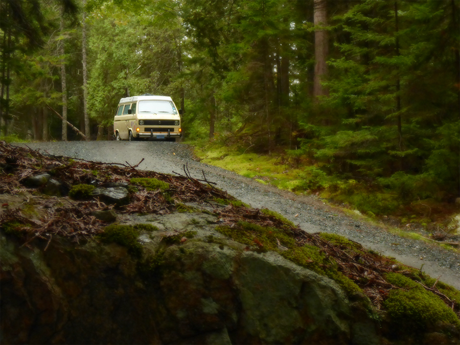
Day 15: Digby, Nova Scotia
Over breakfast we write postcards to family, and I include one to the original owner of our Westfalia, who I recently met by chance. She and her husband picked the van up at the factory in Hannover, Germany in the summer of 1983 and had it shipped to their home in the US. It briefly changed hands one more time before we bought it, and I think she’ll be pleased to know that 34 years later it’s still making coast-to-coast road trips.
 In clear and sunny weather we roll through the verdant rolling fields surrounding the Annapolis Basin, then swing north at Windsor, NS to catch the Glooscap Trail. Closely following the shore, this scenic driving route runs 360 km (220 mi) along the south and north sides of the Minas Basin, the eastern portion of the Bay of Fundy.
We cruise along the shore, stopping at various roadside parks and scenic overlooks. At the Walton Lighthouse we find a small wedding party gathering for their ceremony on the high bluff overlooking the bay.
We stop for a picnic lunch at Burntcoat Head, site of the world’s highest tides. Because of the unique combination of topography and water flow, the tides here average 17 meters (56 feet). But during a major storm in 1869, the high tide was recorded at an unimaginable 22 meters, or 71 feet.
 After lunch we tour the lighthouse, a replica of the original 1858 structure, and the small but informative historical museum upstairs. As we’re heading back to the Westy we once again meet our friends from Minnesota in the EuroVan, and stop to chat.
As we continue eastward, I notice that many of the roadside mailboxes here bear the same names as those of the Loyalist settlers I learned about in the lighthouse museum, and I recall a forgotten 250-year-old link to the colonial United States.
 During the American Revolution of 1775, tens of thousands of American colonists who supported the British cause, and who advocated against declaring American independence, fled the colonies and migrated here and elsewhere in British North America. They built modest homes, farms, and businesses, and established some of the area’s first educational, religious, social and governmental institutions, many of which survive today.
We swing around the back of the basin to drive to Five Islands Provincial Park, where we find a site on a hill overlooking Fundy at sunset.
Day 16: Five Islands, Nova Scotia
This morning we get up early and race back to Maitland on the banks of the Shubenacadie River, which we’ve been told is a good spot from which to witness a tidal bore.
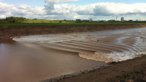
Photo: http://www.tripsister.com
A natural phenomenon that occurs in only a few places in the world, a bore happens when a rising tide moves into a bay which narrows at the back, especially one with an outflowing river. As the bay grows more shallow, and the shores more narrow, the incoming tide tends to ‘stack up’ to form a rising, rolling wave at the leading edge.
Depending on the season, the lunar cycle, and a few other factors, the bore can range anywhere from a ripple to over 2 meters (6.6 ft) in height.
We pull in behind the Frieze & Roy General Store, and Lorie runs in for coffee and donuts while I claim a spot on the river bank among the German tourists.
While we wait, a silver pickup parks nearby and the owner gets out. I see him eyeing the Westy with some interest. He eventually comes over and tells us all about his ’76 Camper: road tripping across the country to music festivals, the girls, the hazy years.
He says lots of people wanted to buy his magic Bus over the years—to experience the vanlife long before it was a hashtag—but were horrified by the occasional need to adjust the distributor points, or to replace a broken accelerator cable with a piece of fishing line in order to get home.
 He tells us he eventually sold his Bus to a local restorer who makes them look better than new, “and I get first dibs on buying it back. But, you know …” he shrugs and gazes wistfully across the brown tidal flat.
“Yeah,” I reply, “what’s the cost to buy back your youth?”
He laughs. “Well, I gotta go milk three hundred cows.”
At last the tide comes in, a low churning riffle sweeping across the surface of the cappuccino-colored water, surging gently up onto the muddy banks in a wide arc.
Frankly, it’s a bit underwhelming so we race up the river a few miles to the Fundy Tidal Interpretive Centre.
Here a modified old railroad trestle extends over the river bank, and a small crowd has gathered to await the arrival of the tidal bore approaching from downstream. An interpretive guide provides helpful narrative while Zodiac inflatable motor skiffs buzz around in the roiling brown water.
Within a few minutes a collective “Oooh …” sweeps through the spectators as the bore swings around the bend and churns upriver toward us. The river seems to stop and reverse direction, briefly flowing backwards. Confined here within the narrower river channel, the wave on the leading edge is certainly higher than before, perhaps a half meter (18”) high. But as it swishes past us and continues up the river, it soon peters out and dissipates.
The show apparently over, a disappointed tourist turns to leave and says to me, “So, that’s a tidal bore, huh? Now I know why the locals call it a Total Bore …”
On the way back to Five Islands Ocean Resort we stop for groceries at the Masstown Market. A sort of large rambling grocery store, deli, farmers market, bakery, and restaurant, the market seems to go on forever, and we restock provisions for our continuing month-long trip. Among other things, I grab some local craft beers, a half-pound of smoked Fundy salmon, and am thrilled to rediscover a childhood favorite—Jiffy Pop popcorn in the familiar silver pan with the extraordinary expanding turban-shaped foil dome.
Back in camp, we build a fire and watch the turning tide drain the bay like a bathtub while enjoying ”The Magic Treat — as Much Fun to Make as it is to Eat.”

Day 17: Five Islands, Nova Scotia
Donuts and coffee get us going and on the road, but we stop in Parrsboro for a proper breakfast. We find the Harbour View Restaurant right on the water next to the wharf. It’s hard to beat the view, and my eggs & haddock breakfast is perfectly serviceable, but Lorie’s lukewarm omelet is made with canned mushrooms and hand-torn barely-melted scraps of American ‘cheese’ slices.
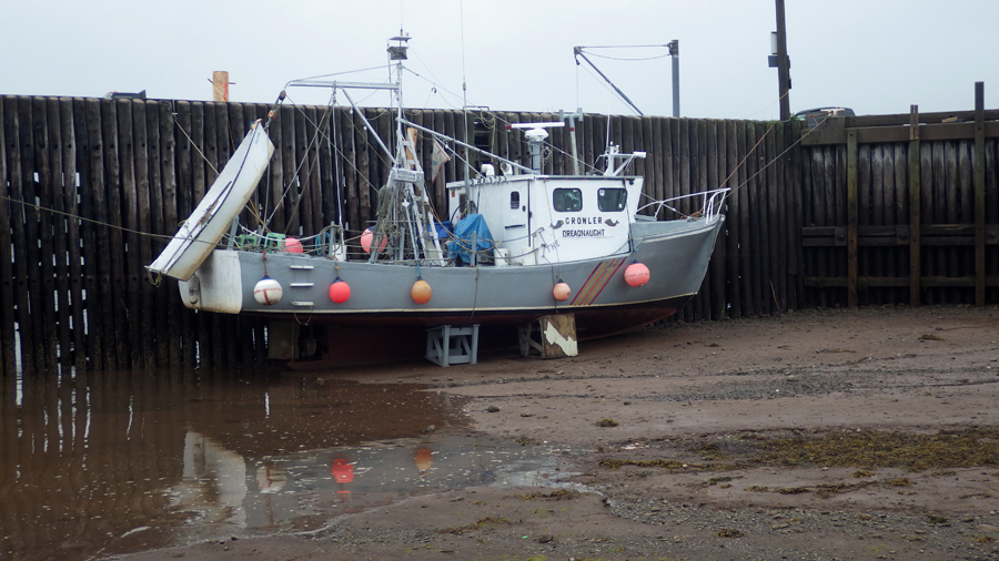 Afterwards we stroll around the beach at the world-famous low tide, finding a few tiny crabs hiding in the lingering puddles, and observing the timber cradles into which the fishing boats settle when the tide drops, sometimes as much as 50 feet (15 meters). For those keeping score at home, that’s as high as 7.3 Vanagon Westfalias.
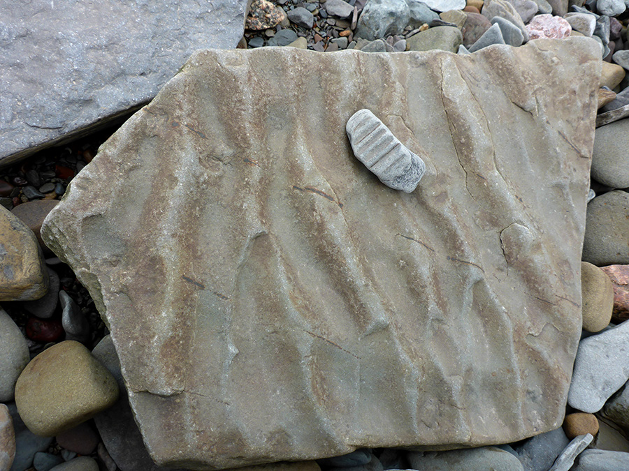
Just around the corner is the Fundy Geological Museum, which we find packed with well designed exhibits and displays illustrating the rich geological history of the region. Real and replica fossils from some of the oldest dinosaur bones in Canada: the world’s first reptiles, early dinosaurs, giant dragonflies, and more.
 We are astounded to learn that 250 million years ago, before super-continent Pangea broke apart and the pieces began floating around the planet all loosey-goosey, Nova Scotia was snug up against modern-day Morocco.
We continue driving west along the Glooscap Trail to Port Greville, where we stop into the Age of Sail museum.
The friendly host greets us and sets us loose among the exhibits housed in an 1854 church, and boasting some great displays and thousands of artifacts from the days of local lumbering and boat building. Port Greville has a rich history in this regard, having built and launched hundreds of wooden sailing ships from the snug cove just below the museum.


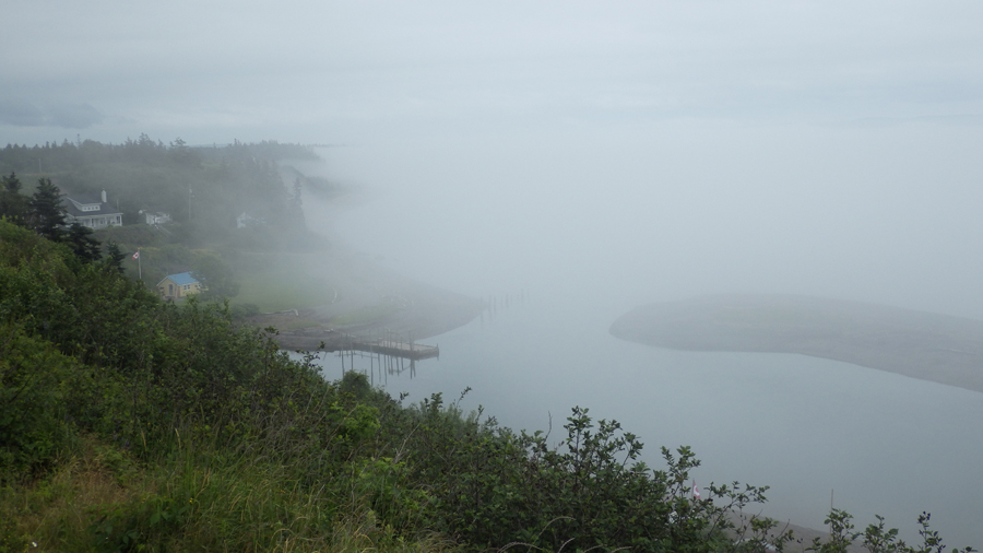
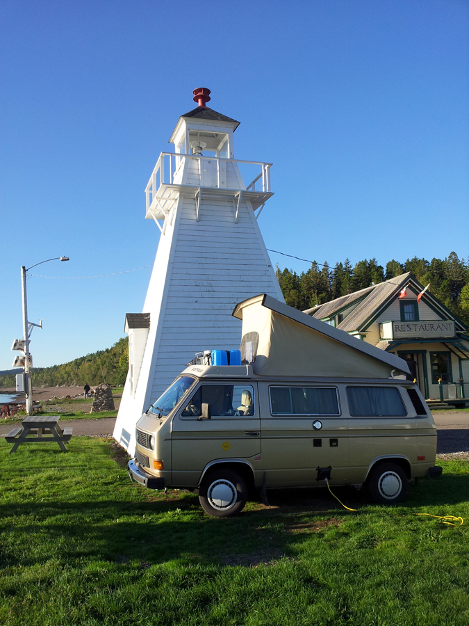
When we leave, we find this part of the Minas Basin completely socked in with fog, and we take extra care on the twisty, hilly roads. Within a few miles, and in keeping with our nautical maritime theme, we arrive at the Old Shipyard Beach Campground at Spencers Island, NS. Our plan is to park the Vanagon on an assigned patch of gravel between the large RV’s and campers, but when Lorie sees the quaint little cabins just a few steps from the Fundy shore, she books one.


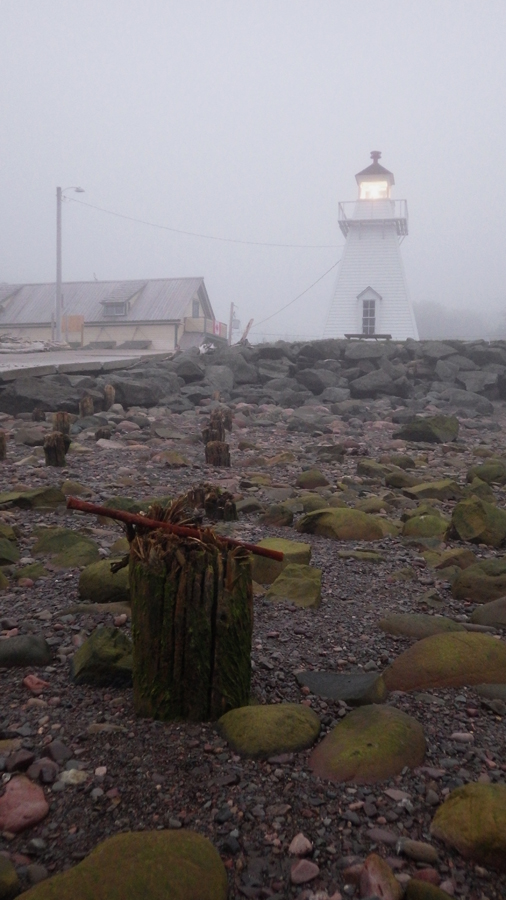

After getting settled we stroll up to the restored Spencer’s Island Lighthouse. Built in 1904 and still bearing its original wooden clapboard siding, the lighthouse was crucial to the settlement and economic development of the Spencer’s Island area, also a significant shipbuilding town. The light helped provide safe passage for the many ships and crews that travelled this rugged and often foggy shoreline of the Bay of Fundy. It’s one of the few original lighthouses built here on the north shore still in existence.
We enjoy drinks on the front porch as the gloom descends into evening.
Day 18: Spencer’s Island, Nova Scotia
Upon our arrival last night I noticed a large pond immediately behind our cottage, but this morning I see it has completely drained with the falling tide to reveal a grassy salt marsh. Six hours later, it will once again be a small lake.
After breakfast in the cabin we drive north to the Joggins Fossil Centre.
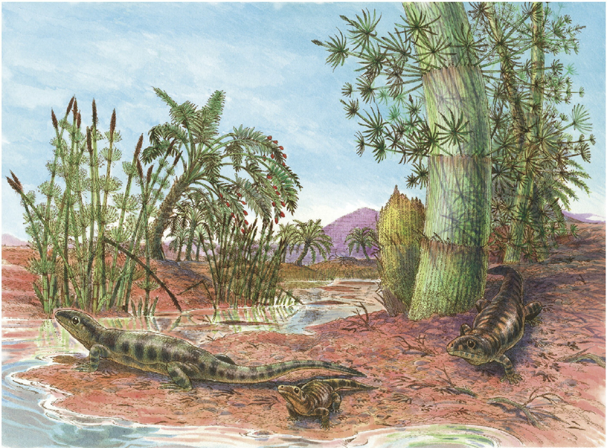 Officially included on the UNESCO World Heritage List, the cliffs here have been described as the “coal age Galápagos” for their unmatched wealth of fossils of prehistoric life. Fossilized skeletons and tracks of very early animals, and plants of the rainforest in which they lived, can be found here, and we’re eager to find some ourselves.
The visitors center and museum offers a great introduction to geology in general, as well as the birth and development of modern geological sciences.
 During the mid-1800’s, Charles Lyell, considered by many the father of modern geology, explored these tall cliffs on the shore of Fundy and declared the Joggins exposure of Coal Age rocks and fossils to be “the finest example in the world”. Along with his colleague, Nova Scotian geologist Sir William Dawson, Lyell discovered, among other things, the earliest known reptile to ever walk the planet. Lyell’s writings would influence those of Charles Darwin and many other preeminent natural scientists of the day.
Armed with this geological and historical background, we join a walking tour. Our guide is Calvin, a young geology student from nearby Acadia University, and his knowledge and obvious enthusiasm are contagious. But best of all is his ability to explain complex principles of geology and prehistory in simple terms.
As we follow Calvin down the stairs we notice placards installed every 10 meters (30 feet) or so, denoting the corresponding geologic time period through which we’re descending. By the time we step off the stairs and onto the rocky beach we’ve gone back over 300 million years into the geological past.
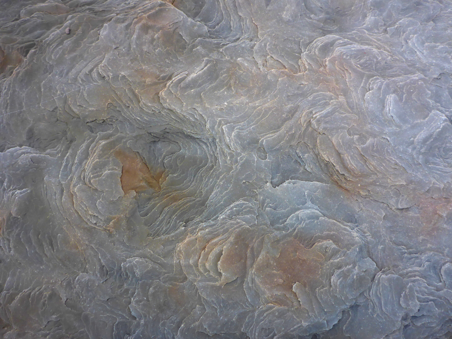
 From the water’s edge, one can look back at the 25-meter- (80-foot-) tall cliffs, comprised of multiple distinct layers. The strata are tilted here, so by simply hiking along the base of the cliff one can clearly see—and even lay one’s hand upon—several eons of time.
We don’t have to look hard to see large fossils embedded in the cliff face, slowly being exposed by the erosion of the high tides of Fundy. We see the fronds of prehistoric horesetail ferns, shellfish, even intact two-meter-long sections of fossilized tree trunks.
Most are high out of reach, but scattered about the cobble beach we find countless mystifying fossil artifacts: leaves, stalks, branches, coprolites, even the footprints left in ancient mud by a passing tetrapod. It’s difficult to turn around for fear of stepping on another 300-million-year-old specimen …


We gaze from one end of the 15 kilometre (9 mile) cliff to the other in the hazy distance, and ponder the uncountable fossils and other relics of bygone eras. It makes one’s own existence here seem small, insignificant, and oh so brief …
Day 19: Spencer’s Island, Nova Scotia
Lorie sleeps in late today, and I take my coffee out to the front porch to look for the sun among the heavy gloom.
Our next-door neighbor rumbles up on a four-wheeler and unloads a couple of buckets full of red seaweed he’s just collected from the intertidal zone. He dumps the broad flat multi-lobed leaves on the ground in front of his porch to dry.
“Dulse,” he says simply, seeing my curious gaze.
 A kind of seaweed that grows in the shallows, he explains he’ll soon rinse the 50-cm (20-in) long leaves and pack them into mesh onion sacks and then take them home to hang in his garage for further drying.
From there, the dulse can be ground into flakes or a powder and used as seasoning for soups or stews, cut into strips and fried like bacon, or his favorite—simply torn into small scraps and eaten like chips. Later today, I will see roadside stands offering small sandwich bags of the dried seaweed snack.
My interest and appetite whetted, Lorie calls me home for breakfast, then we hit the road and drive out to Cape d’Or lighthouse. We hike down to the tower perched right on the very point at the entrance to the Minas Basin. This is a prime location for a lighthouse, visible for many miles across the sweeping Bay of Fundy and serving as a marker above the treacherous waters of the Dory Rips, created by the collision of three strong tidal currents.


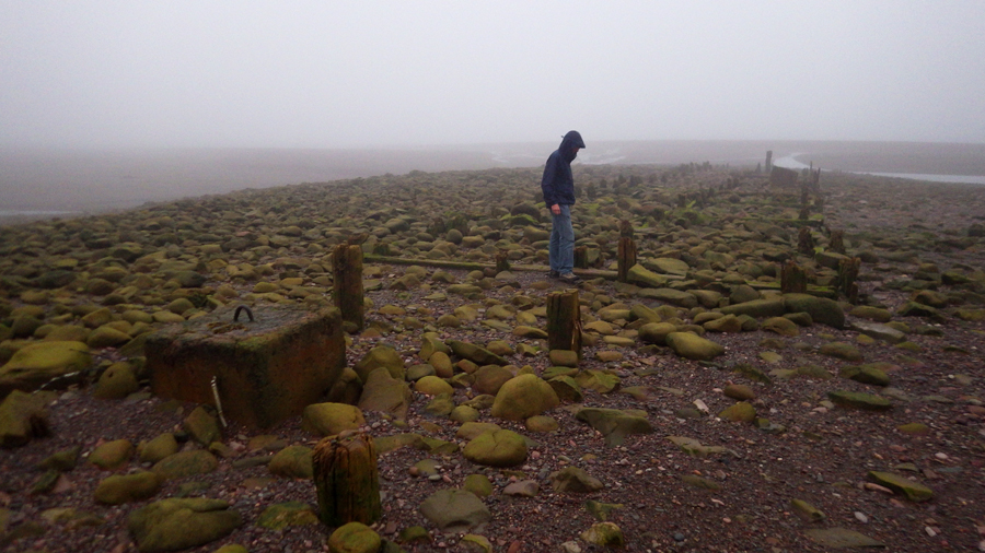
Fundy is a bifurcated bay, the back portion split into two smaller bays, divided by the high headland of nearby Cape Chignecto Provincial Park. About 40 square kilometres (10,000 acres), Cape Chignecto is the largest provincial park in Nova Scotia, and encompasses some of the area’s most spectacular scenery, rare “fog forests,” Alpine-like ecosystems unique to the region, and an endangered moose herd.
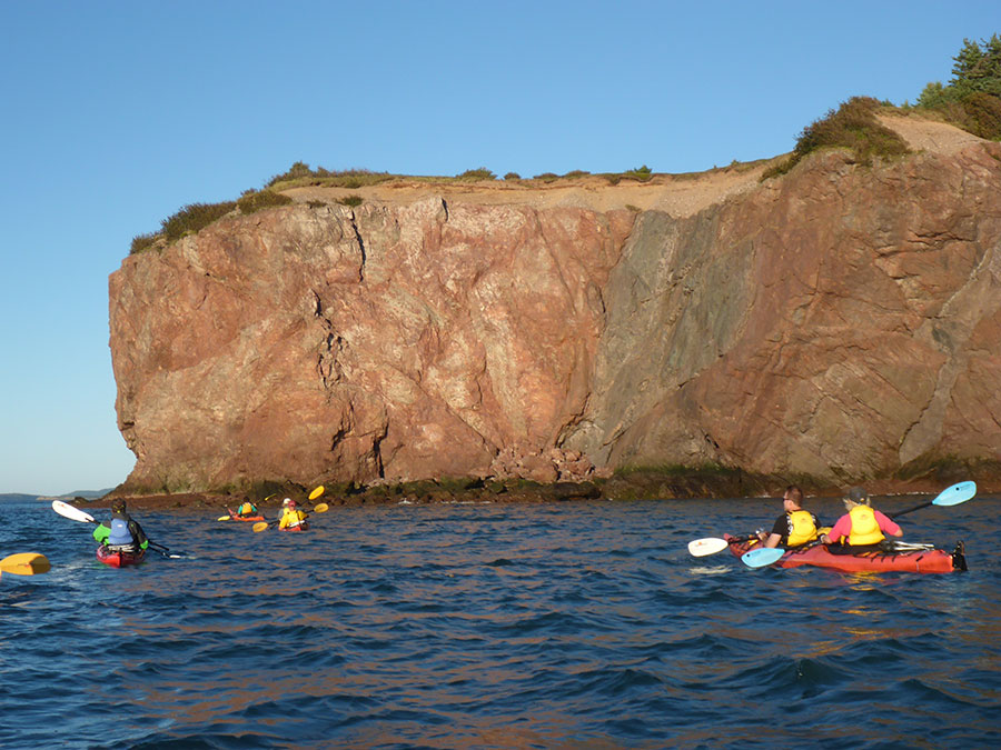
Though the park offers backcountry camping and 50 kilometres of trails, from the visitors center it’s only a short hike down to the water’s edge where we clamber around on the Red Rocks formations.
Then it’s back to Advocate Harbour to check in at Nova Shores Adventures, where we have booked an afternoon of kayaking. Directions in hand, we drive out to the remote Apple River Beach on Spicers Cove to meet up with the guides and the rest of our group.
 About a dozen tandem sea kayaks and other gear are already set out on the sand near the water’s edge, but the wind and waves have kicked up, so our guides delay our launch a couple of hours. While waiting, we all enjoy the field-prepared lunches and stroll the broad beach near the mouth of the river.
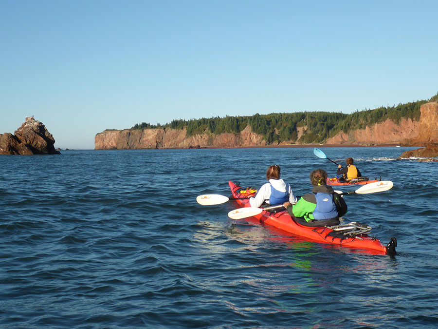
Finally, the wind dies and the waves lie down, and our guides give the okay. We all launch our kayaks out through one-foot breakers, then meet up to form a tight group for the one-mile paddle to the first point.
Clearing the peninsula, we cruise the tall cliffs to a cavernous amphitheater large enough to accommodate our entire flotilla of kayaks. Rounding another rocky point, we soon see the Three Sisters, the famous trio of sea stacks rising majestically from the waters of the bay.
According to legends of the native Mi’kmaq people, their creator-god Glooscap had three younger sisters. Like little sisters everywhere, these three followed Glooscap around wherever he went, pestering him and generally getting underfoot as he went about creating all the local natural features, inventing the canoe, and saving the world from an evil frog-monster who had swallowed all the Earth’s water.
Eventually, one day Glooscap had had enough, he lost his temper, and turned his three unfortunate siblings into the giant pillars of stone we see today.


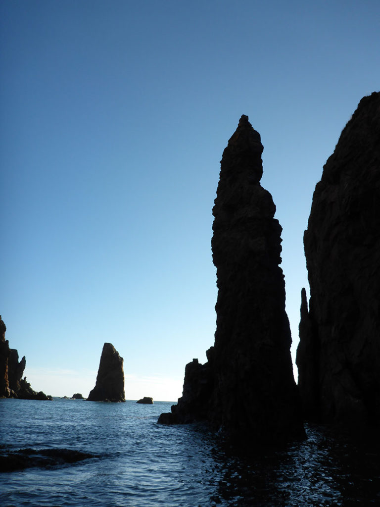

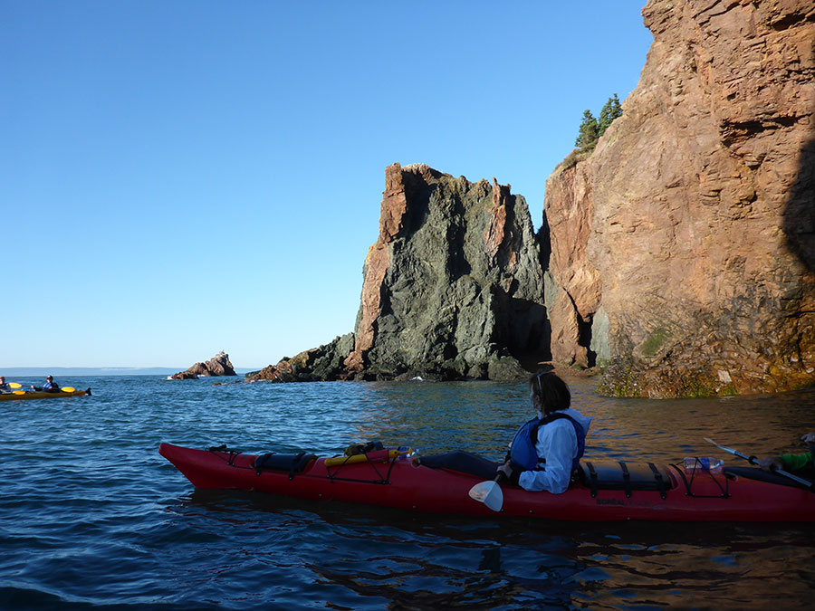


We paddle our kayaks around their feet, through an overhanging sea arch, and slip thorough narrow slot canyons. Across the Bay in the distant sea haze we catch views of distant New Brunswick, through which Lorie and I will drive tomorrow.
We finally turn around and point our bows toward home. The afternoon sun begins to drop behind us, casting a warm light on the tall cliffs, and we enjoy a gentle push from the three-foot swells. A mild tailwind carries us ashore, and we soon land back on the golden beach …
Day 20: Spencer’s Island, Nova Scotia
 After our last night in our seaside cabin at the Old Shipyard Beach Campground, I get up early to make coffee, and then step outside to enjoy our final sunrise on the Bay of Fundy. Today will be a big driving day as we finish tracing the Fundy shore and head south for Acadia National Park.
While Lorie cleans up after a quick breakfast, I carry our bag of recyclables down to the office where I find a gold Vanagon camped next to the lighthouse. I stop to chat with the owners, and as so often happens, we’re soon sharing stories and exchanging travel tips. They are only the second owners of their van, having inherited it from her parents, and it’s in fine shape.
 Lorie and I jump into our own Westfalia and hit the road, giving the other Vanagonauts a friendly wave. It’s a clear day and we’re able to enjoy distant views that have previously been enshrouded in fog. In Parrsboro we spend the last of our Canadian currency on groceries and diesel fuel, then drive north to Amherst and Moncton, hooking around the very back of the Bay of Fundy.
We follow Highways 2 and 1 to St. John, NB, leaving our big fold out Nova Scotia map now in tatters.
Crossing into Maine near Calais, we meet perhaps the most congenial US Customs officer I’ve ever encountered. He’s also the only one ever to request we open the Vanagon’s sliding door for a quick interior inspection. He praises our rig, and climbs inside.
“Oops, your toilet kit is about to fall,” he zeroes in on Lorie’s zipper bag with a prescription medicine bottle peeking out the top. Casually confirming that it is indeed Lorie’s name on the label, he tucks everything away and closes the door. Smiling, he hands our passports back to us and wishes us a good trip.
Our fuel gauge indicates 1/4 tank so I begin looking for a station. And looking, and looking.
And looking …
 We drive for miles and miles through the dense Maine forest without seeing so much as a house, the endless steep hills sapping our speed and our precious fuel. The ups and downs, lefts and rights throw the needle all over, but mostly it hovers in the worrisome orange zone.
I slow to 50 mph to conserve fuel, I coast downhill, and briefly consider stopping at a Highway Department depot to siphon a gallon of fuel from an idle snow plow. As I drive, I recall the bottle of Diesel Kleen fuel additive I carry under the bench seat, and I mentally calculate how far a full quart of the stuff will get me.
Lorie boots up a fuel station finder app, but the regional map looks as dismal as a nighttime satellite photo of North Korea …
Hopefully, we pull into a roadside diner with two pumps out front, but they’re both gasoline. I go inside where I find a lone skinny kid in a dirty smock inexplicably frying up ten pounds of bacon on a Tuesday afternoon, and I ask him where the nearest diesel can be found.
“Fifteen miles that way,” he points with his greasy spatula. “You going that way?”
“I am now …”
We finally coast into Richie’s General Store on kerosene fumes. I open the nozzle and the pump runs and runs and runs …
When I go inside to pay, the checkout girl asks if I realize that I just pumped my old VW van full of diesel fuel?
“Yeah, why?”
“I don’t think they made any VW vans that use diesel. Are you sure it runs on diesel!?”
I glance outside to the far pump island, where the slanting Maine sun casts a warm glow on our cheery yellow Vanagon.
“All day,” I reply, “from coast to coast.”
We cruise down to Winter Harbor without seeing a single other fuel station …
Arriving at Schoodic Woods Campground, we choose a site then go back to the office to register. Lorie runs inside and as I wait in the van two strapping young National Park Service rangers march out to start their evening patrol. They cast a suspicious eye toward our beflowered hippie bus. Perhaps looking for an easy first kill, the commanding officer strides up to my window.
 He looks me up and down, and his eagle eyes scan the Vanagon’s interior.
“You all set?”
“Yeah …”
He nods.
“I like your van,” he states flatly. “Very … colorful.”
“Umm, thanks?”
“Carry on.”
Lorie returns and we drive down to get settled in a great campsite, the stunted green spruce of these coastal northern boreal forests bathed in the golden light of sunset. We build a campfire against the brisk evening air, and the occasional breeze carries the sound of fishing boats on the nearby harbor.
Day 21: Winter Harbor, Maine
The day dawns gray and wet so we drive into Winter Harbor for a big breakfast, with extra helpings of overheard local gossip. Then we’re off to tour the Schoodic Peninsula.


The only part of Acadia National Park located on the mainland, Schoodic is located about five miles across the narrows from the park proper, and has similarly rugged shorelines as Mount Desert Island. But being far more secluded and virtually undeveloped compared to Bar Harbor and other popular destinations, Schoodic is the quiet side of Acadia.
 We drive the loop road, stopping at pull outs and scenic overlooks to see the harbor, the windswept, rocky point, and distant views of Cadillac Mountain.
Continuing northwest, we take in a few small fishing villages, the gritty hardworking side of coastal Maine, then swing west to Bar Harbor on Mount Desert Island.
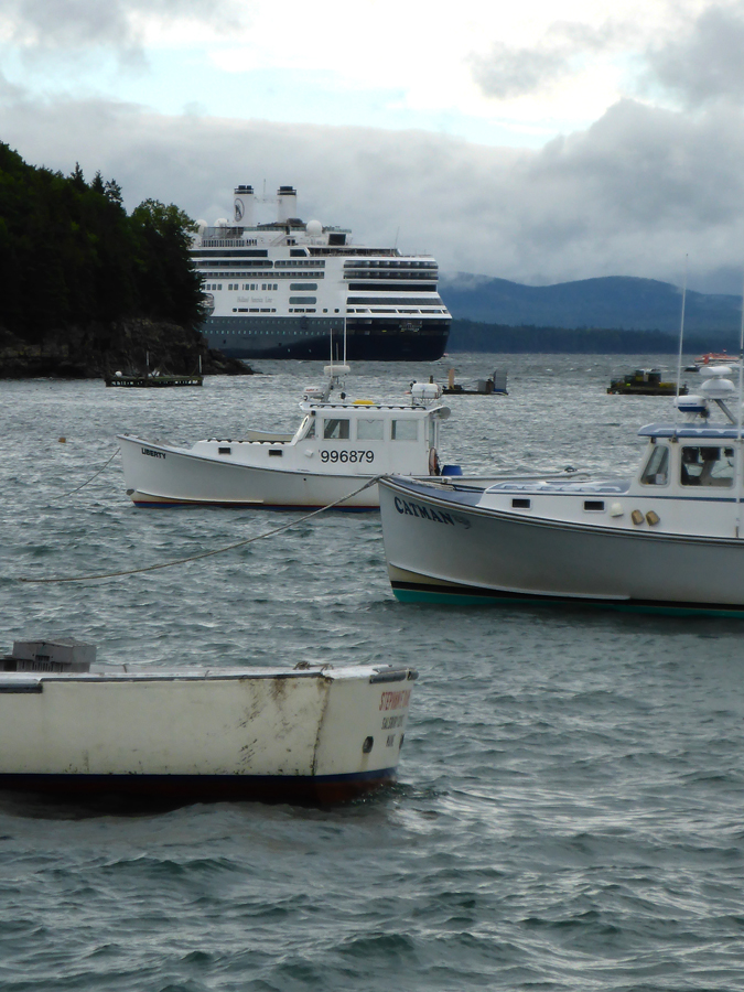
I don’t recall what I envisioned Bar Harbor to be but it sure wasn’t this: heavy workaday traffic, the roads lined with gift shoppes, fudge outlets, and lobstah shacks. The town center is even worse, packed tight with countless trinket vendors, galleries of faux art, and novelty tee shirteries.
We park the van and stretch our legs, mingling with the thousands of well-heeled tourists on shore leave from the three gigantic cruise ships anchored in the harbor, who stroll aimlessly around in their Helly Hansen expedition rain wear and Italian loafers while licking organic ice cream cones.
We peruse the seaweed soaps and kelp candles, crab-shaped keychains, and pirate-themed bottle openers. Inspired to buy something nautical, I shop for a new knitted watch cap for the recent cold evenings, and I find a high-end sporting goods boutique offering 33% off Patagonia outdoor wear. So, instead of the name-brand beanie costing me the usual arm and a leg, I am able to purchase it for only a finger and a couple of toes.


After a few weeks of enjoying some of the most scenic natural wonders of the region, and looking forward to more in Acadia National Park tomorrow, we find this bustling marketplace of schlock a little overwhelming.
The only saving grace here is that about every third place is a pub, tavern, or alehouse. So, after going with the flow for awhile we dive into the nearest drinkery (always our first refuge), where we enjoy a couple of local IPA’s over a basket of fish-n-chips.
We finally jump in the Westy and follow the caravans of tour buses out of town and past countless inns and lodges with “No Vacancy” signs, leaving the clamoring throngs behind us, and return to our restful campsite in Winter Harbor.