Day 14: Lewistown, Montana
 We stop in at the Bureau of Land Management field office on the east side of town to get current road conditions and other advice before embarking on our next foray off the beaten track. Motoring north thirty-five miles to Winifred, we duck in behind the grain elevator to catch the gravel Dy Trail to Knox Ridge Road, and soon enter the Missouri Breaks Backcountry Scenic Byway.
When Lewis and Clark camped here twice in May of 1805 they described the region as “the Deserts of America”, and later settlers would call this section of the Missouri River the “Bad Lands.” Indeed, compared to the vast and plentiful plains through which the explorers had just passed, and the lush green alpine forests which awaited them in the Rockies, the Missouri Breaks area must have seemed a desolate and lonely place forsaken even by Nature herself.
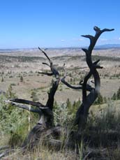
The sculpted valleys and hillsides, striped with alternating layers of volcanic and sedimentary deposits, though bleak and inhospitable, are quite beautiful. The Missouri has carved a deep and meandering channel down into the surrounding plain, and the Byway road skirts the edge of this valley to offer spectacular vistas.
At Woodhawk Bottom we take a side trip down a steep and winding descent into the river basin. The road here is comprised of a very loose, powdery soil, and is quite narrow where it threads along the dangerously steep hillsides. With many blind curves and sudden declines, and no place to turn around, we end up getting drawn farther in than we like before fully realizing the conditions.
 The steep downgrades and shifty soil soon have our brakes heating-up, and I can smell the hot pads. I downshift again so the transmission can share the load, and we finish the descent at a crawl.
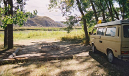
The harrowing drive is well worth it, offering a lovely shaded campsite among the willows right along the river. It takes little imagination to see the good captains and their thirty-one fellow explorers sprawled out here on the sandy soil, stretching their aching muscles and getting a fire going for yet another night camped on the riverbank.
The frighteningly steep descent now becomes an equally daunting uphill climb that has the transmission growling and Lorie and I hunched forward in our seats. But we churn upward and back to Lower Two Calf Road, where we continue eastward through an increasingly warped and folded landscape, our passing witnessed only by a few free-range steers, a bighorn sheep, and a large golden eagle.
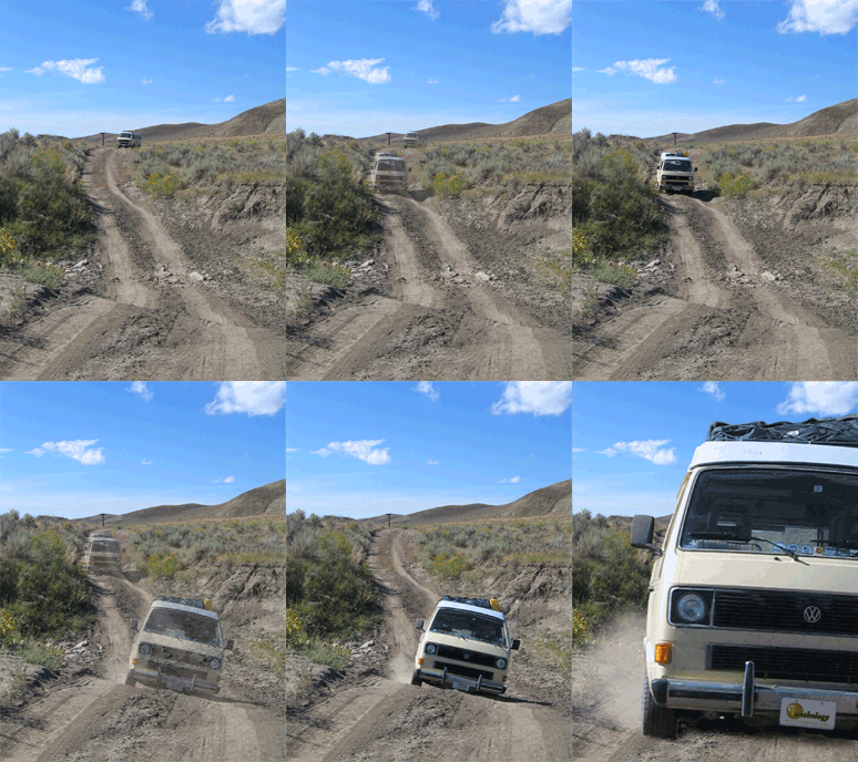
Another series of twisty switchbacks brings us once more down to river-level, and the road forks. One branch promptly dead-ends on the banks of the Missouri while the other poorly marked route drops into the deep, washed-out, dry bed of Two Calf Creek before climbing back up into the hills at a grade steeper than anything I’ve ever seen. With a sinking feeling we realize that we must either backtrack nearly forty miles of rough road, or negotiate the dry creekbed and scrabble our way up the bluffs to the road we hope lies just beyond.
 As Lorie walks ahead to spot me, I ease the Westy down into the arroyo and we thankfully manage to avoid hanging up the bumpers or bashing our propane tank on a rock. Clawing our way up onto the plain, the gears growl and the drive wheels spin and jounce on the loose and rutted soil. At one point I glance over at Lorie and, through her window frame, it seems the horizon is tilted at a dizzying forty-five-degree angle. Just outside, the ground tumbles away into a deep and vast ravine that would easily swallow a thousand crumpled Vanagons without so much as a glance from anyone but the occasional passing turkey vulture …
After a couple miles of this seemingly interminable ascent, we finally level off and, with a sigh of relief, come to the junction with Knox Ridge Road. One can turn southwest here, and return to Winifred via the upper route, but we instead continue east a few more rugged miles to the junction with US-191. As we make the final climb to the highway, we meet a large 4WD pickup full of local hooligans, and they stare slack-jawed as we come puttering out of the rough backcountry in our little “hippie wagon”.
As our tires gratefully touch pavement once again and we reacquaint ourselves with the higher gears not used since leaving the highway in Winifred early this morning, we are happy to be heading home. We have driven over 2500 miles, across the vast Great Plains, over the high alpine passes of the “Crown of the Continent”, and seen hidden places virtually unchanged since Lewis and Clark paddled and hiked them. But we are tired and hungry and a bit bedraggled. Even our trusty Vanasazi is muddy and dusty and bug-spattered, and she has a thousand miles to go.
At Malta we rejoin the Great Northern Highline, turn east now, and let the ceaseless westerly winds carry us homeward …
Some Points for Backcountry Travel
ROAD SURFACE
Though gravel for perhaps the first twenty miles eastward from Winifred, the Missouri Breaks Backcountry Scenic Byway soon turns to a loose and silty soil, which actually offers a softer, less harsh ride than the chatterbumps, and is not especially difficult to drive. But this dusty material will become a dangerous and impassable “gumbo” when wet, sticking to everything it touches, clogging up the tires and wheel-wells of even the strongest 4WD vehicle, and eventually bringing you to a complete halt there in the outback. A local Leroy rancher we met at Logan Pass highly recommended the Byway, but suddenly turned all wild-eyed and shaky as he emphatically advised us to “get the hell out of there at the first raindrop!” In addition to short-term forecasts, it would also behoove visitors to check on recent weather conditions before entering, to avoid any residual “gumbo pots.”
About forty miles east of Winifred, Lower Two Calf Road turns quite rough and begins a series of treacherous descents and climbs, with hairpin switchbacks negotiating very precipitous hillsides. Remember that when encountering opposing traffic on such narrow grades, uphill traffic has the right-of-way.
VEHICLES
To be honest, a 4WD vehicle is recommended for this route, as the eastern sections and many of the spur roads are quite rough. With quality light-truck tires and some very tricky maneuvering, we were able to pilot our 2WD Westy through the entire Byway, but I shiver at the thought of an unwitting tourist heading into this area with their Ford Taurus rental car …
SAFETY
This area is hardly more populated today than it was in the time of Lewis and Clark; it is truly the outback. In the nearly five hours it took us to make our way through the fifty miles of the lower route, we encountered only three other travelers, and this was on a Friday afternoon. If you drive in here on a Tuesday morning and get yourself good and stuck, you may not see another soul for four or five days. Be sure to have adequate fuel, water, and food in the event of an unintended and prolonged backcountry stay. As always, it is advisable to bring your own tow straps or chains, jumper cables, and fuel hand pump, rather than expecting your would-be rescuers to carry them for you.
Cell phones? Ha! If you can scramble to the top of a nearby butte, you might manage to get a clean signal to make a call out. Good luck describing your location to the reluctant tow-truck driver.
 Notes for the Vanageek
- Total Trip Mileage: 3838 Miles
- Total Fuel Used: 152 Gallons
- Overall Trip Average: 25 MPG
- Oil Consumption: 3 Qt.
- Other Westfalias seen: 6 Microbusses, 12 Vanagons, 6 EuroVans; nearly ALL inside Glacier National Park


