Camp Westfalia

Archive for Journeys, Day 1

Pacific Northwest 2

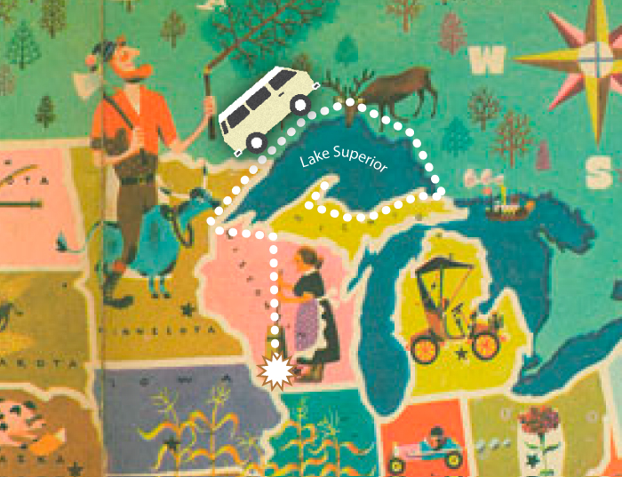
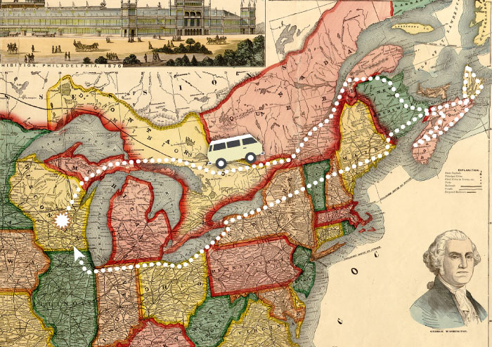
We recently returned from a four-week, 6800-mile Westfalia road trip from Wisconsin to the Pacific Northwest. We leisurely followed Highway 101 down the Pacific Coast through much of Washington and Oregon, then returned through John Day country and spent a few days in Yellowstone National Park.

We drive hard from Wisconsin and arrive at Badlands National Park about sunset. Before taking a site at Sage Creek campground we must carefully navigate a small herd of the native bovines. Note: a 2500-lb. bison has the right of way over a Vanagon.

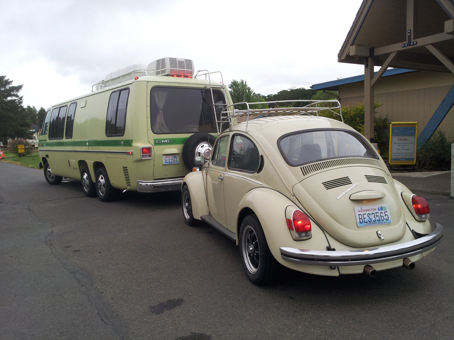
An early start gets us over the Continental Divide at Homestake Pass, then on to the Missoula, Montana, KOA tonight, where a fellow Kamper™ arrives in a vintage GMC motor home towing a sweet Beetle.

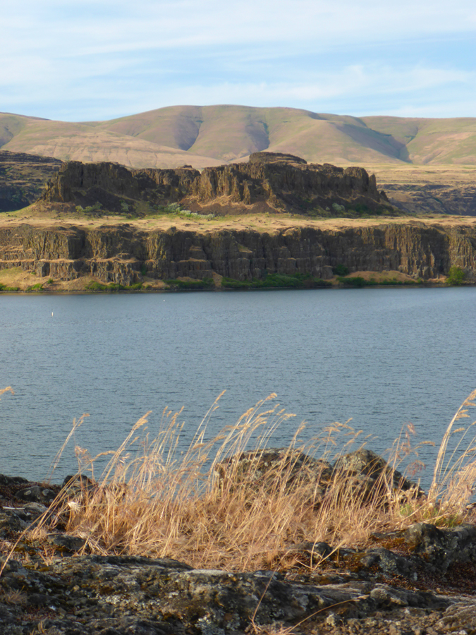
At Kennewick, WA, we join the mighty Columbia River and opt to drive the northern bank rather than the more usual I-84 on the southern shore. The very lightly traveled Highway 14 follows the river down through stunning and ever-changing landscapes and ecosystems, sometimes high above the river, skirting around soaring basalt bluffs, and eventually entering deep forest near the Cascade Range.

We camp at Columbia Hills Historical State Park, a small but lovely campground right on the banks of the Columbia. Just a short hike away are several Native American petroglyphs which were saved from inundation when the nearby Dalles Dam was built.

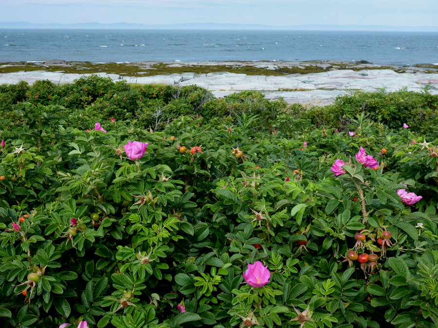
We follow the Columbia River all the way down to where it empties into the Pacific, camping at Cape Disappointment State Park. Our site is just a few steps from the ocean, and only a mile from where Captain William Clark camped with a few of his men when the Lewis & Clark expedition arrived here in 1805.

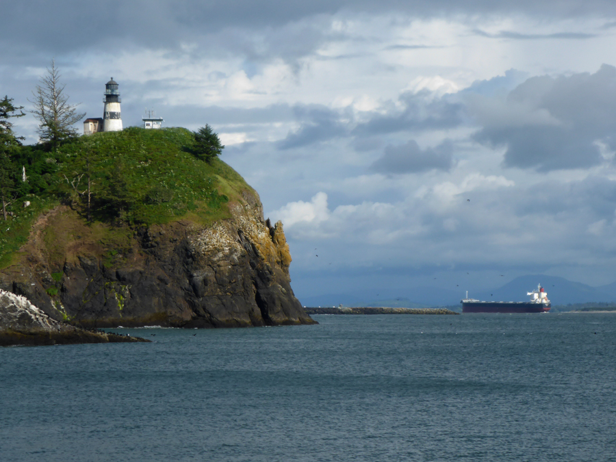
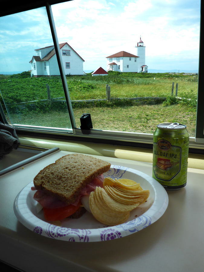
The Lewis & Clark Interpretive Center sits on a decommissioned 1904 artillery battery, built to overlook and protect the harbor entry at the mouth of the Columbia River below.

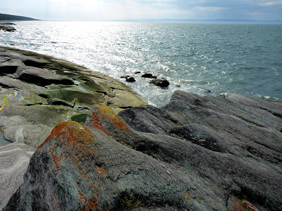
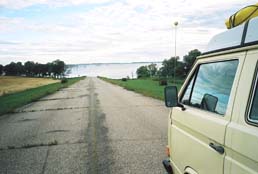
Having arrived at the edge of the continent, I guess this is as far West as the Westy will be driving.

Exploring the backwoods of Leadbetter Point State Park.

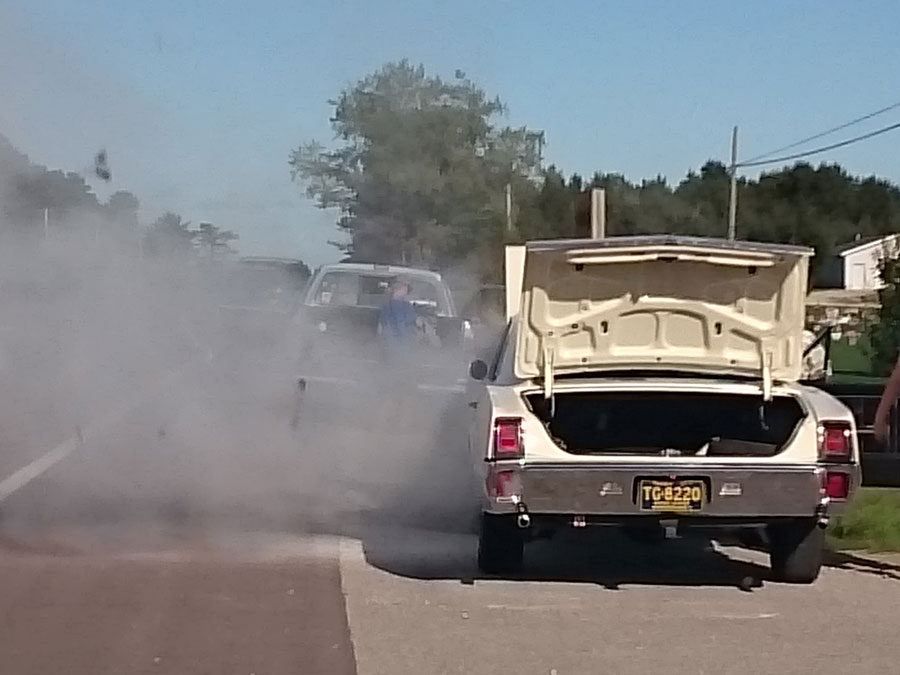
Fortunately, the Westy requires no welding during this trip.

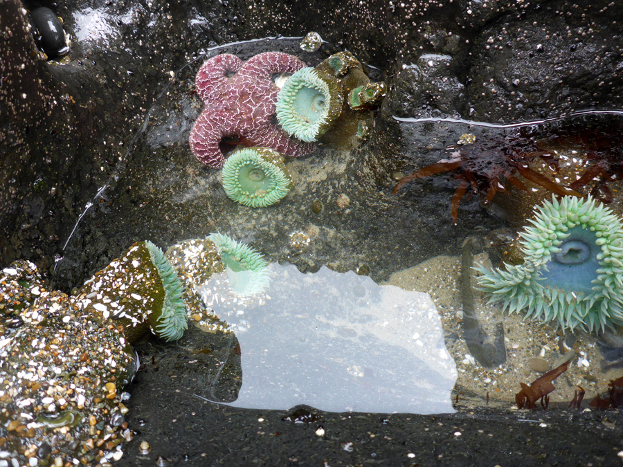
An afternoon at Heceta Beach reveals entire worlds thriving in the tide pools: anemones, sea stars, crabs, sea urchins, and more.

Our campsite near Florence, OR, offers a commanding view of the mouth of the Suislaw River; one afternoon a small pod of orcas swims up the river, hunting sea lions.

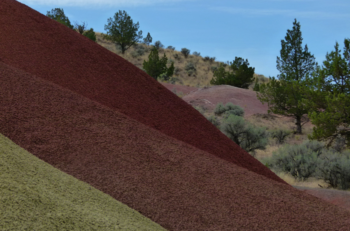
At John Day Fossil Beds National Monument, volcanic ash and other debris were laid down over millions of years, then eroded, leaving these colorful badlands.

The rusticated stone Roosevelt Arch at the north entrance of Yellowstone National Park, named for Theodore Roosevelt, who happened to be visiting the day the arch was begun and was asked to lay the cornerstone.

At Mammoth Hot Springs, geothermal-heated water travels underground through limestone, dissolving calcium carbonate, which then precipitates to form these hills of travertine.

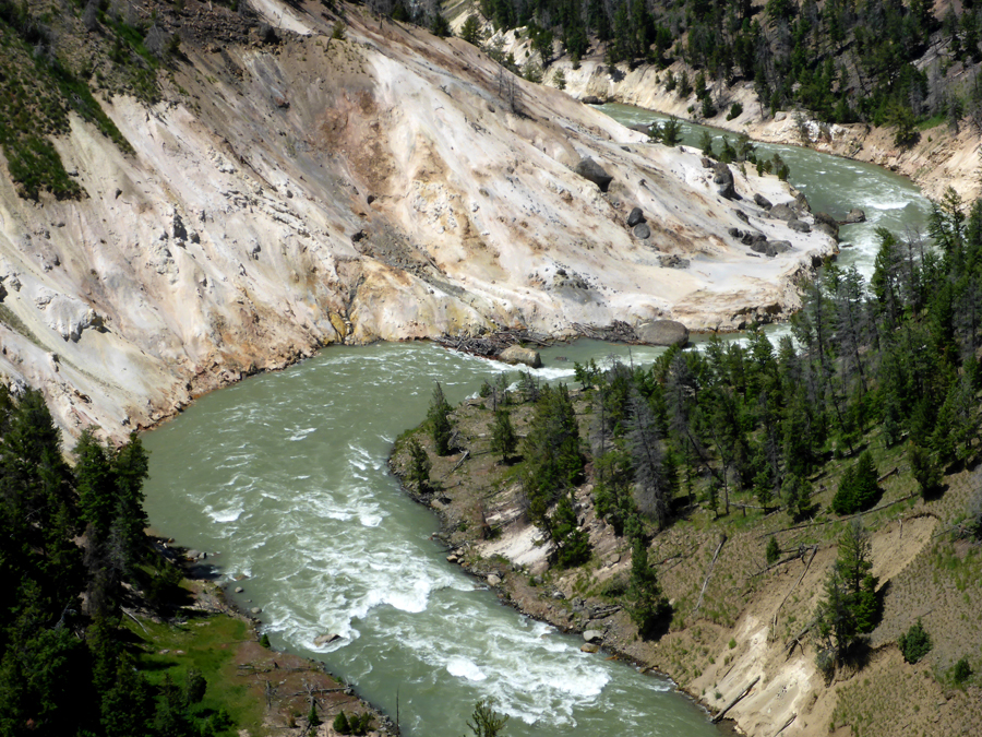
The Yellowstone River roars through the Grand Canyon of the Yellowstone.

The rugged terrain of the Park requires some advanced highway engineering.

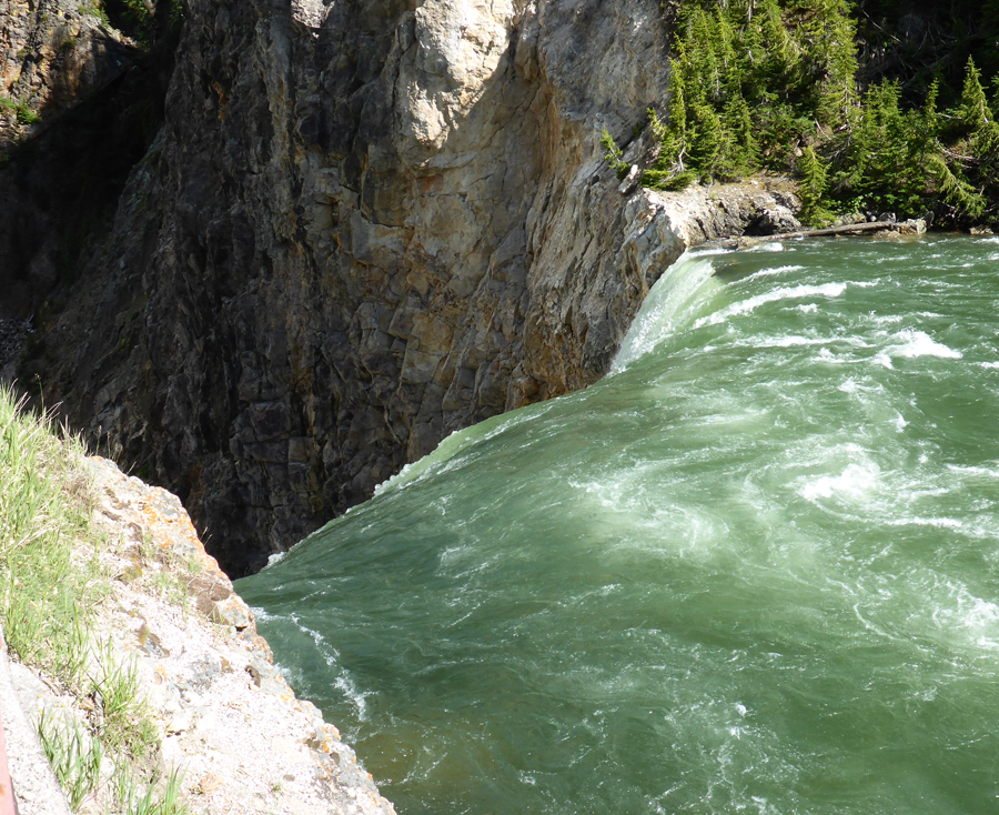
At the head of the Grand Canyon, the Yellowstone River drops over 100 feet at Upper Falls.

A young grizzly cub learns from Mom how to dig for grubs.

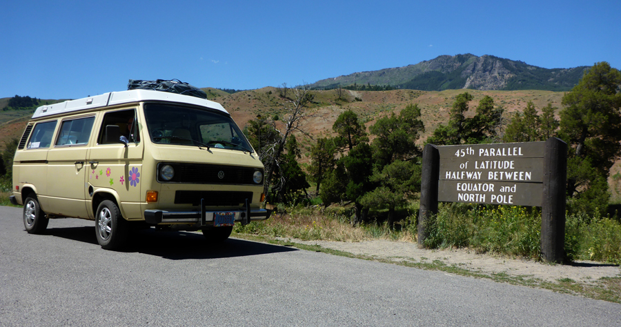
Tiny Isa Lake, straddling the Continental Divide, drains into TWO oceans: the Pacific and the Gulf of Mexico. Either way, for the Vanagon, it’s all downhill from here …

A quick side trip through Grand Tetons National Park and Jackson Hole.

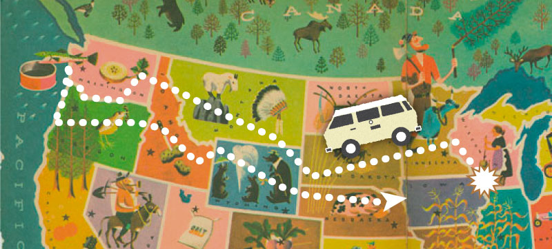
Homeward bound, the Rocky Mountains fade behind us.

We turn a few heads in Nebraska.

Our final night on the road, in a quiet Nebraska county campground …


What do you think? Leave a question or comment below, and use the social links to share with friends!

More Journeys Here!

Seaway Trail to Nova Scotia, Week 1

Six thousand miles along the Saint Lawrence Seaway through Ontario, Quebec, New Brunswick, and Nova Scotia, to Maine’s Acadia National Park.

“I have travelled around the globe.  I have seen the Canadian and American Rockies, the Andes, the Alps and the Highlands of Scotland, but for simple beauty Cape Breton outrivals them all.”
Alexander Graham Bell

Last fall, the Camp Westfalia crew embarked on a 4-week, 6000-mile roundtrip tour from Wisconsin to the extreme northeastern points of Cape Breton Island, returning home through Maine. Highlights of this trip included Montreal, the Bay of Fundy, Acadia National Park, and more.

We had long wanted to drive this historic route, the St. Lawrence Seaway being the ancient ‘water highway’ of natives, voyageurs, and modern vessels since the end of the last ice age. And having previously circumnavigated the upper Great Lakes of Superior and Michigan, we were eager to see the others.

Hop in and ride along …!

Day 1:  Escanaba, Michigan

We drive hard from Wisconsin into the Upper Peninsula of Michigan, wedged between Lakes Superior and Michigan. We cannot ask for fairer weather today, the warm autumn sun tempered by the cool lake breezes wafting in through the Vanagon’s wing windows.

A few miles past Manistique, we crest a rise in the highway to see a nicely restored classic 1960’s sedan pulled over on the side of the road, hood up and smoke rolling from the open engine compartment. I stop hard on the shoulder a safe distance back, grab the Westfalia fire extinguisher, and rush ahead to find the owner in a Hawaiian shirt peering into the open engine compartment.

“I think I’ve got it …” he announces, having just emptied his economy-sized extinguisher. But a moment later sparks erupt and the carburetor is again engulfed in flames. I quickly hand him my extinguisher and he puts it out for good.

Near St. Ignace, Mich., we pause at a roadside rest area for a view of the Mackinac Bridge. Spanning the five-mile straits between Lakes Michigan and Huron, it’s the longest suspension bridge in the Western Hemisphere.

We don’t take the bridge today, but instead turn north, finally crossing into Ontario and taking a campsite in Sault Ste. Marie.

Day 2: Sault Ste. Marie, Ontario

After breakfast in a Tim Horton’s (delectable donuts, characterless coffee), we jump on the Trans-Canada Highway and swing east, the Vanagon’s 1.9-liter diesel thrumming steadily as we motor along the north shore of Lake Huron.

Several years ago on our circumnavigation of Lake Superior , we paused in modern-day Thunder Bay to visit Fort William. Along with nearby Grand Portage, this collection point formed the western nexus of the great North American fur trade. Beaver pelts collected in the western forests were brought down to the lake, loaded into immense canoes paddled by twelve hardy men, and transported 1400 miles down the entire length of the Great Lakes to Montreal.

I think of these rugged, determined voyageurs today as we head eastward along the same route in the Vanagon, cruising along at a mile a minute, sipping coffee …

Shortly past Sudbury we join the Ottawa River and follow it all afternoon, finally camping on its south bank at Fitzroy Provincial Park.

Day 3: Ottawa, Ontario

Cruising past Ottawa, we soon enter the New France separatist stronghold of Quebec, where I learn, among other things, that while kilometers are considerably smaller than miles, it doesn’t take a whole lot of them to get one in trouble with the local gendarmerie.

Near Montreal we take a campsite at the La Prairie KOA. After checking in at the office we putter along at a stately pace to our assigned site. But no sooner have we parked than an attendant comes racing up in a golf cart and skids to a stop beside our driver’s door, a cloud of dust swirling around him.

Quebec is known for its rich French culture and arts, as seen in this Montreal KOA Kampground™

“You must slow down in the Kampground™,” he informs me in a thick French accent. ”Your speed must be eight km/h!”

I glance at the Vanagon’s speedometer, and see that it starts at 18 km/h, or 10 MPH.

“Do you know how fast you were driving?” he asks.

“Umm … nine?”

He is not amused.

In the end, errors are acknowledged, amends are made, and an international incident is averted which may very well have resulted in my permanent expulsion by an angry New-Frenchman in a yellow golf Kart™.

Day 4: Montreal, Quebec

We break camp and head north for a day in the city, somewhat naively assuming this will be a leisurely jaunt.

But we soon realize that the greater metropolitan area of Montreal has recently suffered an ongoing barrage of intercontinental ballistic missiles bearing thermonuclear warheads, resulting in the near-total destruction of all major roads, highways, bridges, and many city streets.

We carefully traverse an endless narrow ribbon of broken pavement, outlined by a veritable sea of orange signs and barrels, and surrounded on all sides by dense morning rush-hour traffic, immense construction (or destruction?) equipment. Plumes of dust and smoke rise from towering pyramids of concrete rubble.

After about two hours of this post-apocalyptic mayhem, we finally find a quiet cafe in Vieux (Old) Montreal for some of the best croissants and coffee we’ve ever tasted.

Built on an island at the confluence of the Saint Lawrence and Ottawa rivers, Montreal was first settled by First Nation peoples over 4000 years ago, then by French explorers and traders in the 1600’s. The second-largest French-speaking city in the world (after Paris) Montreal remains a major commercial and cultural hub in Canada.

After breakfast we walk the streets of Old Montreal to the Notre-Dame Basilica, its twin Gothic Revival bell towers rising two hundred feet toward the blue heavens. Built between 1824 and 1843, the Roman Catholic church remained the largest in North America for over fifty years.

We stroll in off the Place d’Armes, the second oldest public square in Montreal. Built in 1693, the square has served as a major gathering place for public and military events, hay and wood markets, and even as a Victorian garden.

Inside, the Basilica’s dramatic and grand interior is rich and colorful, every surface gilded with gold, silver, reds, blues, and purples. Our eyes follow the soaring walls upward to the dark blue ceiling, spotted with celestial stars, and daylight streams in through immense stained glass windows. Even non-believers are offered a glimpse of a world beyond this one …

In the multi-level parking structure on the King Edward Quay overlooking the roaring Saint Lawrence River, we jump back in the Vanagon and head for our final Montreal stop: the site of the old fur trading post at Lachine.

Lorie punches the address into the GPS and we make our way through the dense metropolitan traffic on rough cobbled streets, our route taking us further and further away from the river and up steep inclines. Finally, the GPS helpfully informs us that we have reached our destination, but it is a three-story brownstone walk-up, at least ten city blocks from the river.

I’m an avid paddler of canoes and kayaks myself, and something tells me this isn’t right. Even the most enthusiastic of voyageurs wouldn’t be so foolish as to haul his 35-foot canoe this far from the water. Uphill. Full of four tons of beaver pelts.

We check the map and find a similar address in a more likely location, and are soon at the western end of the Canal de Lachine. We park the van and walk across the footbridge to the small island where the stone warehouse and office overlooks the canal. It was here that the furs from the North American interior were transferred from canoe to sailing ships for delivery to Europe, and it marked the final destination for our hardy voyageurs.

For avid Great Lakes-region paddlers and history buffs, this is sacred ground. As I stroll the shady lawn, I imagine dozens of immense canoes hauled up here, hundreds of bone-tired men sprawled on the grass. Exhausted from their thousand-mile journey and elated to have arrived before the worst of the winter storms, they turned in their furs and collected their pay. Tonight, they would eat well, would drink even better, and would sleep the sleep of the weary.

Reluctantly, we dive back into heavy highway traffic, which has not been improved by the addition of sweltering afternoon heat. A few days from now, a Quebecois Westy owner we meet at a Cape Breton beach will tell me that Montreal is the great provincial laughingstock for its intolerable traffic situation and perpetual road construction, and for seemingly cornering the world market on orange barrels. Some have suggested the city’s visitors bureau adopt a new slogan: “Montreal—We’re busy, come back next year!”

We continue eastward to Montmagny, where we stop only for fuel but where we also make some new friends.

A new Mini Cooper pulls in and stops at the adjacent fuel pump, and François and his little family pile out to excitedly admire our Westfalia. François tells us that he’s currently on his third Westy, a Syncro. His partner and Lorie exchange travel stories while François and I chat about the inevitable mechanical misadventures, and we all share the instant camaraderie that seems to come with Vanagon ownership.

François’ delightful young daughter, perhaps five or six, is of course a native French-speaker like her parents, but she sings for us a charming little English song she is learning in school. In appreciation, Lorie plucks one of the many small magnetic flower stickers from the flanks of our Vanagon and presents it to the girl; she promptly applies the single pink flower to her father’s gunmetal silver Mini Cooper.

François recommends an intriguing side-trip for us, and even calls ahead to request that the French-speaking ferry operators hold a place for us on the last boat. We reluctantly bid our new friends au revoir, and hurry up the highway to the wharf, and are soon gliding across the dark waters to the mysterious L’Isle-Verte, the Green Island.

There is little to see in the darkness when we roll off the ferry and onto the pier. Motoring up and down the single main gravel road running the length of the island at night, it seems François’ assurances of ample overnight parking/camping sites here were perhaps somewhat optimistic.

Finally, one of the side roads peters out in a small gravel parking area and we stop, pull the curtains, and settle in for a night of quiet stealth-camping …

Day 5: L’Isle-Verte, Quebec

We wake early in the morning to see that we are just a few short steps from the St. Lawrence Seaway, so we stroll down to the water’s edge to investigate the small tide pools there. Out on the water, over ten miles wide here, we see oceangoing freighters steaming in from the Atlantic Ocean and heading upriver perhaps even as far as Duluth, Minn., over 2000 miles away at the far western end of Lake Superior.


We drive to the only place which can be considered a café on this isolated island, and go inside for coffee.

“Hello,” I say, and the proprietor greets us warmly, though upon hearing my English the two Quebecois women at the next table look away coldly. We enjoy a pair of freshly steamed caffè latte while poring over our maps.

When Lorie steps away to visit the jewelry workshop in the next room, the owner points to our maps and in halting English inquires of our origins.

“Wisconsin,” I reply.

“Ah, oui. I drove trucks to Wisconsin,” he says, “Milwaukee, Madison, Wausau …”

“Yes, we came up through Sault Ste. Marie, Ottawa, Montreal, to here,” I trace the route on the map with my finger.

His eyes widen, perhaps recalling all those miles he himself has driven so many times. He glances out the window to where the old Vanagon is parked on the grass, then looks back at me.

“You have a very fine machine,” he declares earnestly.

Lorie returns with a lovely handmade necklace and matching earrings, thereby chalking up perhaps 1% of this tiny island’s annual GDP, and we spend the day exploring the few roads, beaches, and a beautiful old lighthouse. We catch the first evening ferry back to the mainland, and continue northeasterly as a misty rain turns to a torrential downpour, finally taking a campsite at Parc national du Bic.

Day 6: Rimouski, Quebec

We part ways with the Seaway at Mont-Joli and turn inland to climb through hilly highlands toward Campbelltown. A Canada lynx, tall as an American Boxer and over a meter long from its bob tail to the tips of its tufted ears, emerges from the dense forest and dashes across the highway just ahead of us.

The skies clear as we motor south along the Northumberland Strait and take a campsite at Amherst Shores Provincial Park, where the attendant at the office is perhaps the most helpful and congenial of any we’ve met. We settle in for the evening and find this place to be one of the nicest and quietest public campgrounds on this trip so far.

We are impressed by how the Nova Scotia Parks department bundles their firewood for sale: nice large helpings, with an assortment of sizes from kindling up to larger pieces of dry wood that snaps and crackles satisfyingly. And they include a wad of old newspapers to get you started. Heck, even the firepits have been cleaned and tidied for your campfire enjoyment.

Day 7:  Northport, Nova Scotia

After a quick breakfast in camp we motor east along Nova Scotia Hwy 6, the Sunrise Trail, with periodic side trips to tiny shoreside parks. Even from the highway we catch glimpses of harbour seals lounging on rocks near the shore, and they turn their heads to watch as we pass by.

We continue through New Glasgow, then cross the kilometer-long causeway over the Strait of Canso to Cape Breton Island. Knowing this may be the last city of any size we’ll visit for awhile, we stop in Port Hawkesbury to replenish some groceries, pick up a few forgotten items, and replace the fire extinguisher I spent on the collector car in Michigan.

At St. Peter’s we choose a nice hillside campsite at Battery Provincial Park. A tidy white lighthouse, built in the distinctive wooden pepper-shaker style, stands over the entrance of the St. Peter’s Canal and lock system, allowing large boats to sail a half mile from the Atlantic Ocean to Bras d’ Or Lake, in the heart of Cape Breton Island.

After long hot showers, we enjoy a stroll around the grounds as the afternoon sun descends over St. Peter’s Bay.


Check out Week Two of this road trip, when we tour Cape Breton Island’s Cabot Trail, and make our way to the Bay of Fundy!

Great Northern Roadtrip, Day 1

A 3800-mile cross-country roadtrip from Wisconsin to Glacier National Park, retracing portions of the routes of Lewis and Clark, and the nation’s northernmost transcontinental railroad.

“No sand or heavy mountain grades,
Mosquitos as scarce as hen’s teeth,
No bad creeks or rivers to ford,
Plenty of water, no sand storms,
Eighty tourist camping grounds, all free as the air,
Real live Indians and crying papooses”

From “Theodore Roosevelt International Highway: Guide To Montana”, 1921

Day 1: Amnicon Falls State Park, Superior, Wisconsin

To journey across the northern Great Plains in a brand-new 1921 Model T, jouncing along roads described as “Slightly improved dirt and gumbo”, must have been an epic roadtrip indeed, fraught with hazards and great discomfitures. These days we are thrown into a rage when our smooth highway journey is spoiled by a blundered drive-thru order. “I didn’t order Diet Coke …!”

So this morning as my traveling partner, Lorie, and I drive our 1983 Volkswagen Camper away from the edge of Lake Superior and climb US Route 2 up the steep bluffs behind Duluth, Minn., we embark on a roadtrip that will soon join the path of many earlier westward explorers who went before us.

Over a century ago, railroad magnate James J. Hill began laying track for his Great Northern Railway along this same route, the nation’s fifth and northernmost transcontinental railroad, linking the Great Lakes and the Mississippi River with the Pacific Ocean. Our journey also marks the bicentennial of the 1804 outbound leg of the Lewis and Clark expedition, which followed the Missouri River up to the Continental Divide and beyond. And long before that were the Sioux, Hidatsa, Arikara, and other native Americans who for thousands of years had used the water highway of the upper Missouri as a route for trade, hunting, and warfare.

Paul-Bunyan-Babe-Bemidji-largeWe motor along through the dense northern forests of Minnesota with a light rain falling and gray skies. At Bemidji we swing in off Route 2 to pay homage to Paul Bunyan, mythical king of the lumberjacks. Legend has it that the famous ten thousand lakes of Minnesota were formed by the oversized feet of the giant Paul, along with his bovine sidekick, Babe the Big Blue Ox, as they stomped around in the thick northwoods, a’choppin’ down trees.

Local Native Americans find that quite curious, as they seem to recall there being plenty of lakes here before the guys in flannel shirts showed up, so who knows? In any case, looking at Paul’s misshapen and uncomfortable footwear, I wonder if he shouldn’t have been called Paul Bunion.

The other feet, shown here for scale, are those of your humble author. The sandals are undoubtedly more comfortable, but completely unsuitable for creating a Land O'Lakes, and probably should not be worn anywhere west of the Mississippi. More on that later.

The other feet, shown here for scale, are those of your humble author. The sandals are undoubtedly more comfortable, but completely unsuitable for creating a Land O’Lakes, and probably should not be worn anywhere west of the Mississippi. More on that later.

US Route 2 has been called the Great Northern Route, in honor of Hill’s railroad. Locals along the western portions of this highway applied the same nickname they used for the railway, “The Highline,” since it closely parallels the Canadian border, sometimes veering within eighteen miles of our northern neighbor. Nearby Interstate I-90, though perhaps offering a smoother and faster drive west, unfortunately suffers from the same maladies as most Interstates: seemingly endless superslab monotony, eerily identical ‘travel plazas’, and dense clots of glaze-eyed motorists. Completely unsuitable for the fine art of Westy touring.

Instead we cruise along the smooth and sparsely driven two-lane highway through these green forests, Robert Frost’s evocative “road less traveled by.” We shall see if that indeed makes all the difference.

Toward evening, we roll into Devils Lake, North Dakota, and decide to stop for the night. I passed through here once a couple of years ago, and I know there’s a campground nearby, so we turn south to find it.

Road to Nowhere

There is definitely something odd going on in Devils Lake, and like the first time I visited here, we are soon struck by a pervasive sense of death, impending doom, and nature gone wrong. The Sioux who lived here before white immigration called the place Spirit Lake, but the spirits seem disgruntled now. Above-average precipitation in recent years has caused the lake to rise more than twenty-five feet, and to nearly triple in size, from seventy square miles to over two hundred.

devils-lake-north-dakota-silosNeedless to say, this has gobbled up lots of farmland, hundreds of homes, highways, railroads, and other infrastructure, and is threatening to consume the city of Devils Lake. In recent years, more than 350 million in federal dollars have been spent to relocate people, raise roads, and build levees, and everywhere you look there are giant earthmovers and great piles of rip-rap. Side roads turn off and promptly disappear beneath the waves, standing forests of dead and blackened trees line the shallows, and abandoned farms poke up out of the water.

The local Chamber of Commerce has tried to put a smiley face on the matter, enthusiastically calling themselves “The Sportsman’s Paradise!”, but everyone is still sandbagging. Indeed, the place has become renowned as a regional fishing hotspot, but we didn’t see many other pleasure craft like water skiers or sailboats. You wouldn’t want to snag your keel on someone’s submerged silo or windmill, I guess.

devils-lake-north-dakota-largeWe drive around looking for the campground for over an hour, the map directing us down roads which no longer exist, and I swear our compass spins in circles. Great swarms of insects the size of sparrows hurl themselves at our windshield, and local landmarks appear to have been uprooted and transplanted five miles away from their original locations. I don’t know exactly what the citizens here did to anger the spirits or Mother Nature, but something is definitely amiss.

We finally stumble upon the state park, and gratefully settle in for the night.

Southwest by Westy, Days 1-3

A five-thousand-mile motor tour through several states in the great American Southwest, visiting sites both historic and prehistoric: Mesa Verde, Bryce Canyon, Zion National Parks, and more.

What’s so great about the Great Plains?
Desolate. Flat. Dark, and lonely.
All these fail to truly capture the topographical and emotional essence of a long night drive across the heartland.

Seventy million years ago, when the vast North American inland sea drained away, the landscape which emerged here was the extensive, nearly flat seabed of the former ocean, with nary a hill nor a dale rising above the smooth horizon.

So today the road has nothing to climb, nothing to skirt. The interstate highway engineers must simply have chosen a compass point and begun pouring concrete. Even within the narrow corridor of highway reflectors reaching into the black distance, I think I can see the curvature of the earth …

Day 1: 2:00 a.m., Somewhere in Central Nebraska

If you’ve seen one mile of highway in the heartland, you’ve seen them all, and I don’t want to look at every one of them. Hence the long night drive. But I derive a certain satisfaction from making good headway across these immeasurable distances, in light traffic and under the cover of darkness. Out here on the black highway, sailing along under the stars, it’s just me and the truckers. Even Lorie, my partner and faithful traveling companion, has folded the back seat down into a bunk and now sleeps to the rhythm of concrete expansion cracks passing beneath our wheels. So begins our great Southwest adventure.

Leaving our home in southern Wisconsin about 3:00pm on a Friday afternoon, we have driven our 1983 Volkswagen Vanagon Westfalia camper south into Illinois and then swung west onto I-80, bound for Denver. Far ahead, I watch the setting sun fall behind the horizon, but I continue driving all through the night.

By 5:30am Saturday morning, my growing fatigue has developed a resistance to the repeated dosages of convenience store coffee. Even the AM talk-radio crackpots fail to keep my interest. While I’ve been driving the dark side of the planet, the sun has been traversing the light side, and now reappears in my rear-view mirror to begin a new day.

After 13 solid hours on the road, it is time to rest. I swing into a truck stop, scuttle in between the Peterbilts, turn off the engine, and join Lorie for a few hours of peaceful slumber …

Day 2: Elm Creek, Nebraska

westfalia-truckstopAt 8:30am we are awakened by the call of the open road, and by the sound of traffic already on it. After taking on fuel, food, and coffee we resume our journey. By mid-afternoon we arrive in the mile-high city of Denver. Being the gateway to the Southwest for those of us who live in the upper Midwest, we stay here only long enough to enjoy a walk on the 16th Street pedestrian mall, visit the lovely old Union Station, and share a chicken wrap at a sidewalk bench.

We head south out of Denver, fighting evening rush-hour traffic on I-25, and finally arrive in Castle Rock, CO, about 7:00pm. Twenty-nine hours and 1033 miles after leaving home, we find a place to pull off for the night, pop the top on the camper van, and settle in for a luxurious full eight hours of sleep.

Day 3: Castle Rock, Colorado

We make little progress today. I suppose for every adventure there is an equal and opposite misadventure, and our first comes today, just west of Walsenburg, CO. Upon beginning our ascent over the first range of the Rockies, the engine temperature gauge rises dangerously and the warning light flashes. Pulling over to let it simmer down and replace some lost coolant, we resume our climb only to have the same thing repeated. It seems our 20-year-old coolant-system cap can no longer hold back the pressure against the thin mountain air, and begins leaking anti-freeze.

We reluctantly but wisely retreat back down the hill and by the time we pull into a Pueblo auto parts store and install the four-dollar replacement, it is late afternoon. We decide to camp at a nearby state park.

A Superior State of Mind, Day 1

A thousand-mile circumnavigation of the world’s largest inland body of water, Lake Superior, our route taking us through three US states and the Canadian province of Ontario.

“I had with me a youth (Etienne Brule) who wanted to … see the great lake, take note of the rivers and the peoples living along them; and discover … the most curious things about those places and peoples …”
Samuel de Champlain, Great Lakes explorer, 1610

We are a nation of explorers.

North America was one of the last major land masses of the world to be found by early European voyagers, and even after her coasts had been well charted, her interior remained shrouded in mystery to the developed world for centuries.

More than a hundred years after Columbus stumbled onto what he believed was India, French explorers were only beginning to make their way up the St. Lawrence River to discover the seemingly endless waterway which beckoned them ever westward. Even as recently as the Lewis and Clark voyage of discovery, many believed that deep in the American interior dwelt the long-lost tribes of Israel, veritable mountains of salt, and wooly mammoths and other prehistoric beasts.

Forming nearly a third of the contiguous US border with Canada, the Great Lakes and St. Lawrence comprise by far the largest chain of inland lakes anywhere in the world. Certainly, the grandest of these is Lake Superior.

Drawn to the mystique and beauty of this place, we plan to travel around her entire body—350 miles long and 160 wide. Sticking close to the shore for most of the way, our thousand-mile circumnavigation will take us through three US states and the Canadian province of Ontario, camping along the way.

Join us as we embark on this Superior roadtrip …

Day 1:  Minoquoa, Wisconsin

After breakfast in camp this morning we set sail on a northerly course along US Route 51 to Ironwood, straddling the border with Michigan. We swing west on our old friend US Route 2 and the trees soon part like a green coniferous curtain to offer our first glimpses of Lake Superior. The native Ojibwa people knew her as Kitchi-gummi, “Great-water” or “Great-lake”, while the French called it Le Lac Superieur—”Upper Lake”. Superior is indeed the largest freshwater lake in the world, covering over 30,000 square miles and containing an almost incomprehensible 3,000 cubic miles of water, enough to entirely flood all of North and South America to a depth of nearly twelve inches. At 600 feet above sea level, it is the highest of the Great Lakes chain.

So large and cold is this vast inland sea that it often generates its own weather systems, cooling nearby regions by several degrees and annually dumping as much as twelve to fifteen feet of snow on towns here along her southern shore. Warm summer weather blowing in off the golden wheat fields of the upper Great Plains, upon encountering the cold mass of Superior, often turns to violent, windy thunderstorms which send powerful waves crashing onto her rocky coasts.

The sheer visual weight of Superior is dramatically contrasted by the dense and dark forests surrounding her, and we find our eyes drawn to and held by the vast open sky above her. We continue west on Route 2, the rocky and pebbled beaches scrolling past the Vanagon’s windows, and we soon pull into the old mining and lumbering town of Ashland.

The Ojibwa had lived and prospered on Chequamegon Bay for thousands of years when the first whites beached their canoe here in 1659. Famed French explorers Radisson and Groselliers erected a small stockaded cabin, generally regarded as the first European settlement in Wisconsin, before continuing their search for furs in the lands west of Superior. It would be nearly 200 more years before white settlement began in earnest, when a couple of adventuresome fellows from Ohio built a cabin and began raising their families here in what would later be called Ashland.

We continue west on Route 2 for a couple miles and stop at the Northern Great Lakes Visitor Center. After popping the Westy top and fixing soup and sandwiches in a quiet corner of the parking lot, we go inside to take in the enlightening exhibits regarding the natural and human history of the region. The Center also offers an enclosed, four-story observation tower which offers panoramic views of the Ashland harbor.

Twin diesel Vangon Westfalias

Twins separated at birth? After this happy reunion, the two Westfalias frolicked in a nearby meadow, scampering around in circles and sniffing one anothers’ tailpipes.

It is only a short jaunt northward on Hwy 13 to Washburn. A bit fatigued by the late drive last night, we decide to stop for the evening at a small municipal campground overlooking Chequamegon Bay. No sooner do we settle into a site and enjoy a walk along the water’s edge than who should motor through the campground but our Westy’s spittin’ image—a 1982 diesel Vanagon, owned by a friendly couple from Minoqua, where we camped last night. After the requisite greetings, they invite us over to their site after dinner, where we chat and swap travel stories.

Having previously owned three Volkswagen cars (and at various times vowing I’d never do it again), I knew when we bought the van that we were joining an elite and eclectic community. But we didn’t expect to be so warmly embraced as we’ve been as owners of a VW Westfalia Camper. Wherever we go, hippies beep in their rusty old Type 2 Busses and retired couples flash the lights of their shiny VW Eurovans. Every random encounter in a grocery store parking lot or campground becomes an opportunity to exchange pedigrees and swap Westfalia Camper tips. As it turns out, Westy-owners are a cult within a cult.

Later, we swing by the grocery store for some forgotten supplies, then across the street to the self-proclaimed “World’s Only Underground Dairy Queen”. Viewed from the front, one might easily mistake this popular ice cream joint for a Dairy Queen of the more usual, superterranean variety. But closer inspection reveals that this DQ is either: a) indeed built into a small hillside, or b) a regular DQ which a disgruntled bulldozer driver has attempted to bury beneath tons of dirt, for reasons unknown. After all, who can fathom the dark and tortured soul of an unhappy heavy-equipment operator?

Sitting at the picnic tables under the shade trees, we savor our sundaes and ponder this mystical edifice of soft-serve.