Camp Westfalia

Archive for Lake Superior

Lake Superior Circumnavigation 2

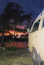
The Camp Westfalia crew recently embarked on another Lake Superior Circle Tour: 1000 miles around the wild and rugged shores of the Greatest of the Great Lakes. Ride along!

We drive north today toward the inland sea of Lake Superior. Happily cruising along in very light traffic under sunny skies, when suddenly an old El Camino in the right-hand lane veers left in front of us, to cross the median. I throw the wheel over hard to the left and lock up the Vanagon’s brakes, and we go into a four-wheel crabbing skid. We finally stop in the median cross-road, only five feet from his door.

The eighty-year-old driver smiles and goes on his way, apparently oblivious to his deadly mistake. I scowl and go in search of a good stiff drink to settle my nerves …

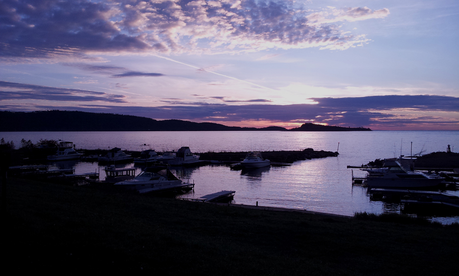
From Duluth we continue north along Minnesota’s North Shore. Make it as far as Grand Portage, Minnesota, where we have a late-night slice of pizza in the casino cafe. We take a site in the adjacent RV park overlooking the marina, and settle in among the retirees squandering their 401k’s in the casino.

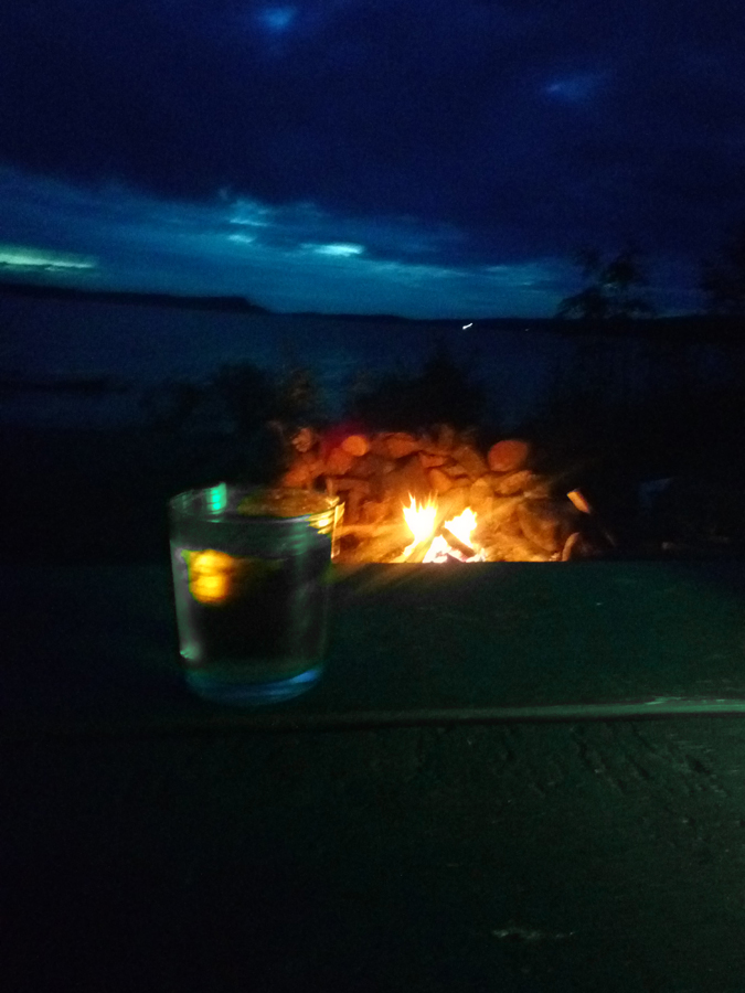
“Lorie’s Lounge” is soon open and (as previously mentioned) I finally enjoy my long-awaited adult beverage …

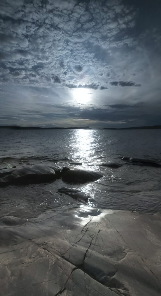
Sunrise on Lake Superior.

Our border crossing is uneventful, and we soon hit Thunder Bay, Ontario.


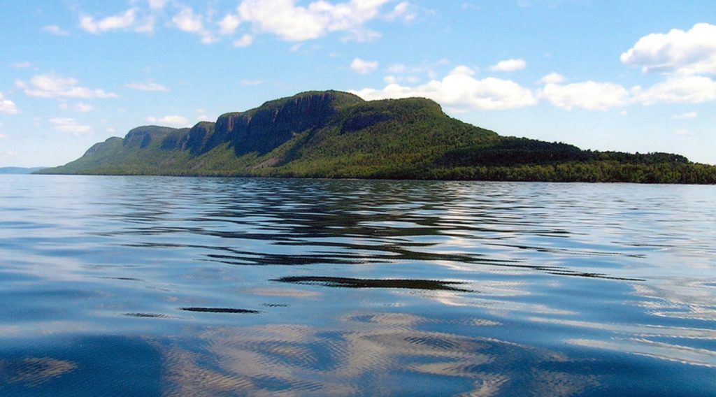
After a quick tour of the Sleeping Giant peninsula, we continue eastward along the Trans-Canada Highway, around the northernmost point of Lake Superior. Late afternoon finds us in Rossport, Ontario, where we stop at Rainbow Falls Provincial Park for lakeside camping on the Inland Sea …


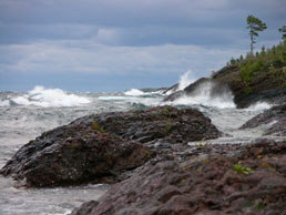
We cruise the north shore today, rolling through rugged and rocky Canadian Shield country. Cold inland lakes glitter between granite mountains.

Exploring remote forest roads often leads to beautiful new discoveries. Sometimes not …


We finally camp at Pukaskwa National Park.


At Young’s General Store in Wawa, Ontario we are greeted by one of the city’s famous gargantuan geese. This particular bird was recently retired, and replaced by a new stainless steel model, which can be seen right from the highway.


Another fantastic campsite right on the beach at Agawa Bay Campground.

There are a few advantages to travelling in the off season: no crowds, no noise, no bugs (my god, the bugs!). In fact, not much of anything at all …


Pancake Bay Provincial Park. Legend has it when Lake Superior voyageurs camped here, they knew they were only one day away from fresh supplies in Sault Ste. Marie. So they used up the last of their flour and enjoyed a big ole batch of pancakes.

Mmmm, pancakes …


Having nearly completed our loop of the lake, I realize the Westy is entirely too clean. So, before turning south for home, we let her off the leash for a bit of backwoods romping in the dirt.

For an unabridged account of one of our Lake Superior Circle Tours, check out “A Superior State of Mind.”

A Superior State of Mind, Day 15

Day 15: Fort Wilkins State Park, Copper Harbor, Michigan

A cold rain continues to spatter against the pop-up roof this morning. Though snug and dry inside the Westfalia, we are beset by a growing sense of gloom today, only partly caused by the gray and wet skies. A hot breakfast helps a little, and we soon hit the road with coffee mugs in hand for a day of windshield touring. He cruise down the spectacular rocky coast along Hwy 26, the surf pounding Agate and Grand Marais Harbors, and motor into the small town of Eagle Harbor.

Eagle Harbor keweenawIn the spring of 1846 a body washed up on this section of Lake Superior shoreline. The man’s boots bore the initials, “D.H.”, and word spread like wildfire throughout the Keweenaw that the famed Douglass Houghton had finally been found.

Before his life was cut short at the age of thirty-six, the good Dr. Houghton had already achieved a lifetime of accomplishments. Earning his medical degree at age nineteen (and a Bachelors degree in geology in only six months), he was instrumental in saving many lives during the cholera epidemics, and accompanied Henry Rowe Schoolcraft in the 1832 expedition to find the headwaters of the mighty Mississippi River. Upon returning to his home in Detroit, no sooner had he cleaned the mud from his fateful boots than he was informed that in his absence he had been elected mayor; evidently his associates, knowing his popularity, had placed him on the ticket, and he’d won quite handily. He would serve two terms.

In 1837 Houghton was named Michigan’s first state geologist and three years later joined his old exploring buddy, Henry Schoolcraft, to survey the Keweenaw Peninsula. Dr. Houghton’s glowing reports of copper deposits ignited the rush to this area that would become the first and largest copper boom in the nation. Intensive surveys and mineral assessments were necessary to begin issuing land claims to prospectors and miners, and Houghton and his staff fanned out over the peninsula to conduct the work.

Eagle Harbor lighthouse
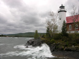
They labored long hours, and late into the season. On October 13, 1845, Houghton finished his work near here and, accompanied by an assistant, three French voyageurs, and his dog, Meme, set out for the mouth of the Eagle River to meet the rest of his survey crew. Superior’s mood soon turned foul with one of her notorious nor’easters, and she threw high winds and waves at the little party in their canoe. The voyageurs, who had been chosen for their famous skills on this inland sea, wondered aloud whether they should put ashore, but Houghton insisted they continue. The waves grew taller and steeper, threatening to swamp the men, and again the professional paddlers suggested they get out of the thick of things.

“Press on boys, press on,” Houghton replied. One of the doubtful Frenchies tossed him a life jacket (which he declined to wear), and moments later a tall wave struck broadside, broaching the canoe and tossing everyone into the icy water. One of the voyageurs was able to clamber atop the overturned canoe and pull Houghton out of the water, but a second large wave struck them again and scattered the party. Everyone made it safely to shore but the doctor and Meme …

Photo: Library of Congress, Prints and Photographs Division, Detroit Publishing Co. Collection

Photo: Library of Congress, Prints and Photographs Division, Detroit Publishing Co. Collection

One hundred sixty years later, almost to the day, Superior seems to be reveling in her deadly powers again. A howling wind makes the water look like a dark, jagged mountain range rolling ashore, and she throws green and icy waves up on the rocks and the foundation of Eagle Harbor lighthouse. There is a lingering sense of foreboding here, so we hurry back to the comfort of the Westy and motor up and over the stony spine of the Keweenaw, through autumn forests lush with color in the morning rain.

Due to the orientation of the uptilted geologic plates that form the Keweenaw Peninsula, all the best copper mining was to be found on its southeast flank. Here, as Houghton explained before his unfortunate demise, the edge of the Lake Superior basin was exposed at an angle of about twenty degrees, allowing access to the rich copper deposits to be found underground, so all the major mine sites of the Keweenaw were strung along this fault line. For a glimpse into the dark, subterranean underworld which drew so many here to seek their fortunes, we go to the Delaware Copper Mine and park the Westy on the tailings pile. Wearing ill-fitting yellow hard-hats (possibly made by Fisher-Price) we make our descent into the belly of the beast, down Shaft #1 a hundred feet to the first level of the mine.

Delaware Copper Mine
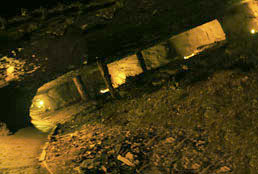
Opened in 1847, the Delaware mine produced eight million pounds of copper over its three-decade life, and vast caverns have been excavated in the steeply slanted layers of stone here. When a vein of copper ore was found, the miners, working in two-man teams, spent five days a week hammering holes into the surrounding stone; one man held and turned the drill tool while the other hit it with a six-pound sledge hammer, driving an inch-and-half-diameter hole three feet deep. Saturday was “blasting day”, when the holes were carefully packed with black powder and ignited to blast loose the living rock; Sunday was a day of rest while the resultant dust settled in the mine shafts. On Monday morning, the rubble was sent up to the surface for sorting the waste rock from the richer ore, and the miners began drilling another inch-and-half-diameter hole.

Needless to say, it was difficult and dirty work, cold and wet and deep underground. Even with the low wages of less than twenty cents an hour, each man had to pay for his own supplies used in the mining process: candles, powder, fuse, even the drill steel. It wasn’t until about 1880 that pneumatic drills were finally brought in, but the Delaware mine closed within a few more years, its ore played out.

As we navigate the dimly-lit catacombs of the mine on our self-guided tour, skirting around shallow puddles and occasionally stooping so as not to conk our heads, we hear quiet rustlings and inhuman whispers from overhead. A bit unsettled, we prudently hurry on, and arrive in a large open cavern which can only be described as … well, cavernous. The high vaulted ceiling and sound-swallowing space, ominously lighted, invites cliched comparison to a grand European cathedral, but it really isn’t that large. More like a small Southern Baptist chapel, somewhere in rural Alabama. Underground.

We stand agog, admiring the creative architectural potential of blasting powder, until we hear the voices again, and this time they are louder and more ill-tempered. Disembodied voices are one thing, but angry disembodied voices are quite another. The beastly scoldings and chatterings soon grow even louder and more aggressive. We have no flashlight with us so must rely upon our overactive imaginations to determine their source, and the frightful possibilities are unsettling. Large hairy subterranean spiders? Oversized and eyeless albino cave rats? Grouchy gargoyles?

As we quickly make toward the exit of the chamber something whooshes past our heads, and in the dim glow of the tunnel lights we see the leathery whirring wings of several small brown bats. They squeak and screech and send us fleeing up the tunnel like a couple of skittish schoolgirls. We gratefully make our way back up the drippy stairs to the surface, where we turn in our toy helmets and collect our wits.

Mandan ghost town keweenaw

Mandan, Michigan

For every boom there is a bust. At one time the town that sprang up around the Delaware mine was over a thousand strong, but by 1893 all but twenty-five diehards remained here. Such was the fate of most of the mine towns of the Keweenaw: Cliff, Phoenix, Gay, Central, and others. A few miles north of Delaware a forlorn gray signpost, easily missed even at diesel Westy speeds, marks the turnoff to Mandan, another once-thriving mining town now lost to the mists of time.

A short drive into the woods brings us to Main Street, now a rutted and rough double-track through the wet forest. Mandan had its ups and downs over the years. Though fairly pure copper deposits were found here, deep underground layers of sand complicated the mining of it. The mine was closed sometime in the 1860s, but a new shaft was sunk around the turn of the century, and as the copper came up the town resurged. The Keweenaw Central Railroad ended at the depot here, a new school and general store opened, and the town numbered over three hundred. But when the copper proved less plentiful than hoped, operations were ceased for good, local commerce dwindled, and people drifted away to seek their livelihoods elsewhere. By 1929, with most of the large Keweenaw copper mines closed and the nation in the final days before the Great Depression, eighty-five percent of Keweenaw County residents went on general relief. As more mines closed over the years, the decline continued; as recently as 1910 the population of Keweenaw County was over 7,000; by 1990 it had dwindled to 1,701.

For some, the most suitable gravestone of all: a pure and unadorned node of native copper

For some, the most suitable gravestone of all: a pure and unadorned node of native copper

Where the homes and businesses of a town of 300 once lined this path, now stand only two or three lonely houses, still quietly proud alongside the collapsed remains of their less fortunate neighbors. We are spattered by another gentle wave of rain, shaken from the overgrown apple trees by a stray gust of Superior wind, or perhaps the wistful sighs of the ghosts of those who once lived here …

We return eastward along U.S. 41, the dreary skies and low-hanging forest closing in on all sides to form a veritable tunnel through which we putter further forward in time, like the old miners in their underground burrows. Our questions about the fates of the people who made their lives here, so long ago, are partly answered when we skirt around the east end of Brockway Mountain and discover the Copper Harbor Cemetery.

This hillside graveyard, hushed and tranquil, but within earshot of the booming surf which assaults the nearby Superior shoreline, is scattered with small limestone monuments to those who rest here. Some survived only to the age of one or two before succumbing to a deadly outbreak of diphtheria or influenza, while others lived into their eighties. With names and dates ranging back a century and a half, this place serves as silent testament to those hearty souls who made their lives in a place which can sometimes be cold and harsh, yet is always strikingly beautiful.

copper harbor sunsetParadoxically, this modest resting place for the Copper Country’s dead is a faithful reflection of life here on the shores of Superior. Like many of the Keweenaw’s residents past and present, this tidy graveyard is modest and simple, without such niceties as polished marble or delicate lawns, and it bears the signs of constant abuse by the harsh elements.

Yet it is proudly stoic, reserved, peaceful. Quietly persisting like the hardy northern wildflowers that fringe the graves here; stunted, and with leaves like leather, but also bearing delicate and vibrant petals of red and gold. In the midst of this often harsh and austere world, the people of this land have managed to make for themselves a quiet and restful place of comfort, even a final resting place.

We solemnly return to the Vanagon and quietly depart. Tonight Lorie and I will spend a final evening sleeping among the ghosts of the soldiers at Fort Wilkins, and tomorrow our wheels will turn southward toward home. We have nearly completed our thousand-mile circle tour of Superior, just as we have witnessed the rise, fall, and continuing cycle of life here on the shores of this greatest of lakes.

VanageekNotes for the Vanageek

  • Total Trip Mileage: 1640 Miles
  • Total Fuel Used: 65 Gallons
  • Overall Trip Average: 25 MPG
  • Oil Consumption: 1 Qt.
  • Other Westfalias seen: 3 Vanagons, 1 EuroVan

A Superior State of Mind, Day 14

Day 14: Fort Wilkins State Park, Copper Harbor, Michigan

Though Fort Wilkins spent far more years in disuse and decrepitude than in active service, today it provides a remarkably clear view into life in a remote military garrison a century-and-a-half in the past. Thanks largely to an extensive WPA project in the 1930s, twelve of the original buildings dating from the 1840s have been beautifully restored to their former glory and are now maintained by the Michigan DNR.

After an early breakfast in camp we hike over to the fort, the rising sun slanting in over the lawn as we stroll the old rooms and boardwalks of the garrison. As a young park staffer unfurls Old Glory and sends her up the tall whitewashed pole, one can easily imagine the two companies of troops assembling on the central parade ground for reveille and roll call.

fort-wilkins-cannonLife here was often harsh. The men (and the few women) who lived here were nearly completely isolated from the outer world and all its comforts. With no roads in the entire region, what food and supplies for daily life could not be grown or hunted locally was delivered by sailing ship. The John Jacob Astor, the first American commercial vessel to sail Lake Superior, was such a ship, and the two-masted wooden brig carried miners and supplies all around the Superior shoreline for ten years before meeting her fate here at Fort Wilkins.

On September 21, 1844, the Astor had just finished unloading supplies at the Fort when a sudden turn in the wind prevented her from leaving the harbor. As the wind increased, the Astor began to drift, dragging her anchor across the rocky bottom, and she was thrown up on the shore. Though the captain struggled to free her, it wasn’t to be, and her bones still litter the bottom of the harbor today.

We take a ride in a small boat out on the harbor today, skirting around the black reefs that throw up flumes of white spray, and out to the Copper Harbor lighthouse. Prompted partly by the wrecking of the Astor and by the plights of other ships trying to thread the narrow and treacherous harbor entry, mariners began complaining to Washington and in 1847 Congress appropriated the money to construct the lighthouse. In February of 1849 the first keeper arrived at the new station with his family.

Up until this time, the nation’s navigation aids had been under the jurisdiction of the US Treasury Department, with responsibilities for lighthouses falling to the Fifth Auditor. Stephen Pleasonton was a longtime government bureaucrat with no maritime or technical skill. Sourpussed and tight-fisted, he ran the program on a shoestring, and the lighthouses of that era reflect it: due to inferior construction materials and hurried workmanship many lasted only a few years in the harsh environments of the seashores and Great Lakes regions. By 1866 the first Copper Harbor lighthouse was so decrepit that it was declared beyond repair; it was torn down and a new one constructed in its place, keeping only the Fourth Order Fresnel lens from the original.

fort-wilkins-parade-groundOur small tour boat putters behind the point on which the lighthouse sits, and we disembark at the same landing used by the lighthouse keepers who lived and worked here for over fifty years. Preserved in the same condition as it was at the turn of the century, the Copper Harbor lighthouse is now maintained as part of Fort Wilkins SP, and a History Department staffer guides us around the grounds and the Cream City brick buildings. The original oil-fired light in the forty-two-foot tower has since been retired, and a modern light installed on a steel tower alongside the old one, but it’s still easy to imagine the solitary and often desolate life led by those lonely lightkeepers and their families. “… beyond the most distant wilderness and remote as the moon,” statesman Patrick Henry told Congress after early mining attempts were abandoned in 1771.

Returning to the mainland, we enjoy the first of several fine meals at the Harbor Haus restaurant (watch for the billboards featuring beckoning German maidens and their delightful dirndls), as we watch bald eagles diving for fish in the harbor. We motor a few miles farther north to where US 41 ends in a quiet cul-de-sac (the southern terminus is eight states and nearly 2000 miles away in Miami), then continue beyond the end of the pavement on a narrow gravel road toward the far tip of the Keweenaw Peninsula. We turn off on a smaller gravel-and-dirt jeep trail for another mile through the lush, overhanging boreal forest, the fall colors now dripping with a cold rainstorm that has blown in off Superior, until we come to the trailhead into a Nature Conservancy Preserve (NOTE: this final section of ‘road’ may be rough and rutted, so drive slowly. The surface is mostly coarse crushed gravel, so traction is good even in the wet, and we had no great difficulty negotiating it with our 1983 diesel Westfalia).

Copper Harbor Lighthouse

Copper Harbor Lighthouse

A short hike in the rain brings us to Horseshoe Harbor, a lovely and remote bay protected from the fierce lake winds by a veritable wall of uplifted 600-billion-year-old rocky ridges. While Lorie strolls the placid water’s edge, enjoying the myriad colors and textures of the gravel beach, I scramble up the protective natural wall, and am nearly thrown back down when the full force of the north wind hits me.

The view beyond the protection of the ridge reveals green waves ten feet tall rolling in off the jagged surface of Superior to spend their wind-driven power on the volcanic shore with resounding booms. As the water rushes back down the sloped faces, it forms new waves which surge back out into the lake, and when these meet with the next series of incoming waves, both crash together and leap upward twenty feet or more. All along this ancient wall of stone, the inland sea churns and boils, these waves having rolled for seventy miles across Superior before finally arriving here to deliver their final blows on the shore. I imagine the Astor or another unfortunate vessel from the days of the wooden sailing ships losing her anchor and being driven toward a rocky and desolate coast like this, and the struggle of the crew to steer her clear of certain foundering. Before the wind can shove me over the edge, I clamber back down behind the wall, cold and wet, my ears ringing in the sudden stillness. The Vanagon carries us back into town, where we warm up with a hot meal and drinks at the Harbor Haus.

As we enjoy our dinner, a rather peculiar gentleman at the next table asks the waitress about a place to stay on a future visit, and she helpfully provides the names of several nearby hotels. His interest piqued, he questions her further every time she returns to fill his water glass or to top up his coffee, and wants to know all about each place of lodging: their proximity to sites of interest, their comparative values, the relative thread counts of their percale pillow cases, the heartiness with which their toilets flush. And on and on it goes, each time the unfortunate waitress hustles past with an armful of dirty plates.

He is dining alone, so perhaps is more interested in the conversation and the company than in actual lodging, but clearly he has nearly exhausted the overburdened young woman’s knowledge of local hostelries, and she soon takes to hiding in the kitchen. So he now directs his attention to us.

horseshoe-harbor-keweenaw“So, where are you folks staying at?”

Lorie and I exchange sidelong glances, a sort of split-second staredown, which I handily win by inserting a forkful of rice pilaf in my mouth. I shrug and begin chewing.

“We’re camped at the state park,” Lorie graciously replies over her shoulder, her voice all sweet and syrupy, but her eyes casting daggers at me.

“Oh, you’re camping. Outside!” our astute new friend observes. “Aren’t you worried about wild animals?”

Despite her momentary puzzlement, Lorie manages to fix me with a silent glare, and her fingers twitch toward her steak knife.

“Um … no,” I quickly offer. “No, not really.”

“Well, I’m worried about them,” our nervous dinner companion replies. “Up here there’s bears and mountain lions. Wildcats. Badgers, too!”

I nod, a couple of buttered green beans poised just beyond my lips.

“There’s all kinds of very vicious animals. It’s a regular jungle up here,” he continues, glancing out the window with distrust. “Have you seen any wolverines?”

“No,” I admit. “But I saw a very ornery red squirrel yesterday …”

“Well, I wouldn’t be able to sleep outside with all those dangerous creatures out there, prowling around and stuff …” The waitress sneaks up behind him to furtively slip his dinner bill onto the table, but her escape is foiled when he begins to dispute the charges, and we are allowed to dine in peace.

We return to our campsite, and enjoy a restorative campfire to take the chill out of the air. But I cast wary glances toward the woods whenever I hear a twig snap, and we finally retreat to the relative safety of the Westy.

A Superior State of Mind, Day 13

Day 13: McLain State Park, Houghton, Michigan

No sooner had the great glaciers begun melting and retreating back to the northern climes of Canada, about 11,000 years ago, than prehistoric human hunters and gatherers began following the game animals and burgeoning fauna which advanced in the wake of the ice sheets. Besides the well known mastodons and wooly mammoths, there were also seven-foot-tall ground sloths to be had, oversized beavers that weighed almost 500 pounds, and vultures with twelve-foot wingspans. As early as 4000 B.C., another reason early humans came here to the Keweenaw Peninsula was in pursuit of the precious red metal—copper.

Copper artifacts from the Reeder collection (1904). Photo courtesy Michigan Technological University archives and Copper Country Historical Collections. Reeder Collection 6.

Copper artifacts from the Reeder collection (1904).
Photo courtesy Michigan Technological University archives and Copper Country Historical Collections.
Reeder Collection 6.

Few places on earth bear such abundant deposits of copper, and of such purity. Prehistoric peoples here gouged the ore from hillsides and caves, and used crude smelting and forging techniques to make hardened tools and implements. Even elaborate jewelry was fashioned from the malleable metal, and used to barter goods with other early American natives in the region. It is estimated that 1.5 billion pounds of copper were manually excavated and worked by these prehistoric people.

Under clear and sunny skies we break camp and motor up along the north shore, making a brief diversion up the Brockway Mountain Drive, a steep climb along the exposed rocky spine of the peninsula. The 1.6-liter diesel thrums noisily back in the engine bay as we struggle upward, hundreds of feet in four miles, and we finally arrive at the peak of West Bluff. While Vanasazi gratefully pauses to catch her breath, we leap from the cab and take in the sweeping vistas offered by this high point of land. The southern view reveals a descending series of lesser peaks dropping away to the Keweenaw Bay, while to the north we gaze out over the blue expanse of Lake Superior, 700 feet below, great tankers and ore carriers moving slowly along the horizon. Puttering down the other end of the bluff, we quickly descend into the idyllic and charming town of Copper Harbor. With embracing shoreline arms and a long island to form a natural breakwater across the bay, Copper Harbor is a picturesque example of a lake captain’s perfect refuge from the brutal and violent storms that can strike these shores of Superior.

Brockway Mountain
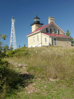
The ancient peoples who first mined copper here on the Keweenaw eventually ceased working and disappeared entirely, and their culture, their methods of early metalworking, their knowledge, were all lost to the mists of time. Among the whites who later moved into this region, stories and legends of the red metal persisted, fueled by the occasional discovery of five-ton boulders of pure copper. But it wasn’t until French fur-trapping voyageurs seeking a safe harbor for their canoes spied La Roche Verte—The Green Rock—that serious modern-age mining began. The vein of nearly pure copper silicate—which can still be seen today—rising from the dark waters of Superior shot up the rocky shoreline and continued into the green forests beyond. With the building of the Soo Locks in 1855, large commercial vessels could now ply the upper lake, making feasible the large-scale extraction of copper; visions of immense wealth danced in the eyes of speculators, and a tent city of eager prospectors sprang up on Porter Island at the mouth of Copper Harbor; the rush was on.

fort-wilkinsTo protect the the miners and other workers from the hordes of ravaging Indians, a military fort was commissioned. As it turned out, the natives were uninterested in the copper, and friendly besides. So the soldiers spent more time keeping the peace between the hard-drinking miners, who grew especially restless when they finally realized what the natives already knew: the copper was really hard to dig up.

Fort Wilkins has had a spotty history, closing two years after it was built in 1844, then being recommissioned again after the Civil War, only to be abandoned for good in the 1870s. As the fort fell into decline hunters, fishermen, and other outdoor enthusiasts surreptitiously slept in its barracks and camped on its grounds, so we figure it will be a nice place to park the Westy and pop our top tonight. Fortunately, this is not only much easier these days but actually encouraged, as evidenced by the Michigan State Park sign at the entrance to the old fort. We purchase our permit and settle into our campsite on the shore of Lake Fanny Hooe.

A Superior State of Mind, Day 12

Day 12: L’Anse, Michigan

Over breakfast in a small diner overlooking L’Anse’s lovely namesake harbor, we peruse our gazetteer, then head southwest into the Ottawa National Forest. Encompassing 14,000 wooded acres of rugged and rocky wilderness, the Sturgeon River Gorge Wilderness unit is bisected by the Sturgeon River as it makes its way twenty-five miles northward to empty into Lake Superior. The Vanagon bumps along the dirt and sand forest roads, nimbly dodging the numerous bear hunters parked on the roadsides fiddling with the remote controls for their hound dogs (doesn’t seem very sporting) and we disembark at a trailhead.

birch-treesPropped against the base of the sign declaring the various trails which depart from here, there is a handmade memorial of sorts, poking above the weeds. It is an eight-by-ten picture frame, and beneath the glass—sun-faded, water-wrinkled, and lightly speckled with mildew—a hand-scrawled sheet of paper reads, “DANGEROUS CLIFFS! While walking our dog here on May 19th he ran off and fell over an UNMARKED CLIFF. He broke his neck and died! Please BEWARE, and don’t let this happen to YOUR beloved friend!” Near the bottom, the epitaph concludes with, “In memoriam Poochie, 2005”. Or Poppins, or Diggity, or Mr. Snuffles, or whatever the name was.

Undaunted, and unburdened by clumsy canines, we proceed onward with dogged determination. We begin our descent a mile or so down the switchbacked trail into the gorge, skipping merrily around freshly fallen and aromatic horse apples, the sound of roaring water growing louder and larger. While there are indeed a few impressive ledges and dropoffs along the way, there is hardly anything worth calling a cliff here. And if the ample horse droppings are any indication, one wonders just what sort of a dog was unable to navigate a reasonably uncomplicated footpath frequented by half-ton pack animals. Not to seem unsympathetic, but perhaps the dog world is all the better for the absence of such inept and undexterous representatives as the ill-fated and unfortunate Pugsley. Or Scooter, or Scamp, or whatever the name was.

Though I myself am off-leash today, I obey all of Lorie’s voice commands and thereby manage to avoid tripping over my own feet and go careening off into the thin, pine-scented air to plummet to my death, and we soon arrive safely at Sturgeon Falls.

Sturgeon Falls
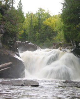
The river has carved a 300-foot-deep canyon in the region’s volcanic bedrock here, and it rushes through a steep and narrow chute before crashing spectacularly over a twenty-foot ledge. We sit at the base of the falls, taking in its impressive and eternal power, and enjoy a trail snack while letting the spray from the falls drift over and cool us. Finally refreshed, we climb the steep gorge trail to the Westy and return to the head of the harbor, where we catch US 41 at Baraga and continue north onto the Keweenaw Peninsula.

Counterintuitively, and for reasons unknown, the name of this place is pronounced KEY-wha-naw, suggesting that during the anglicization of the Ojibwa word, one of the ‘e’s got misplaced. In any case, it means “place we cross over”, in reference to the easy canoe route across the peninsula, which saved about 90 miles of open water paddling around the peninsula.

If it is true that the northerly neighbor states of Wisconsin and Michigan, when seen on a map, resemble a slightly mismatched pair of mittens, then the Keweenaw is where the friendly state of Michigan’s upper peninsula delivers to the world a hearty thumbs-up, visible even from outer space. This great projection of land arcs sixty miles out into Lake Superior from the northwest corner of Upper Michigan, and its bony skeleton is comprised of billion-year-old basalt. Even the massive mile-thick sheets of ice marching down from Canada couldn’t grind away this hard volcanic stone, and as the glaciers moved south into Wisconsin, the knifelike prow of the Keweenaw Peninsula split them and sent them slowly coursing around on both sides. Today these basalt ramparts still tower nearly a thousand feet above the lake, offering commanding views over the expansive surface of Superior and standing in mute testament to the steadfast forces of nature.

McClain State Park
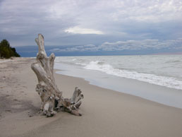
With its long natural and human histories, there is much to see and do here, so we stop in to the Chamber of Commerce visitor center in Houghton for some maps and other information. It’s already past the end of the summer season, the autumn leaves are a few weeks away from peak color, and a chilling wind blows in through the shipping canal. It’s pretty slow in the welcome center; it’s just us and the friendly woman behind the desk, who seems either worn out by the summer tourists or resting up for the upcoming fall-color rush. We select some maps and brochures, and indulge her invitation to sign the guest book; it’s nearly closing time and we are the third visitors on today’s page.

Crossing the big steel girder bridge, we swing west and follow the north shore of the portage canal several miles to McClain State Park, where we find a nice campsite mere feet from a sandy ledge overlooking the lake. The winds howling in off the vast surface of the water threaten to overturn our dinner plates, but we enjoy our supper at the picnic table as the sun sets behind Lake Superior.

A Superior State of Mind, Day 11

Day 11: Lake Superior State Forest, Deer Park, Michigan

Leaving our cozy campsite, we continue west on Michigan State Hwy 58. The road soon turns from firm, compacted sand to limestone rocks the size of one’s fist. It is the largest ‘gravel’ I have ever seen covering a road.

“Huh,” I think as the rough surface chatters our teeth and threatens to shake the Westy kitchen cabinets loose from their mounts, “musta fixed a washout here.” But the road continues like this, every turn revealing yet another stretch of lumpy boulders, and we soon slow to a more prudent speed. This continues. For eighteen. Agonizing. Miles. By the time we finally hit pavement again just outside Grand Marais, Michigan, our ears are ringing …

bald eagleIt has begun to rain again, so we forego a hike in Pictured Rocks National Lakeshore. We backpacked here several years ago, but the best views of the painted cliffs are from the waters of Lake Superior, either from a tour boat or your own sea kayak.

Just beyond Munising we pause at a roadside scenic overlook and upon disembarking notice that the cobblestone road has claimed one of our plastic wheel covers. It also occurs to me that this is the same wheel cover which I had to remove in order to change the wheel this morning, so perhaps the road is not entirely to blame. I didn’t really care for the looks of the covers anyway, and will later replace them with something a bit less fruity, but they were the factory originals and are pretty expensive to replace. So if you find yourself driving this same road, and you spot my wheel cover lying in the weeds, please pick it up and email me before selling it on eBay …

We putter west to Marquette, then up through L’Anse—French for ‘cove’—at the head of Keweenaw Bay. Continuing northwesterly, we venture out onto the Abbaye Peninsula, pointing like a finger into the vastness of Lake Superior. The roads grow narrower and more scarce, then soon turn to sand and nicely compacted gravel. We see the last of the power poles in front of a lonely cottage, hinting that the small cabins beyond here are without electricity. With autumn shrubs brushing along Vanasazi’s muddy flanks, the double-track threading through the Copper Country State Forest eventually peters out at a small trailhead very near the last bit of land on this peninsula.

Point Abbaye

Point Abbaye

A short stretch of the legs on the wooded path brings us to Point Abbaye, offering a sweeping view of slate-gray Superior, from the eastern edge of the Keweenaw Peninsula to the hulking headlands of the Huron Mountains, rising 800 feet above the lake. Near their feet, floating just offshore, lie the Huron Islands, about eight miles distant. A national wildlife refuge for nesting waterfowl, one of the two small islands also hosts a tall white lighthouse, gleaming faintly in the waning afternoon grayness. We potter about in the tide-pool-like bowls on this stony point of land as a commercial fishing boat chugs into the harbor with it’s catch, then finally head back down to L’Anse.

After having slept in the Westy for nearly another week, we opt for a room in a motel above the beautiful little harbor tonight, and enjoy long hot showers and sprawling on the queen-size bed. Today is our wedding anniversary, and we quietly celebrate with a fine dinner in a local example of that beloved upper-midwestern institution, the ‘supper club’, before retiring for the evening.

A Superior State of Mind, Day 10

Day 10: Sault Ste. Marie, Ontario

In the morning, we cruise down to the famous Soo Locks to see if we might glimpse any big ore carriers passing from one Great Lake to another, but alas we do not. Driving here, at higher speeds again, I once again notice the rear wheel vibration, and take the opportunity to inspect the tires. Reaching under the left-rear wheel arch and running my hand over the circumference of the tire, I find a distinct bulge in the tread, and can see a 6″-diameter distortion of the rubber: a classic case of terminal tread-separation. We’re in a rather pleasant waterfront park on a sunny morn, so Lorie puts her feet up and reads a book at a picnic table while I jack up the Vanagon and install the spare.

michigan-waterfall
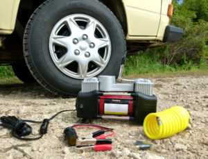
When we bought the van a year before, the previous owners had recently experienced a highway blowout and replaced the right-rear tire. Now the opposite tire is trashed. Subsequent online research will later confirm that the German frat boys from whom we bought the van had made the common mistake of installing everyday passenger-car tires on the Westy, when light-truck or Load Range C or D are required. With the heavy rear-engine configuration of the Vanagon, and the added weight of the Camper package, conventional car tires will squirm like cheap sneakers on an elephant, and dangerously begin unravelling within several thousand miles. Upon returning home I will install the correct tires, which, besides vastly improving the handling, also offer superior wear.

We pass through Canadian Customs and across the St. Mary’s River, the short watercourse by which Lake Superior drains into Lake Huron. As we motor over the International Bridge and gaze down at the river, we ponder the fact that, so large is Superior’s capacity, the water flowing far beneath us flowed into and fell onto the lake’s vast surface nearly two centuries ago, and is only now making it’s way out.

michigan-waterfall2At the opposite end of the bridge, we stop for US Customs. Though we have no contraband, we cross our fingers and hope the Customs officers will not look unkindly upon our ‘hippie bus’ and see fit to give it a thorough inspection. To search through every nook and cranny, some of which even I have yet to discover, would undoubtedly take hours. But with one look at our undilated pupils and bland Midwestern faces, they wave us through after only a few pointed questions, and we motor south then west into Michigan’s Upper Peninsula.

This area is blessed with numerous beautiful waterfalls, dropping from the hard Canadian Shield spine of the Upper Peninsula to the rugged southern shore of Lake Superior, and we spend the better part of this day visiting several.

Nearly thirty years ago this month, just a few miles offshore of this point of land, a tragic day in Great Lakes maritime history occurred: the wreck of the Edmund Fitzgerald. Most know what little they do about the event through folk singer Gordon Lightfoot’s popular song memorializing the event, and it’s a pretty concise rendition of that disaster.

On November 9, 1975, the 700-foot bulk carrier (a hundred feet longer than the Irvin we toured in Duluth) slipped out of the Superior harbor and headed north, then east across Superior toward Sault Ste. Marie, her belly full of taconite pellets bound for Detroit. The next night one of Superior’s notorious early-winter storms arose and the Fitzgerald ran into forty-five-knot winds, and seas as high as thirty feet, so she headed for the protection of Whitefish Bay, just east of here.

Original painting by Bud Robinson

Original painting by Bud Robinson

No one knows for certain what happened, but at some dire moment that night the Fitzgerald began taking on water. The captain of the “Fitz”—and those of several other freighters out on the lake but fortunate enough to be out of the worst of the weather—proclaimed it the worst storm he’d ever encountered. He reported that the ship had lost both radar units and part of her ballast pumping system, and was severely listing. Another nearby freighter joined the Fitzgerald to provide radar guidance and to accompanying her to the safety of the harbor, fifteen miles distant.

“… how are you making out with your problem?”, the other captain asked via radio.

“We are holding our own,” replied the captain of the Fitzgerald. It was the final word from the ship, and she soon disappeared from all radar. The entire crew of twenty-nine went down with the ship, which now lies broken in two large sections in 530 feet of water.

Deer Park michigan
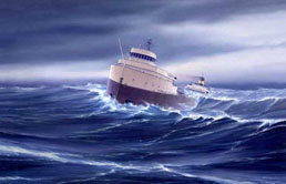
Some blame defective cargo hatch covers, which allowed the huge waves which broke over the deck that night to flood the Fitzgerald’s holds. Others point to faulty or damaged ballast-tank vents, which prevented pumping sufficient to keep her afloat. Still others hint that she may have earlier struck a shallow shoal off Michipicoten Island, near Lake Superior Provincial Park, causing an unseen and fatal breach. Even after all these years and numerous investigations regarding the exact cause of the Fitzgerald’s tragic and deadly loss, answers are not forthcoming, and details remain as murky as the dark depths of Superior.

We cross the Two Hearted River, which lends its name—if not its actual geographic location—to Ernest Hemingway’s novel, “Big Two-Hearted River,” set in the nearby logging town of Seney, Michigan. A lovely backwoods shoreline drive west from Deer Park brings us to a quiet, virtually uninhabited campground in Lake Superior State Forest, where we make camp just in time to watch the sun descend on a placid forest lake.

A Superior State of Mind, Day 9

Day 9:  Sault Ste. Marie, Ontario

In the morning we quickly dress and motor into town. We have tickets for the Agawa Canyon tour train, a hundred-mile ride up among the granite valleys and pristine lakes of the Canadian Shield country, aboard the Algoma Central Railway. We board the waiting train and soon enter 22,000 square miles of uninhabited recreational wilderness known as Algoma Country, densely forested and liberally dotted with beautiful northern lakes and streams. There are very few roads through this rugged country, and the Railway is the only means of access to private camps and cottages in this remote region.

maple-leavesThere is an even earlier, passenger-service train each day, which mainly hauls local backcountry residents and those venturing into the woods for hiking, fishing, and hunting. On a couple occasions several years ago, my family loaded camping gear and two canoes onto the train’s baggage cars and rode up to Mile Marker 92, where a spectacular steel trestle spans the Montreal River. Here we yanked the signal cord running through our car and the train stopped while we quickly off-loaded our stuff by the side of the tracks. As we lugged the gear down to the water, the train tooted its horn and continued on its way northward, not caring whether it ever saw us again. We paddled fifteen miles or so up the wide flowage and camped and fished on a remote backwoods island. We saw not another soul until we returned to the tracks a week later and flagged down the daily train for a ride back to Sault Ste. Marie.

Agawa-Canyon-ParkThis passenger-service train is often filled with local backwoods residents who live year-round in scattered cabins and shacks, shaggy and aromatic Yukon Cornelius types, perhaps on their once-a-month sojourn into the city for more cornmeal, gunpowder, hamhocks, and guitar strings. Heck, maybe even their monthly hot bubble-bath …

But today we ride in comfort and style on the plushly appointed Tour Train, loaded with dozens and dozens of elderly sightseers wearing oversized sunglasses. Turns out the old guy seated across from us is from Toronto, and in his youth flew Hawker Hurricane fighter planes for the British Royal Air Force during World War II. He saw plenty of action in his day, pursuing Messerschmitts through the skies of France, but now he is mesmerized by the golden forested scenes rolling past our window.

Mid-day we arrive at Agawa Canyon Park and disembark for a two-hour lunch layover in a beautifully rugged setting. We hike up one of several trails, some leading to spectacular waterfalls, spry ninety-year-old ladies in white sneakers elbowing their way past us up the stairs. We finally arrive at the uppermost deck and enjoy a grand view of the canyon from hundreds of feet above the river while we catch our breath, then race the old gals back down again.

We vow to return for the Algoma Central’s wintertime Snow Train excursion, when this rugged country is draped in the ample snowfall from nearby Lake Superior. Just before nightfall, we return to the depot in Sault Ste. Marie and spend another night at the KOA.

A Superior State of Mind, Day 8

Day 8: Wawa, Ontario

Today dawns to a cold, wet sleet. We hit the road early and the Vanagon’s tires soon thrum and hiss on the wet pavement. The highway veers closer to the shoreline as we enter Lake Superior Provincial Park, then heads into the interior of the park. The campgrounds are closed this late in the season, and the rain keeps us in the comfort of the Westy, but the weather cannot hide the beauty of the place. At 380,000 acres, the park encompasses many miles of classic Superior shoreline, dense forests, and ancient river canyons, with ample opportunity for backcountry hiking, camping, and whitewater paddling.

F-H-Varley-painting

Original painting by F.H. Varley

So beautiful is this region that it inspired a loose circle of Canadian landscape artists to work in the area in the 1920s. While many other artists and critics considered the Canadian wilderness an aesthetic wasteland, the Group of Seven, as they came to call themselves, found abundant inspiration here, and spent the next decade sketching and painting the captivating surroundings.

Strongly compelled by European Post-Impressionism, the group created colorful and bold interpretations of the striking land- and waterscapes to be found here, and their work, seen at prestigious exhibits and shows, cultivated a new and fresh approach to landscape painting which came to be known as the Canadian School. The group eventually disbanded, but their ideals influence landscape painting to this day.

Somewhere just south of Montreal River Harbor, we see our first moose—a stuffed one—alongside the road, presumably a tourist attraction for the nearby filling station. But as we approach on the highway, the taxidermied bull moose raises his head and bolts across the road in front of us, followed by his equally lively mate. As the bull leaves the pavement, he glares over his shoulder at me, straight in the eye, and I recall the words of the Wawa RV-park manager; this fella indeed looks as though he is inclined to crash right thru the windshield …

superior-mooseOn the long, final run toward Sault Ste. Marie, I perceive a faint vibration emanating from the left-rear wheel. In retrospect, I seem to vaguely recall first hearing the noise a couple days ago, and the gentle thrumming has slowly grown since then. Hoping it does not indicate the imminent failure of a CV joint, I determinedly put my foot down and continue east and southward.

By nightfall we arrive in Sault Ste. Marie, and I cannot help but think of my voyageurs still out on the lake. Though we have covered the distance from Thunder Bay in just under nine hours of driving, those hearty souls are likely pulled up on a lonely shore and settled beneath a stand of cedars to stay out of the sleet for the night. It will be many days of hard paddling for them before they reach this place, and many more to Montreal beyond, bearing their load of furs for a rich man’s hat.

Making our own camp beneath the pines in a KOA campground, we pop the Westy’s top and enjoy a dinner of fresh-boiled rice and canned chicken while listening to the familiarly NPR-like Canadian Broadcasting Corporation, then turn in for the night.

A Superior State of Mind, Day 7

Day 7: Kakabeka Falls Provincial Park, Thunder Bay, Ontario

After breakfast in camp, we amble down to see the beautiful Kakabeka Falls. Here the Kaministiquia River flows down from the Laurentian Divide and suddenly plunges over the lip of a slate geological fault. Sometimes called the Niagara of the North, Kakabeka drops over 120 feet in a spectacular, roaring falls, crashing at the base and producing perpetual wreaths of mist and spray.

Kaministiquia-falls
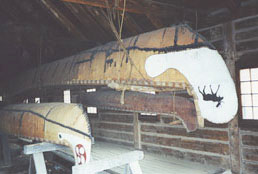
It is only a short drive to where the Kaministiquia enters Lake Superior. In 1803 the North West Company built Fort William at the river’s mouth, and for many years the site served as the Company’s key shipment center on Lake Superior. Now reconstructed and opened as a living history program, the Fort depicts the days of the booming fur trade, circa 1803-1821. Heavily-laden voyageur canoes arrived here from Montreal, bearing manufactured trading goods for the Fort. Meanwhile, the American and Canadian interiors produced tons of furs—beaver, fox, badger, mink, even raccoon—carried down in small river canoes. These sixteen-foot Indian craft were well-suited to the narrow streams, dangerous rapids, and long portages common in the remote country.

After sorting and packing here at the fort, the furs continued east in huge Montreal canoes. At 36 feet in length, they carried up to 8000 lbs. of cargo and were driven across the great inland sea of Lac Superiore by twelve strong men. On these return trips the canoes were often so heavily loaded with furs that the gunwales were only a hands-breadth above the waterline. These hardy men paddled many miles each day across unpredictable and sometimes stormy Superior, camping along the way. Sticking close to shore, it is nearly 400 miles from here to Sault Ste. Marie, far on the other side of the lake. I imagine these voyageurs of old departing Fort William on mornings similar to this one, paddling into the cold and stinging rain, struggling with their heavy loads and unwieldy canoes into the surging and violent waves of Superiore.

On such portages, these 90-lb. bales of furs were carried two or three at a time on the bent backs of the voyageurs. So it’s no surprise that the most common cause of death among these unfortunate camarades was not snake-bite, pnuemonia, or broken bones, but strangulated hernias.

As I absorb the authentic frontier atmosphere and inhale the musty aroma of damp rodent pelts, I notice Lorie is equally entranced by another historical display, but this one of the voyageur variety. It seems she is a bit enamored of the smart and hairy-faced tour guide in the beads and the leather bathrobe. With wide-eyed interest she asks precocious and obsequious questions about the buckskinnin’ life, and he responds with warm and authoritative answers, stroking his scruffy beard like a backwoods scholar.

I sulk nearby, pretending to peruse the selection of bear-grease candles, and I wonder why this flea-bitten frontiersman can’t find himself a nice native maiden to settle down with, instead of flirting with every passing tourist lady? I swear, if he offers to trade me a musket and some shiny trinkets for my wife, I’ll punch that seedy mountain man right in the chops. Unless, of course, it’s a nice Hawken Caplock rifle with a couple of boxes of ammo. If he also offers to throw in a nice cast iron soup kettle, well, I’ll have a real dilemma on my hands …

Fort-William-canoeAfter a sullen lunch of Voyageur’s Stew (hefty chunks of moose flesh, with a few token peas, carrots, and diced potatoes) eaten in the rustic dining hall, we motor through the gloomy industrial city of Thunder Bay, a grey drizzle constantly spraying the Vanagon’s windshield. Swinging onto the Trans-Canada Highway, we follow the rugged Superior shoreline eastward through Nipigon, Terrace Bay, and White River.

We drive on through an increasingly barren landscape known as the Canadian Shield, a vast region encompassing parts of Alberta, northern Saskatchewan and Manitoba, Ontario, Quebec, Labrador, eastern Minnesota, northern Wisconsin, and northern Michigan! There were once great mountains here, but they were long ago eroded by water and eons of freeze-thaw cycles. Most of the Canadian Shield is now coniferous forests, but here we see the rocky, eroded stumps of the former mountain range.

Though unseasonably warm, most of the provincial parks are closed this late in the season, so we drive late into the evening, finally stopping at an RV park in Wawa, Ontario. When we pay our bill, the proprietor asks if we saw any moose along the road from Thunder Bay.

“Only the ones on the road signs,” I reply.

“You’re lucky. Most nights, they wander out onto the highway. Lots of folks don’t see ’em until it’s too late. ’bout a dozen people get killed along that road every year. Rig like yours …” he gestures out to where the cab-forward, snub-nosed Westy waits, “… a moose’d be right in your lap.”

I nod gravely. “I’ll be sure and watch out for them.”

In camp, we make some dinner and settle in for the night, retracting the pop-up roof to conserve heat in the crisp autumn air.